Near Richmond in Henrico County, Virginia — The American South (Mid-Atlantic)
Malvern Hill
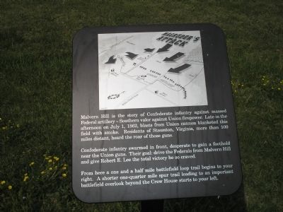
Confederate infantry swarmed in front, desperate to gain a foothold near the Union guns. Their goal: drive the Federals from Malvern Hill and give Robert E. Lee the total victory he so craved.
From here a one and a half mile battlefield loop trail begins to your right. A shorter one-quarter mile spur trail leading to an important battlefield overlook beyond the Crew House starts to your left.
Erected by Richmond National Battlefield Park – National Park Service.
Topics. This historical marker is listed in this topic list: War, US Civil. A significant historical date for this entry is July 1, 1862.
Location. 37° 24.774′ N, 77° 14.991′ W. Marker is near Richmond, Virginia, in Henrico County. Marker is on Willis Church Road (Virginia Route 156), on the right when traveling south. Marker is in the Malvern Hill Battlefield Unit of Richmond National Battlefield Park. Touch for map. Marker is at or near this postal address: 9100 Willis Church Rd, Henrico VA 23231, United States of America. Touch for directions.
Other nearby markers. At least 8 other markers are within walking distance of this marker. Southern Valor vs. Union Firepower (here, next to this marker); a different marker also named Malvern Hill (a few steps from this marker); A Splendid Field of Battle (within shouting distance of this marker); Battlefield of Malvern Hill (within shouting distance of this marker); Union Firepower (within shouting distance of this marker); Battlefield Landscape (within shouting distance of this marker); Seven Days Battles (about 300 feet away, measured in a direct line); The West House (about 300 feet away). Touch for a list and map of all markers in Richmond.
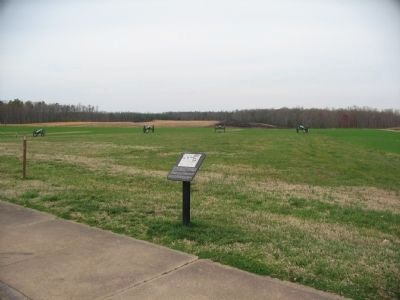
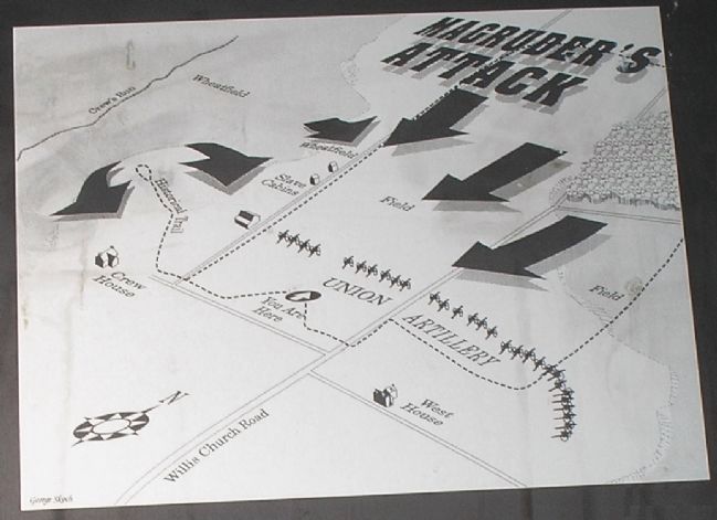
More about this marker. The top of the marker contains a battle map displaying Magruder's attack of the Union artillery placed in front of the marker. The location of the marker is also indicated.
Also see . . .
1. Malvern Hill. CWSAC Battle Summaries. (Submitted on January 11, 2009, by Bill Coughlin of Woodland Park, New Jersey.)
2. Touring Richmond’s Battlefields. National Park Service website. (Submitted on January 11, 2009, by Bill Coughlin of Woodland Park, New Jersey.)
3. Malvern Hill Battlefield Podcast. National Park Service website. (Submitted on January 11, 2009, by Bill Coughlin of Woodland Park, New Jersey.)
4. The Seven Days Battle.

2. Malvern Hill - CWPT
Civil War Preservation Trust's efforts to preserve portions of the battlefield.
Click for more information.
Click for more information.
Credits. This page was last revised on July 7, 2021. It was originally submitted on January 11, 2009, by Bill Coughlin of Woodland Park, New Jersey. This page has been viewed 1,442 times since then and 24 times this year. Photos: 1. submitted on January 11, 2009, by Bill Coughlin of Woodland Park, New Jersey. 2, 3. submitted on March 28, 2010, by Craig Swain of Leesburg, Virginia. 4, 5. submitted on January 11, 2009, by Bill Coughlin of Woodland Park, New Jersey.


