Hinsdale in Cheshire County, New Hampshire — The American Northeast (New England)
Hinsdale and the Power of the Ashuelot
Inscription.
The Village of Hinsdale
From Agriculture to Manufacturing
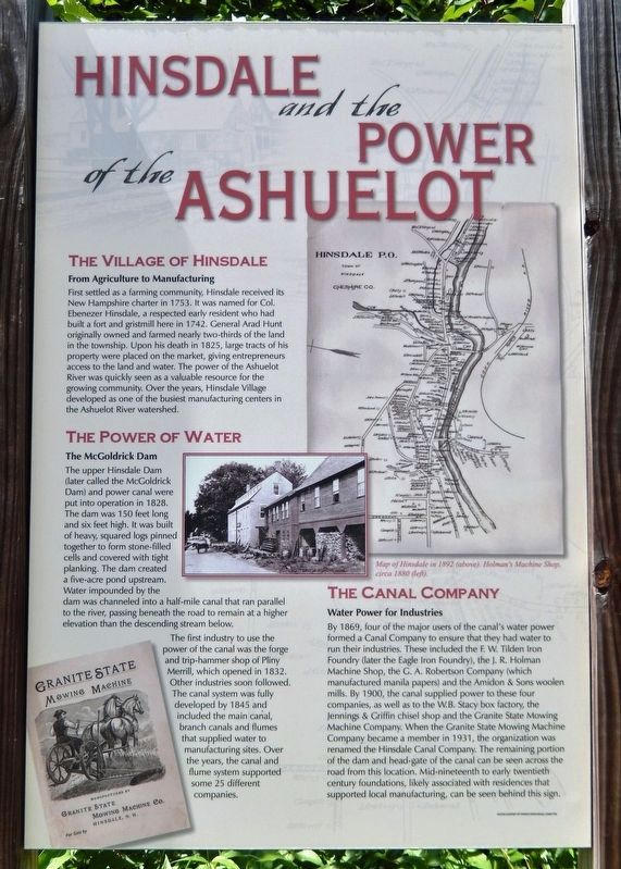
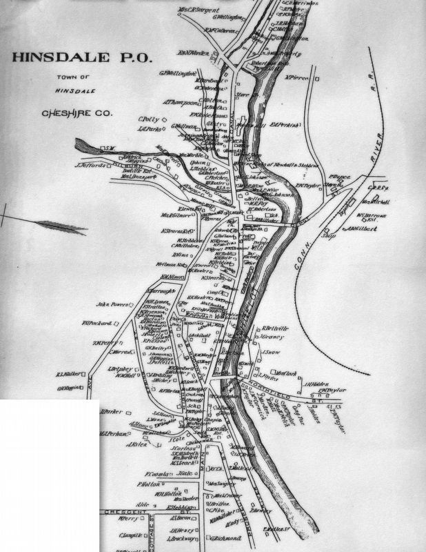
First settled as a farming community, Hinsdale received its New Hampshire charter in 1753. It was named for Col. Ebenezer Hinsdale, a respected early resident who had built a fort and gristmill here in 1742. General Arad Hunt originally owned and farmed nearly two-thirds of the land in the township. Upon his death in 1825, large tracts of his property were placed on the market, giving entrepreneurs access to the land and water. The power of the Ashuelot River was quickly seen as a valuable resource for the growing community. Over the years, Hinsdale Village developed as one of the busiest manufacturing centers in the Ashuelot River watershed.
The Power of Water
The McGoldrick Dam
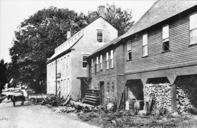
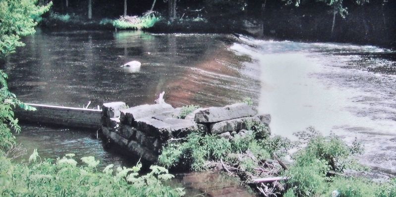
The upper Hinsdale Dam (later called the McGoldrick Dam) and power canal were put into operation in 1828. The dam was 150 feet long and six feet high. It was built of heavy, squared logs pinned together to form stone-filled cells and covered with tight planking. The dam created a five-acre pond upstream. Water impounded by the dam was channeled into a half-mile canal that ran parallel to the river, passing beneath the road to remain at a higher elevation than the descending stream below.
The first industry to use the power of the canal was the forge and trip-hammer shop of Pliny Merrill, which opened in 1832. Other industries soon followed. The canal system was fully developed by 1845 and included the main canal, branch canals and flumes that supplied water to manufacturing sites. Over the years, the canal and flume system supported some 25 different companies.
The Canal Company
Water Power for Industries
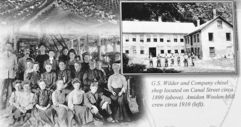
By 1869, four of the major users of the canal's water power formed a Canal Company to ensure that they had water to run their industries. These included the F. W. Tilden Iron Foundry (later the Eagle Iron Foundry), the J. R. Holman Machine Shop, the G. A. Robertson Company (which manufactured manila papers) and the Amidon & Sons woolen mills. By 1900, the canal supplied power to these four companies, as well as to the W.B. Stacy box factory, the Jennings & Griffin chisel shop and the Granite State Mowing Machine Company. When the Granite State Mowing Machine Company became a member in 1931, the organization was renamed the Hinsdale Canal Company. The remaining portion of the dam and head-gate of the canal can be seen across the road from this location. Mid-nineteenth to early twentieth century foundations, likely associated with residences that supported local manufacturing, can be seen behind this sign.
The Industrial Boom
Wool, Boxes and Mowing Machines
The 40-mile-long
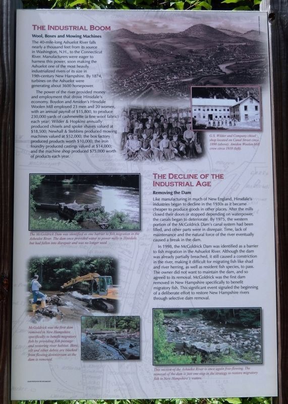
Ashuelot River falls nearly a thousand feet from its source in Washington, N.H., to the Connecticut River. Manufacturers were eager to harness this power, soon making the Ashuelot one of the most heavily industrialized rivers of its size in 19th-century New Hampshire. By 1874, turbines on the Ashuelot were generating about 3600 horsepower.
The power of the river provided money and employment that drove Hinsdale's economy. Boydon and Amidon's Hinsdale Woolen Mill employed 23 men and 20 women, with an annual payroll of $15,800, to produce 230,000 yards of cashmerette (a fine wool fabric) each year; Wilder & Hopkins annually produced chisels and spoke shaves valued at $18,500; Newhall & Stebbins produced mowing machines valued at $52,000; the box factory produced products worth $10,000; the iron foundry produced castings valued at $14,000; and the machine shop produced $75,000 worth of products each year.
The Decline of the Industrial Age
Removing the Dam
Like manufacturing in much of New England, Hinsdale's industries began to decline in the 1930s as it became cheaper to produce goods in other places. After the mills closed their doors or stopped depending on waterpower, the canals began to deteriorate. By 1975, the western portion of the McGoldrick Dam's canal system had been filled, and other parts were in disrepair. Time, lack of maintenance and the natural force of the river eventually caused a break in the dam.
In 1998, the McGoldrick Dam was identified as a barrier to fish migration in the Ashuelot River. Although the dam was already partially breached, it still caused a constriction in the river, making it difficult for migrating fish like shad and river herring, as well as resident fish species, to pass. The owner did not want to maintain the dam, and so agreed to its removal. McGoldrick was the first dam removed in New Hampshire specifically to benefit migratory fish. This significant event signaled the beginning of a deliberate effort to restore New Hampshire rivers through selective dam removal.
Topics. This historical marker is listed in these topic lists: Environment • Industry & Commerce • Settlements & Settlers • Waterways & Vessels. A significant historical year for this entry is 1753.
Location. 42° 47.297′ N, 72° 28.203′ W. Marker is in Hinsdale, New Hampshire, in Cheshire County. Marker is on Canal Street (New Hampshire Route 119) half a mile east of Chesterfield Road (New Hampshire Route 63), on the left when traveling east. Marker is located in a pull-out on the north side of the highway. Touch for map. Marker is in this post office area: Hinsdale NH 03451, United States of America. Touch for directions.
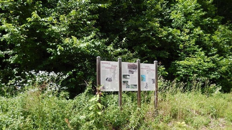
Other nearby markers. At least 8 other markers are within 3 miles of this marker, measured as the crow flies. The Story of Anadromous Fish (here, next to this marker); Hinsdale's Auto Pioneer (approx. 0.2 miles away); Newhall & Stebbins (approx. half a mile away); Hinsdale World War I Memorial (approx. 0.6 miles away); Hinsdale World War II Veterans Memorial (approx. 0.6 miles away); Town of Hinsdale Veterans Memorial (approx. 0.6 miles away); Hinsdale, New Hampshire Post Office (approx. 0.6 miles away); Ashuelot Covered Bridge (approx. 2˝ miles away). Touch for a list and map of all markers in Hinsdale.
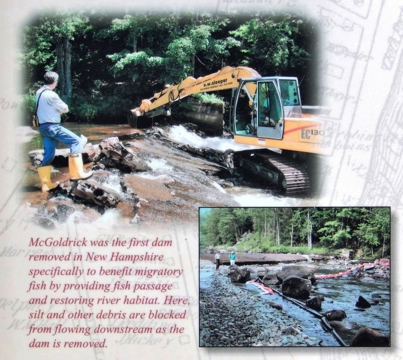
Courtesy New Hampshire Fish & Game Department
7. Marker detail: McGoldrick Dam Removal
Credits. This page was last revised on July 1, 2020. It was originally submitted on July 1, 2020, by Cosmos Mariner of Cape Canaveral, Florida. This page has been viewed 631 times since then and 69 times this year. Photos: 1, 2, 3, 4, 5, 6, 7, 8, 9. submitted on July 1, 2020, by Cosmos Mariner of Cape Canaveral, Florida.
