Near Sudley in Prince William County, Virginia — The American South (Mid-Atlantic)
A Historic Place / Ben Lomond Old Rose Garden
1832
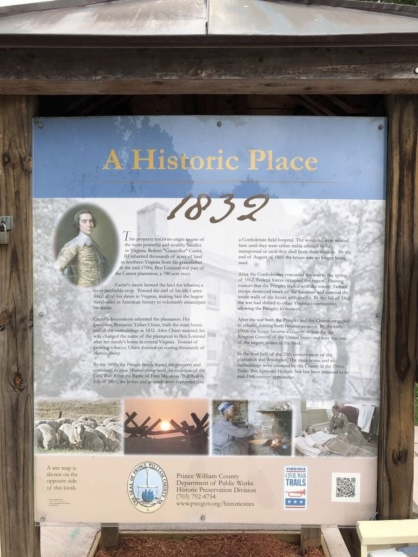
This property traces its origin to one of the most powerful and wealthy families in Virginia. Robert "Councillor" Carter, III inherited thousands of acres of land in northern Virginia from his grandfather in the mid-1700s. Ben Lomond was part of the Cancer plantation, a 700-acre tract.
Carter's slaves farmed the land for tobacco, a most profitable crop. Toward the end of his life Carter freed all of his slaves in Virginia, making him the largest slaveholder in American history to voluntarily emancipate his slaves.
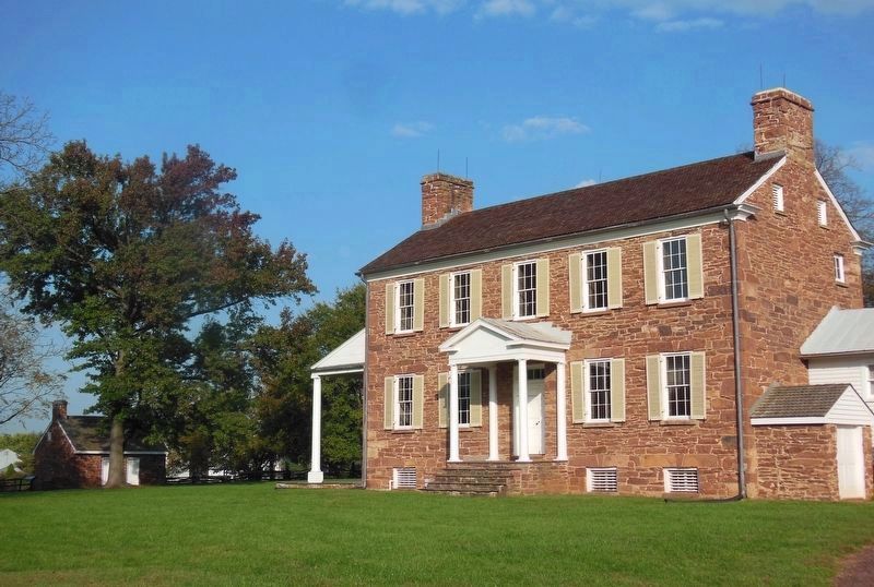
Carter's descendents inherited the plantation. His grandson, Benjamin Tasker Chinn, built the main house and all the outbuildings in 1832. After Chinn married, his wife changed the name of the plantation to Ben Lomond after her family's home in central Virginia. Instead of growing tobacco, Chinn focused on rearing thousands of Merino sheep.
By the 1850s the Pringle family leased the property and continued to raise Merino sheep until the outbreak of the Civil War. After the Battle of First Manassas/Bull Run in July of 1861, the house and the grounds were converted into a Confederate field hospital. The wounded were treated here until they were either stable enough to be transported or until they died from their wounds. By the end of August of 1861 the house was no longer being used.
After the Confederates evacuated the area in the spring of 1862, Federal forces occupied the region. Hearing rumors that the Pringles traded with the enemy, Federal troops destroyed much of the furniture and covered the inside walls of the house with graffiti. By the fall of 1862 the war had shift to other Virginia communities, allowing the Pringles to recover.
In the later half of the 20th century most of the plantation was developed. The main house and its outbuildings were obtained by the County in the 1980s. Today Ben Lomond Historic Site has been returned to the mid-19th-century appearance.
A Fragrant Oasis
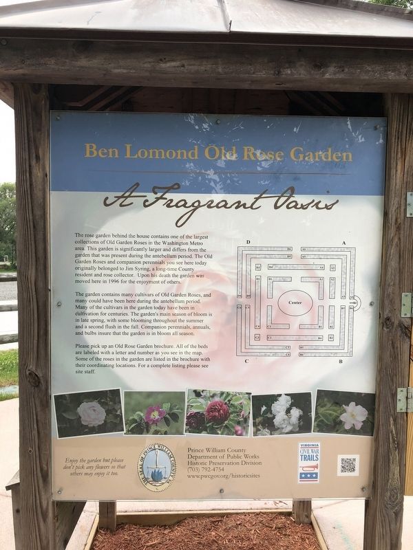
The rose garden behind the house contains one of the largest collections of Old Garden Roses in the Washington Metro area. This garden is significantly larger and differs from the garden that was present during the antebellum period. The Old Garden Roses and companion perennials you see here today originally belonged to Jim Syring, a long-time County resident and rose collector. Upon his death the garden was moved here in 1996 for the enjoyment of others.
The garden contains many cultivars of Old Garden Roses, and many could have been here during the antebellum period. Many of the cultivars in the garden
Photographed By Devry Becker Jones (CC0), July 5, 2020
2. Ben Lomond Old Rose Garden side of the marker
Please pick up an Old Rose Garden brochure. All of the beds are labeled with a letter and number as you see in the map. Some of the roses in the garden are listed in the brochure with their coordinating locations. For a complete listing please see site staff.
Erected by Prince William County Department of Public Works, Historic Preservation Division; Virginia Civil War Trails.
Topics and series. This historical marker is listed in these topic lists: African Americans • Agriculture • Animals • Horticulture & Forestry • Science & Medicine • War, US Civil. In addition, it is included in the Virginia Civil War Trails series list. A significant historical month for this entry is July 1861.
Location. 38° 47.306′ N, 77° 30.337′ W. Marker is near Sudley, Virginia, in Prince William County. Marker can be reached from Sudley Manor Drive, 0.1 miles east of Copeland Drive, on the right when traveling east. Touch for map. Marker is at or near this postal address: 10311 Sudley Manor Dr, Manassas VA 20109, United States of America. Touch for directions.
Other nearby markers. At least 8 other markers are within
Photographed By Devry Becker Jones (CC0), July 5, 2020
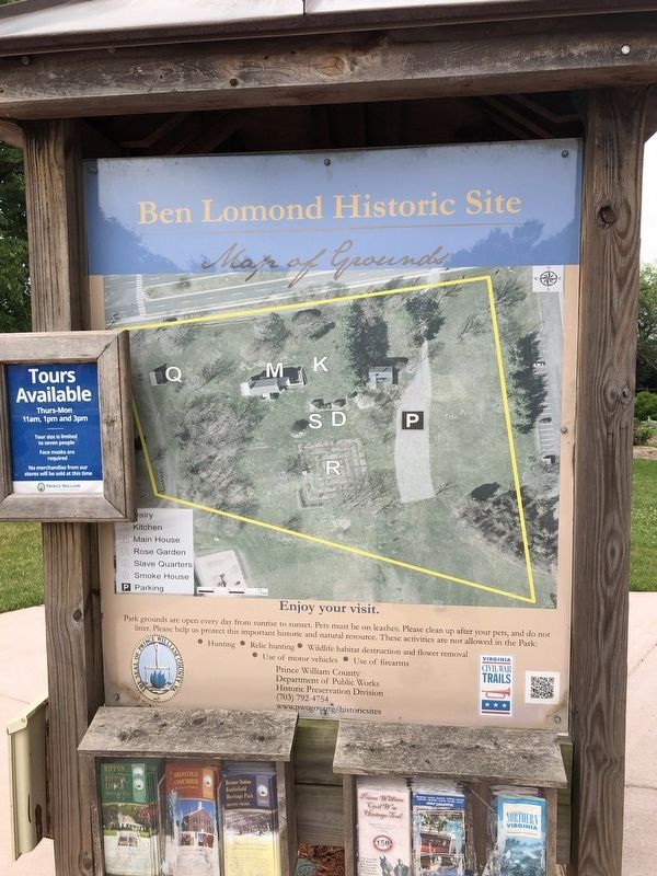
3. Ben Lomond Historic Site side of the marker
Photographed By Devry Becker Jones (CC0), July 5, 2020
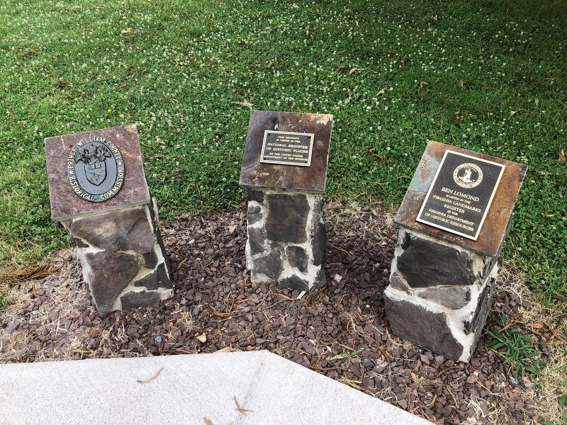
5. Additional plaques nearby
Plaques show for the Prince William County Historical Commission, the National Register of Historic Places and the Virginia Landmarks Register.
Credits. This page was last revised on February 18, 2021. It was originally submitted on July 5, 2020, by Devry Becker Jones of Washington, District of Columbia. This page has been viewed 184 times since then and 20 times this year. Photos: 1, 2, 3. submitted on July 5, 2020, by Devry Becker Jones of Washington, District of Columbia. 4. submitted on February 17, 2021, by Bradley Owen of Morgantown, West Virginia. 5. submitted on July 5, 2020, by Devry Becker Jones of Washington, District of Columbia.
Editor’s want-list for this marker. A wide shot of the four-sided marker • Can you help?
