Southern View in Sangamon County, Illinois — The American Midwest (Great Lakes)
Historic Route 66 Illinois
Photographed by Duane and Tracy Marsteller, July 2, 2020
1. Historic Route 66 Illinois Marker
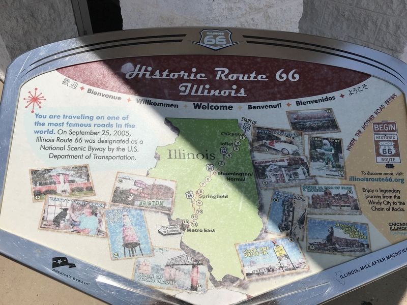
You are traveling on one of the most famous roads in the world. On September 25, 2005, Illinois Route 66 was designated as a National Scenic Byway by the U.S. Department of Transportation.
Erected by Illinois Route 66 Scenic Byway.
Topics and series. This historical marker is listed in this topic list: Roads & Vehicles. In addition, it is included in the U.S. Route 66 series list. A significant historical date for this entry is September 25, 2005.
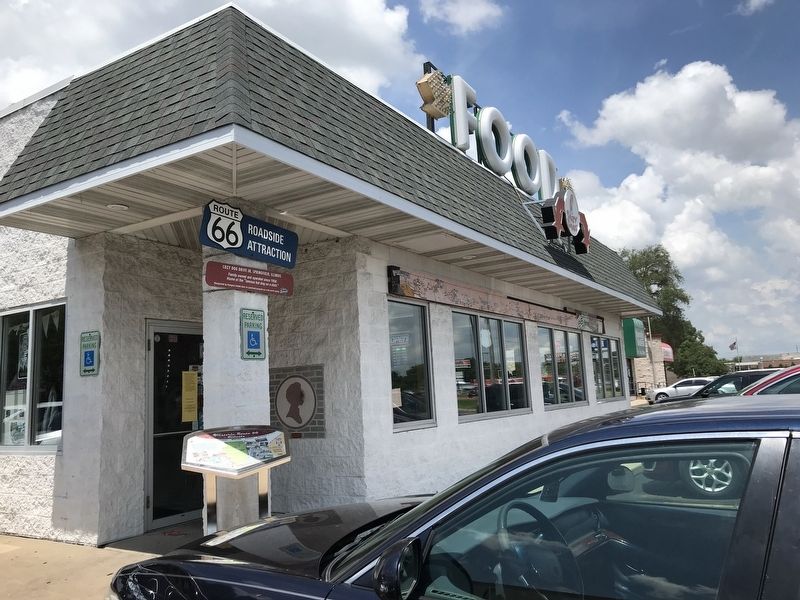
Location. This marker has been replaced by another marker nearby. It was located near 39° 45.741′ N, 89° 38.923′ W. Marker was in Southern View, Illinois, in Sangamon County. It was on South 6th Street (Business Interstate 55) 0.4 miles south of East Linton Avenue, on the right when traveling south. Marker was located at the entrance to Cozy Dog Drive In, a historic counter-serve restaurant. Touch for map. Marker was at or near this postal address: 2935 S 6th St, Springfield IL 62703, United States of America. Touch for directions.

Regionally, this marker was in Central Illinois and in Greater Springfield. It was also in the American Midwest and in the Corn Belt. Globally, it
this page online
Other nearby markers. At least 8 other markers are within 3 miles of this location, measured as the crow flies: Cozy Dog Drive In (here, next to this marker); Cozy Dog Drive In, Springfield, Illinois (here, next to this marker); Springfield, Illinois (a few steps from this marker); Springfield Home for the Friendless / Family Service Center (approx. 1.7 miles away); Turney House (approx. 2 miles away); Howard K. Weber House (approx. 2 miles away); The Bressmer-Baker House (approx. 2.1 miles away); Edwin Watts Southwind Park (approx. 2.1 miles away). Touch for a list and map of all markers in Southern View.
More about this marker. There are two identical markers in the Illinois towns of Pontiac and Staunton.
Also see . . . Cozy Dog Drive In. Wikipedia entry on the historic eatery. (Submitted on July 13, 2020, by Duane and Tracy Marsteller of Murfreesboro, Tennessee.)
Photographed by Duane and Tracy Marsteller, July 2, 2020
2. Historic Route 66 Illinois Marker
Credits. This page was last revised on August 9, 2025. It was originally submitted on July 13, 2020, by Duane and Tracy Marsteller of Murfreesboro, Tennessee. This page has been viewed 577 times since then and 32 times this year. Photos: 1, 2. submitted on July 13, 2020, by Duane and Tracy Marsteller of Murfreesboro, Tennessee. • Devry Becker Jones was the editor who published this page.
