Moorefield in Hardy County, West Virginia — The American South (Appalachia)
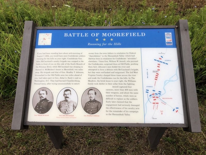
Battle of Moorefield
Running for the Hills
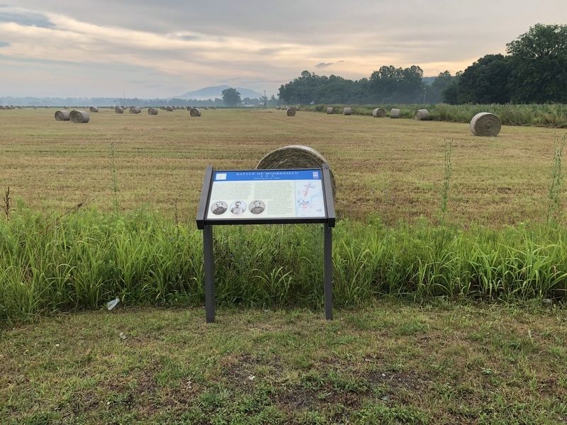
If you had been standing here about mid-morning of August 7, 1864, you would have seen Confederate soldiers running for the hills on your right. Confederate Gen. John McCausland's cavalry brigade was camped in the fields in front of you on this side of the South Branch of the Potomac River, while McCausland was sleeping in Samuel A. McMechen's house in Moorefield, two miles away. His brigade and that of Gen. Bradley T. Johnson, bivouacked in the Old Fields area two miles ahead of you, had taken part in Gen. Jubal A. Early's raid on Washington, D.C. They had burned Chambersburg, Pennsylvania, after trying unsuccessfully to extort money from the town fathers in retaliation for Federal "depredations" in the Shenandoah Valley (which had likewise been in retaliation for Confederate "atrocities" elsewhere). Union Gen. William W. Averell, who pursued the Confederates, surprised them at Old Fields, pushing them here. Johnson's men forded the river and attempted to form a defense with McCausland's brigade, but they were outflanked and outgunned. The 3rd West Virginia Cavalry charged three times across the river and made the Confederates run for the hills. In The Meadows, the brick house to your right, the Williams family took shelter in their cellar from the fighting.
Averell captured four cannons, more than 400 men with their weapons, and about the same number of horses, which were as difficult to replace as the soldiers. Early later claimed that the engagement had seriously damaged the effectiveness of his cavalry arm for the remainder of his campaign in the Shenandoah Valley.
Erected by West Virginia Civil War Trails.
Topics and series. This historical marker is listed in these topic lists: War, US Civil • Waterways & Vessels. In addition, it is included in the West Virginia Civil War Trails series list. A significant historical date for this entry is August 7, 1864.
Location. 39° 5.105′ N, 78° 57.42′ W. Marker is in Moorefield, West Virginia, in Hardy County. Marker is on Harness Road just east of Hyde Street, on the left when traveling east. Touch for map. Marker is at or near this postal address: 596 Harness Rd, Moorefield WV 26836, United States of America. Touch for directions.
Other nearby markers. At least 8 other markers are within 2 miles of this marker, measured as the crow flies. A different marker also named Battle of Moorefield (approx. 0.4 miles away); Gen. Joseph Neville / McNeill's Raid (approx. 1.4 miles away); Confederate Memorial (approx. 1˝ miles away); Olivet Cemetery (approx. 1˝ miles away); Veterans Memorial (approx. 1˝ miles away); Cemetery Hill (approx. 1.6 miles away); a different marker also named Veterans Memorial
Credits. This page was last revised on January 6, 2024. It was originally submitted on July 18, 2020, by Devry Becker Jones of Washington, District of Columbia. This page has been viewed 361 times since then and 38 times this year. Last updated on January 4, 2024, by Carl Gordon Moore Jr. of North East, Maryland. Photos: 1, 2. submitted on July 18, 2020, by Devry Becker Jones of Washington, District of Columbia. • J. Makali Bruton was the editor who published this page.

