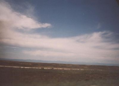
Banner in Sheridan County, Wyoming — The American West (Mountains)
Fort Phil Kearny
Registered National Historic Landmark
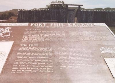
Inscription.
The Land
The land under view where the Great Plains meets the Rocky Mountains was once the Red Man's land of milk and honey, then as now teaming with wildlife. It was a most productive--thus favorite--hunting ground. But it was also a natural route used from time immemorial by nomadic men and migratory beasts. Lying hundreds of miles beyond the 1860 frontier, it was treaty-confirmed Indian country.
Here came a frontiersman, John Bozeman, pioneering a wagon road which followed buffalo, Indian and trapper trails. His time and energy-saving short cut led to the booming mining fields of western Montana. This interloper was followed by miners whose habitual frontier callousness easily stifled any scruple over trespass of an Indian passageway. Faint wheel marks soon became a beaten road known as the Bozeman Trail.
High plains and mountain Indians, notably Sioux and Cheyenne, watching this transgression, resented both the physical act and the implied contempt of the solemn treaty. They made war. The White transgressor called upon their army for protection. In the end the Indians won a brief respite--partly because a developing railroad far to the south canceled the Bozeman Trail's short cut advantage.
The Fort
On July 13, 1866, Colonel Henry R. Carrington, leading four companies of the 18th Infantry, arrived at this site. Carrington, a competent engineer, immediately put his men to work. Through diligent labor they built, by October of that year, the basic units of what became an outstanding example of the complete, stockaded "Indian Wars" military establishment.
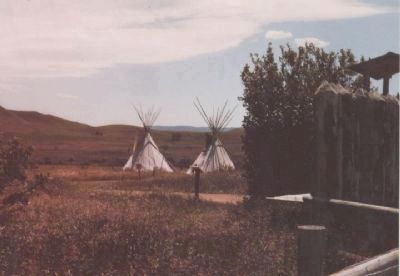
From here, as you face across the tablet, extends the ground where Fort Phil Kearny once stood. Replacement posts mark the original corners of the 800' x 600' stockade. Beyond, contiguous cavalry and quartermaster corrals are marked. At the south west end an animal watering watering gap jutted into Little Piney Creek. The Bozeman Trail passed roughly parallel to the north east side.
Fort Phil Kearny was usually garrisoned by four to six infantry companies, plus one or two companies of cavalry. However, so closely did the Sioux and Cheyenne warriors under the tactician Red Cloud invest the post that these troops were frequently unable to perform Bozeman Trail convoy duty. Incidents of hostility were the daily rule and several of the most famous engagements of the "Indian Wars" relate to this fort.
The military abandoned the fort in August 1868, and it was burned by a band of Cheyenne.
Erected by State of Wyoming.
Topics and series. This historical marker is listed in these topic lists: Forts and Castles
• Native Americans • Roads & Vehicles • Wars, US Indian. In addition, it is included in the National Historic Landmarks series list. A significant historical month for this entry is July 1843.
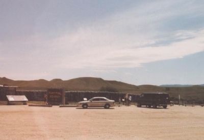
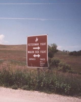
Location. 44° 31.965′ N, 106° 49.644′ W. Marker is in Banner, Wyoming, in Sheridan County. Marker can be reached from Wagon Box Road, 0.4 miles west of Kearny Lane. Wagon Box Road is accessible via Story Road (WY 193 - Old U.S. 87). The Marker is off the public parking lot at the entrance to the Fort Kearney State Historic Park. Touch for map. Marker is at or near this postal address: 528 Wagon Box Rd, Banner WY 82832, United States of America. Touch for directions.
Other nearby markers. At least 8 other markers are within walking distance of this marker. Pilot Hill (here, next to this marker); The Fort Kearny Sawmills (a few steps from this marker); Cemetery Site (a few steps from this marker); A monument Honoring John “Portugee” Phillips (a few steps from this marker); Site of a Sawmill (a few steps from this marker); The Bozeman Trail (a few steps from this marker); Touring the Fort (a few steps from this marker); Protecting the Travelers or the Garrison? (a few steps from this marker). Touch for a list and map of all markers in Banner.
Also see . . .
1. Wikipedia entry for Wagon Box Fight. (Submitted on August 23, 2009, by Richard E. Miller of Oxon Hill, Maryland.)
2. Wikipedia entry for Red Cloud's War. (Submitted on August 23, 2009, by Richard E. Miller of Oxon Hill, Maryland.)
Additional keywords. Red Cloud's War; Lakota.
Credits. This page was last revised on July 21, 2020. It was originally submitted on August 23, 2009, by Richard E. Miller of Oxon Hill, Maryland. This page has been viewed 1,962 times since then and 16 times this year. Last updated on July 19, 2020, by Connor Olson of Kewaskum, Wisconsin. Photos: 1, 2, 3, 4, 5. submitted on August 23, 2009, by Richard E. Miller of Oxon Hill, Maryland. • J. Makali Bruton was the editor who published this page.
