Menoken in Burleigh County, North Dakota — The American Midwest (Upper Plains)
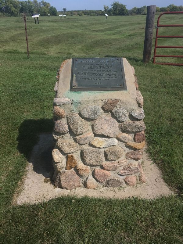
Menoken Indian Village Site
Photographed by Connor Olson, September 16, 2019
1. Menoken Indian Village Site Marker
Registered National Historic Landmark
under the provisions of the Historic Sites Act of August 21, 1955. This site possesses exceptional value in commemorating and illustrating the history of the United States.
U.S. Department of the Interior
National Park Service
1964
Erected 1964 by National Park Service.
Topics and series. This historical marker is listed in these topic lists: Anthropology & Archaeology • Indigenous Peoples and Communities. In addition, it is included in the National Historic Landmarks series list. A significant historical date for this entry is August 21, 1966.
Location. 46° 50.474′ N, 100° 31.094′ W. Marker is in Menoken, North Dakota, in Burleigh County. It is on 171st Street Northeast. Touch for map. Marker is in this post office area: Menoken ND 58558, United States of America. Touch for directions.

Regionally, this marker is in the Mandan, Hidatsa, and Arikara Nation, on the Missouri Plateau, and in Greater Bismarck Area. It is also in the American Lewis & Clark Corridor, on the prairies, and on the Northern Plains. Globally, it is in North America,
this page online
Other nearby markers. At least 7 other markers are within 16 miles of this marker, measured as the crow flies: Menoken Village State Historic Site (here, next to this marker); Early Archeological Studies At Menoken Village (within shouting distance of this marker); a different marker also named Menoken Village State Historic Site (within shouting distance of this marker); Investigating a Pit House (within shouting distance of this marker); Trade at Menoken (about 400 feet away, measured in a direct line); Apple Creek (approx. 3.1 miles away); Garner Park (approx. 15.9 miles away).
Also see . . . Menoken Village State Hist. Site. (Submitted on August 2, 2020, by Connor Olson of Menomonee Falls, Wisconsin.)
Credits. This page was last revised on August 3, 2020. It was originally submitted on July 19, 2020, by Connor Olson of Menomonee Falls, Wisconsin. This page has been viewed 283 times since then and 28 times this year. Photo 1. submitted on July 28, 2020, by Connor Olson of Menomonee Falls, Wisconsin. • Bill Pfingsten was the editor who published this page.
