Mancos in Montezuma County, Colorado — The American Mountains (Southwest)
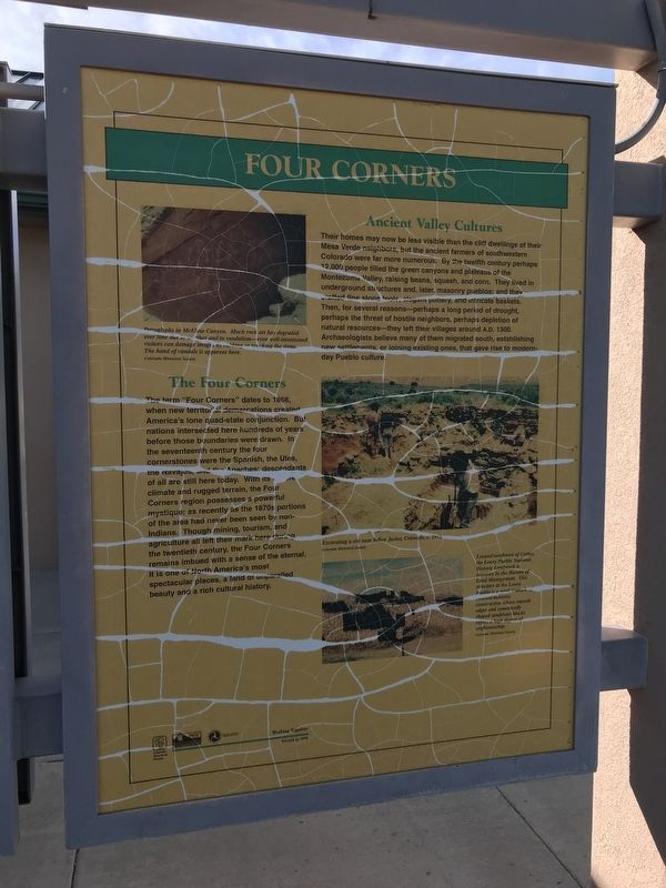
Four Corners
Their homes may now be less visible than the cliff dwellings of their Mesa Verde neighbors, but the ancient farmers of southwestern Colorado were far more numerous. By the twelfth century perhaps 12,000 people tilled the green canyons and plateaus of the Montezuma Valley, raising beans, squash, and corn. They lived in underground structures and, later, masonry pueblos; and they crafted fine stone tools, elegant pottery, and intricate baskets. Then, for several reasons — perhaps a long period of drought, perhaps the threat of hostile neighbors, perhaps depletion of natural resources — they left their villages around A.D. 1300. Archaeologists believe many of them migrated south, establishing new settlements, or joining existing ones, that gave rise to modern-day Pueblo culture.
The Four Corners
The term "Four Corners” dates to 1868, when new territorial demarcations created America's lone quad-state conjunction. But nations intersected here hundreds of years before those boundaries were drawn. In the seventeenth century the four cornerstones were the Spanish, the Utes, the Navajos, and the Apaches: descendants of all are still here today. With its [illegible] climate and rugged terrain, the Four Corners region possesses a powerful mystique; as recently as the 1870s portions of the area had never been seen by non-Indians. Though mining, tourism, and agriculture all left their mark here during the twentieth century, the Four Corners remains imbued with a sense of the eternal. It is one of North America's most spectacular places, a land of unparalleled beauty and a rich cultural history.
Captions
Top left: Petroglyphs in McElmo Canyon. Much rock art has degraded over time due to weather and to vandalism — even well-intentioned visitors can damage images by rubbing or touching the stone. The hand of vandals is apparent here. Colorado Historical Society
Right center: Excavating a site near Yellow Jacket, Colorado, c. 1975 Colorado Historical Society
Bottom right: Located northwest of Cortez, the Lowry Pueblo National Historic Landmark is overseen by the Bureau of Land Management. This structure at the Lowry Paeblo is a good example of coursed masonry construction whose smooth edges and symetrically shaped sandstone blocks reflect a high degree of craftsmanship. Colorado Historical Society
Erected 1998 by Colorado Historical Society and Colorado Department of Transportation.
Topics. This historical marker is listed in these topic lists: Agriculture
• Native Americans • Parks & Recreational Areas • Settlements & Settlers.
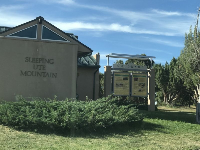
Location. 37° 21.195′ N, 108° 26.625′ W. Marker is in Mancos, Colorado, in Montezuma County. Marker can be reached from U.S. 160, on the right when traveling west. Marker is located in the Sleeping Ute Mountain Rest Area about six miles east of Cortez. Touch for map. Marker is in this post office area: Mancos CO 81328, United States of America. Touch for directions.
Other nearby markers. At least 8 other markers are within 4 miles of this marker, measured as the crow flies. Cortez (here, next to this marker); Southwest Survival (here, next to this marker); Mesa Verde Country (here, next to this marker); Water is Our Story (approx. 3.3 miles away); Greening the Valley (approx. 3.3 miles away); Water Technology (approx. 3.3 miles away); Preserving the McElmo Creek Flume (approx. 3.3 miles away); Mancos Valley (approx. 3.8 miles away). Touch for a list and map of all markers in Mancos.
Credits. This page was last revised on May 13, 2021. It was originally submitted on July 23, 2020, by Duane and Tracy Marsteller of Murfreesboro, Tennessee. This page has been viewed 171 times since then and 11 times this year. Photos: 1, 2. submitted on July 23, 2020, by Duane and Tracy Marsteller of Murfreesboro, Tennessee. • Andrew Ruppenstein was the editor who published this page.

