Downtown in St. Louis, Missouri — The American Midwest (Upper Plains)
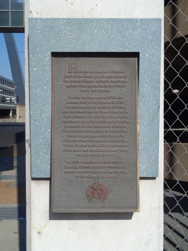
Chief Pontiac
Pontiac was born around 1720 and became chief of the Ottawas in 1755. Pontiac organized a coalition of tribes that stretched from the Great Lakes to the Gulf of Mexico. In 1763 the tribes struck simultaneously at 14 British posts. Pontiac personally led the five-month attack on Fort Detroit, which ended in defeat when Britain forged peace with France, its other adversary for expansion in the New World. Pontiac realized the hopelessness of his cause and negotiated a peace treaty with the British in 1765.
In 1769 a member of a rival tribe in Cahokia, Illinois murdered Pontiac. His remains were buried here, then the edge of the village of St. Louis.
Topics. This historical marker is listed in these topic lists: Cemeteries & Burial Sites • Native Americans • Wars, US Indian.
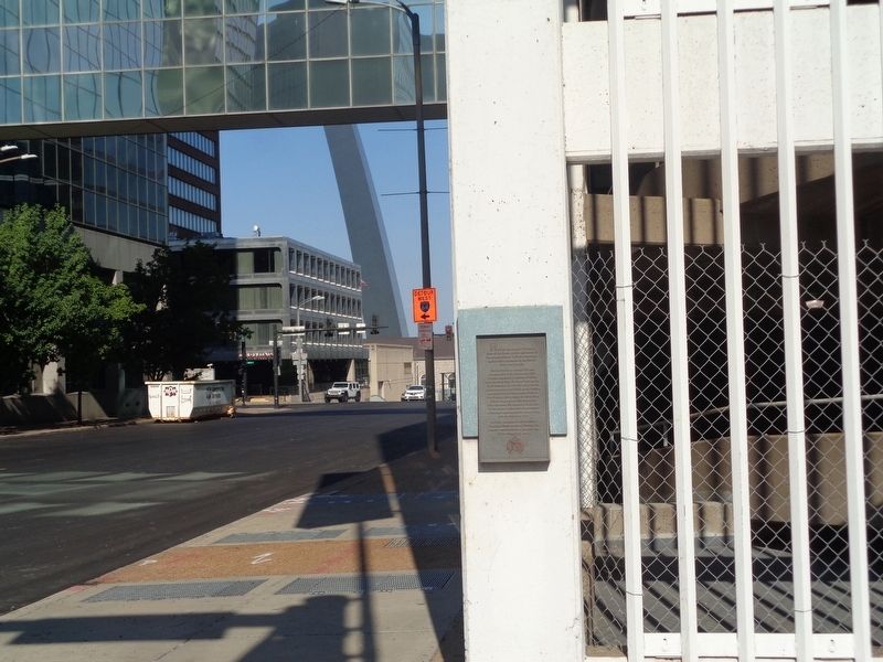
Location. 38° 37.465′ N, 90° 11.416′ W. Marker is in St. Louis, Missouri. It is in Downtown. Marker is at the intersection of North Broadway and Walnut Street, on the left when traveling south on North Broadway. Broadway is a one-way street, heading south. It is mounted at the parking garage across from Ballpark Village. Touch for map. Marker is at or near this postal address: 329R N Broadway, Saint Louis MO 63102, United States of America. Touch for directions.
Other nearby markers. At least 8 other markers are within walking distance of this marker. Fort San Carlos (within shouting distance of this marker); Phelim O'Toole (within shouting distance of this marker); Battle of St. Louis (about 300 feet away, measured in a direct line); Rue de la Tour (about 300 feet away); American Zinc Building (about 400 feet away); Engineers' Club of St. Louis (about 500 feet away); International Fur Exchange (about 500 feet away); Dred and Harriet Scott (about 600 feet away). Touch for a list and map of all markers in St. Louis.
Also see . . . Pontiac (Ottawa leader) on Wikipedia. A full biography on the war chief. There have been disagreements among historians over Pontiac's birth date, as well as the cause of his death and place of burial. Some believe he is buried in Cahokia, Illinois, but no evidence supports it. Places named for Pontiac include the cities in Illinois and Michigan, and even in Quebec in Canada. It was also the name for a popular General Motors automobile brand, which was discontinued in 2010. (Submitted on July 24, 2020, by Jason Voigt of Glen Carbon, Illinois.)
Credits. This page was last revised on January 30, 2023. It was originally submitted on July 24, 2020, by Jason Voigt of Glen Carbon, Illinois. This page has been viewed 1,017 times since then and 196 times this year. Photos: 1, 2. submitted on July 24, 2020, by Jason Voigt of Glen Carbon, Illinois.

