Ditch 2
Double Ditch State Historic Site
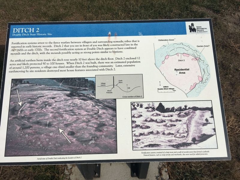
An artificial earthen berm inside the ditch rose nearly 10 feet above the ditch floor. Ditch 2 enclosed 12 acres and likely protected 90 to 100 houses. When Ditch 2 was built, there was an estimated population of around 1,200 persons, a village one-third smaller than the founding community. Later, extensive earthmoving by site residents destroyed most house features associated with Ditch 2.
Photo captions:
Lower left: Aerial view of Double Ditch indicating the location of Ditch 2
Lower right: Fortification systems consisted of a deep moat and a wall of wooden posts that formed a palisade. Natural features, such as steep terrain and riverbanks, also were used for added protection.
Erected by State Historical Society of North Dakota.
Topics. This historical marker is listed in these topic lists: Anthropology & Archaeology • Native Americans.
Location. 46° 56.072′
Other nearby markers. At least 8 other markers are within walking distance of this marker. Missouri River Resources (within shouting distance of this marker); Final Occupation of Double Ditch (within shouting distance of this marker); Geophysical Prospecting in Archaeology (within shouting distance of this marker); Archaeological Excavations in 1905 (about 300 feet away, measured in a direct line); Double Ditch State Historic Site (about 400 feet away); Ditch 3 (about 400 feet away); Midden Mounds (Trash Heaps) (about 500 feet away); Homes (about 600 feet away). Touch for a list and map of all markers in Bismarck.
Credits. This page was last revised on August 15, 2020. It was originally submitted on August 4, 2020, by Connor Olson of Kewaskum, Wisconsin. This page has been viewed 93 times since then and 4 times this year. Photos: 1, 2. submitted on August 4, 2020, by Connor Olson of Kewaskum, Wisconsin. • Mark Hilton was the editor who published this page.
Editor’s want-list for this marker. A wide shot of the marker and its surroundings. • Can you help?

