Near New Market in Madison County, Alabama — The American South (East South Central)
Madison County Poorhouse Farm Site and Cemetery
New Market, Alabama
| — | 1870-1923 | — |
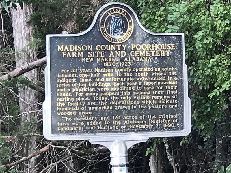
Photographed by Duane and Tracy Marsteller, August 2, 2020
1. Madison County Poorhouse Farm Site and Cemetery Marker
The cemetery and 123 acres of the original farm were added to the Alabama Register of Landmarks and Heritage on November 2, 1990.
Erected by Alabama Historical Commission.
Topics and series. This historical marker is listed in these topic lists: Agriculture • Cemeteries & Burial Sites • Charity & Public Work. In addition, it is included in the Alabama Historical Commission series list. A significant historical year for this entry is 1870.
Location. 34° 54.597′ N, 86° 27.296′ W. Marker is near New Market, Alabama, in Madison County. It is on Beth Road just west of New Market Road (County Road 100), on the right when traveling east. Touch for map. Marker is in this
this page online

Regionally, this marker is in North Alabama and in the Huntsville Metropolitan Area. It is also in the American South, specifically in the Deep South, in Appalachia, and specifically in Southern Appalachia. Globally, it is in North America, a Gulf of Mexico state, the Western Hemisphere, the Western World, and the Anglosphere. Historically, it finds itself in what was once the original Cherokee Nation, the territory of the Mississippian Culture, one of the Confederate States of America, and the Antebellum South.
Other nearby markers. At least 8 other markers are within 7 miles of this marker, measured as the crow flies: New Market Presbyterian Church (approx. 1.4 miles away); Town of New Market (approx. 1½ miles away); Mount Paran Campground and Cemetery (approx. 1.7 miles away); Site of Quick Airplane (approx. 2.9 miles away); Buckhorn Tavern / Buckhorn Tavern Skirmish (approx. 3 miles away); Old Limestone Road Skirmish (approx. 4.1 miles away); Site of Bell Factory (approx. 5.9 miles away); John Williams Walker (1783-1823) (approx.
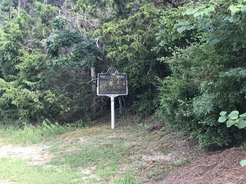
Photographed by Duane and Tracy Marsteller, August 2, 2020
2. Madison County Poorhouse Farm Site and Cemetery Marker
Credits. This page was last revised on August 6, 2020. It was originally submitted on August 5, 2020, by Duane and Tracy Marsteller of Murfreesboro, Tennessee. This page has been viewed 1,488 times since then and 67 times this year. Photos: 1, 2. submitted on August 5, 2020, by Duane and Tracy Marsteller of Murfreesboro, Tennessee. • Mark Hilton was the editor who published this page.
