Early Archeological Studies At Menoken Village
Menoken Village State Historic Site
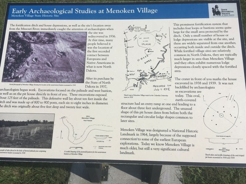
After its purchase by the State of North Dakota in 1937, archeologists began work. Excavations focused on the palisade and west bastion, as well as on the pit house directly in front of you. These excavations exposed about 125 feet of the palisade. This defensive wall lay about ten feet inside the ditch and was made up of 800 to 900 posts, each six to eight inches in diameter. The ditch was originally about five feet deep and twenty feet wide.
This prominent fortification system that includes four loops or bastions seems quite large for the small area protected by the ditch. Only a small number of house or lodge depressions are visible at the site, and these are widely separated from one another, occurring both inside and outside the ditch. While fortified village sites are relatively common in North Dakota, they are typically much larger in area than Menoken Village and they often exhibit numerous lodge depressions closely spaced with the fortified area.
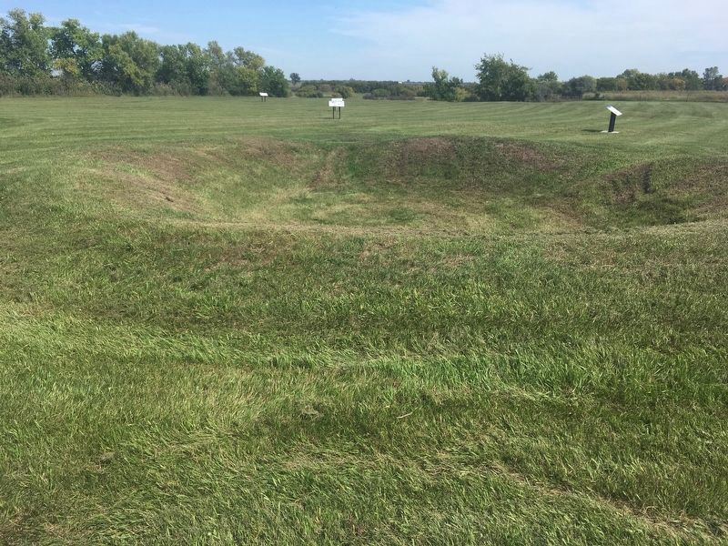
The crater
in front of you marks the house excavated in 1938 and 1939. It was not backfilled by archeologists as excavations are today. This oval, earth-covered structure had an entry ramp at one end leading to a floor about three feet underground. The unusual shape of this pit house dates from before both the rectangular and circular lodge shapes common to later sites.Menoken Village was designated a National Historic Landmark in 1964, largely because of the supposed connection to some of the earliest European explorations. Today we know Menoken Village is much older, but still a very significant cultural landmark.
Photo captions:
Upper left: Aerial photograph of Menoken Village showing the location of the westernmost bastion excavated in 1938
Lower left: Photograph of lathe placed in the holes of burned palisade post comprising of the westernmost bastion excavated in 1938
Upper middle: Sketch map of Menoken Village made by the Columbia University team in 1938
Lower middle: A scaled drawing of the postmold pattern for the westernmost bastion at Menoken Village
Lower right: Sketch plan and profile drawings of the oval-shaped pit house excavated in 1938 and 1939.
Erected by State Historical Society of North Dakota.
Topics. This historical marker
Location. 46° 50.486′ N, 100° 31.078′ W. Marker is near Menoken, North Dakota, in Burleigh County. Marker can be reached from 171st Street Northeast, 0.2 miles north of 30th Avenue Northeast, on the right when traveling north. Touch for map. Marker is in this post office area: Menoken ND 58558, United States of America. Touch for directions.
Other nearby markers. At least 6 other markers are within 4 miles of this marker, measured as the crow flies. Menoken Village State Historic Site (within shouting distance of this marker); Menoken Indian Village Site (within shouting distance of this marker); Investigating a Pit House (within shouting distance of this marker); a different marker also named Menoken Village State Historic Site (within shouting distance of this marker); Trade at Menoken (about 300 feet away, measured in a direct line); Apple Creek (approx. 3.1 miles away).
Also see . . . Menoken Village State Historic Site. (Submitted on August 8, 2020, by Connor Olson of Kewaskum, Wisconsin.)
Credits. This page was last revised on August 12, 2020. It was originally submitted on August 8, 2020, by Connor Olson of Kewaskum, Wisconsin. This page has been viewed 112 times since then and 5 times this year. Photos: 1, 2. submitted on August 8, 2020, by Connor Olson of Kewaskum, Wisconsin. • Mark Hilton was the editor who published this page.

