Shelter Island in Suffolk County, New York — The American Northeast (Mid-Atlantic)
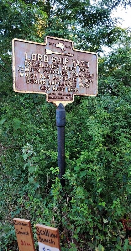
Lord Shipyard
Erected 1932 by State Education Department.
Topics. This historical marker is listed in these topic lists: Wars, Non-US • Waterways & Vessels. A significant historical year for this entry is 1800.
Location. 41° 3.472′ N, 72° 20.924′ W. Marker is on Shelter Island, New York, in Suffolk County. Marker is at the intersection of Menantic Road and Lords Lane, on the right when traveling south on Menantic Road. Touch for map. Marker is in this post office area: Shelter Island NY 11964, United States of America. Touch for directions.
Other nearby markers. At least 8 other markers are within 4 miles of this marker, measured as the crow flies. Site of First Meeting House (approx. 0.9 miles away); Site of First School House (approx. one mile away); James Havens (approx. one mile away); Klenawicus Airfield (approx. 1.6 miles away); Union Chapel (approx. 1.9 miles away); Fire Fighter (approx. 3 miles away); Historic Sites of Early Mills and Bridges (approx. 3 miles away); Downs Carriage House (approx. 3.9 miles away). Touch for a list and map of all markers in Shelter Island.
Credits. This page was last revised on August 11, 2020. It was originally submitted on August 9, 2020, by Jordan Romano of Kings Park, New York. This page has been viewed 187 times since then and 20 times this year. Photo 1. submitted on August 9, 2020, by Jordan Romano of Kings Park, New York. • Bill Pfingsten was the editor who published this page.
