Hanover County
⎯⎯⎯
Henrico County
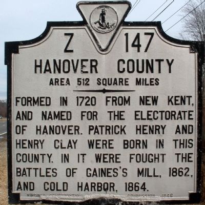
Hanover County. Area 512 Square Miles. Formed in 1720 from New Kent, and named for the Electorate of Hanover. Patrick Henry and Henry Clay were born in this county. In it were fought the battles of Gaines's Mill, 1862, and Cold Harbor, 1864.
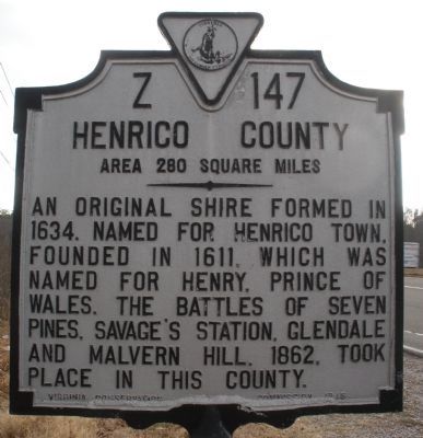
Henrico County. Area 280 Square Miles.. An original shire formed in 1634. Named for Henrico Town, founded in 1611, which was named for Henry, Prince of Wales. The Battles of Seven Pines, Savage's Station, Glendale and Malvern Hill, 1862, took place in this county.
Erected 1946 by Virginia Conservation & Development Commission. (Marker Number Z-147.)
Topics and series. This historical marker is listed in these topic lists: Political Subdivisions • War, US Civil. In addition, it is included in the Virginia Department of Historic Resources (DHR) series list. A significant historical year for this entry is 1720.
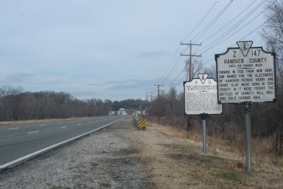
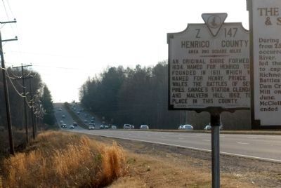
Location. 37° 35.457′ N, 77° 23.151′ W. Marker is near Richmond, Virginia, in Henrico County. It is on Mechanicsville Turnpike (U.S. 360) 0.7 miles west of Elm Drive, on the right when traveling east. Touch for map. Marker is at or near this postal address: 4600 Mechanicsville
this page online

Regionally, this marker is in the Piedmont and in Central Virginia. It is also in the American South, specifically in the Upper South, and on the Eastern Seaboard. Globally, it is in the North Atlantic Region, North America, the Western Hemisphere, the Western World, and the Anglosphere. Historically, it finds itself in what was once the territory of the Mississippian Culture, one of the original Thirteen Colonies, one of the Confederate States of America, and the Antebellum South.
Other nearby markers. At least 8 other markers are within 2 miles of this marker, measured as the crow flies: The Chickahominy River & Seven Days' Battles (here, next to this marker); Seven Days' Battles Begin (approx. 0.4 miles away); Defending Richmond (approx. half a mile away); Chickahominy Bluff (approx. half a mile away); Outer Fortifications (approx. 0.6 miles away); Seven Days Battles (approx. one mile away); Mechanicsville (approx. 1.2 miles away); a different marker also named Seven Days’ Battles (approx. 1.2 miles away). Touch for a list and map of all markers
Other markers no longer nearby. The Seven Days Begin (was approx. half a mile away but has been replaced with another marker now near it); a different marker also named Chickahominy Bluff (was approx. half a mile away but has been replaced with another marker now near it); Richmond Defences (was approx. 0.9 miles away but has been confirmed missing).
Also see . . .
1. Hanover County, Virginia. (Submitted on March 30, 2010.)
2. Henrico County, Virginia. (Submitted on March 30, 2010.)
Credits. This page was last revised on November 5, 2021. It was originally submitted on January 11, 2009, by Bernard Fisher of Richmond, Virginia. This page has been viewed 1,513 times since then and 46 times this year. Last updated on January 19, 2009, by Bernard Fisher of Richmond, Virginia. Photos: 1. submitted on January 11, 2009, by Bernard Fisher of Richmond, Virginia. 2. submitted on January 19, 2009, by Bernard Fisher of Richmond, Virginia. 3. submitted on January 11, 2009, by Bernard Fisher of Richmond, Virginia. 4. submitted on January 19, 2009, by Bernard Fisher of Richmond, Virginia. • Kevin W. was the editor who published this page.
