Mackinaw City in Emmet County, Michigan — The American Midwest (Great Lakes)
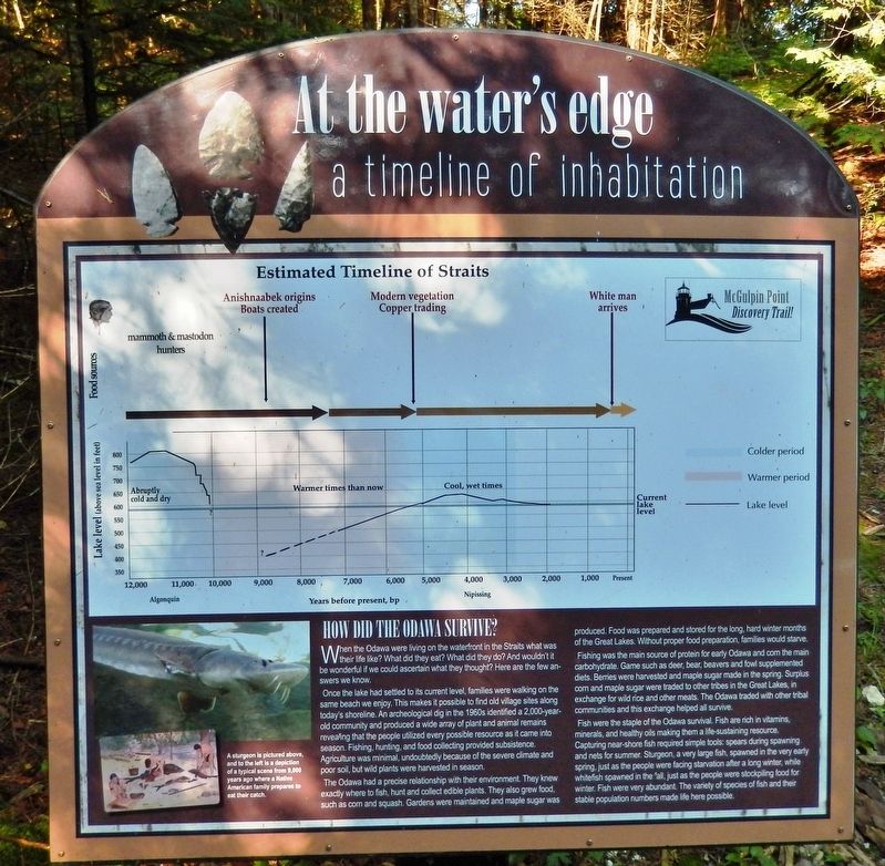
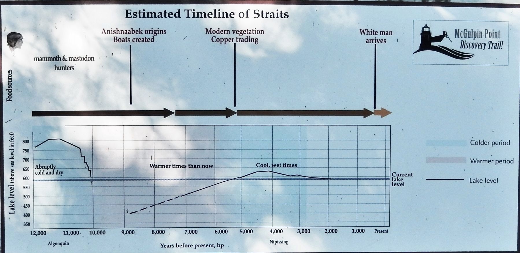
At The Water's Edge
A Timeline of Inhabitation
How Did the Odawa Survive?
When the Odawa were living on the waterfront in the Straits what was their life like? What did they eat? What did they do? And wouldn't it be wonderful if we could ascertain what they thought? Here are the few answers we know.
Once the lake had settled to its current level, families were walking on the same beach we enjoy. This makes it possible to find old village sites along today's shoreline. An archeological dig in the 1960s identified a 2,000-year-old community and produced a wide array of plant and animal remains revealing that the people utilized every possible resource as it came into season. Fishing, hunting, and food collecting provided subsistence. Agriculture was minimal, undoubtedly because of the severe climate and poor soil, but wild plants were harvested in season.
The Odawa had a precise relationship with their environment. They knew exactly where to fish, hunt and collect edible plants. They also grew food, such as corn and squash. Gardens were maintained and maple sugar was produced. Food was prepared and stored for the long, hard winter months of the Great Lakes. Without proper food preparation, families would starve.
Fishing was the main source of protein for early Odawa and corn the main carbohydrate. Game such as deer, bear, beavers and fowl supplemented diets. Berries were harvested and maple sugar made in the spring. Surplus corn and maple sugar were traded to other tribes in the Great Lakes, in exchange for wild rice and other meats. The Odawa traded with other tribal communities and this exchange helped all survive.
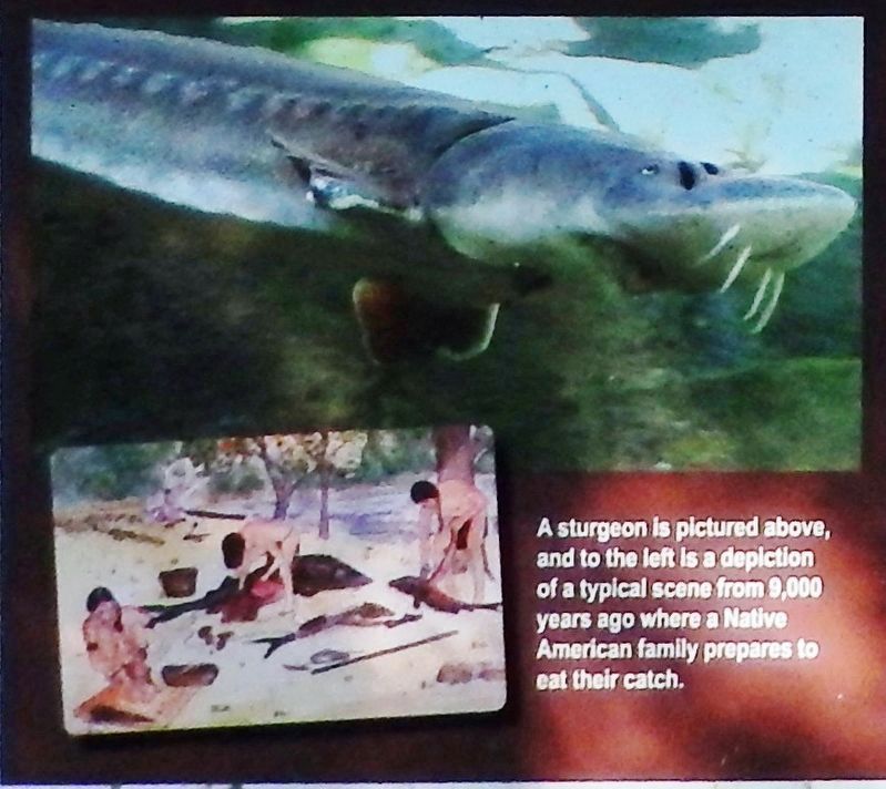
Fish were the staple of the Odawa survival. Fish are rich in vitamins, minerals, and healthy oils making them a life-sustaining resource. Capturing near-shore fish required simple tools: spears during spawning and nets for summer. Sturgeon, a very large fish, spawned in the very early spring, just as the people were facing starvation after a long winter, while whitefish spawned in the fall, just as the people were stockpiling food for winter. Fish were very abundant. The variety of species of fish and their stable population numbers made life here possible.
Topics. This historical marker is listed in these topic lists: Animals • Anthropology & Archaeology • Native Americans • Waterways & Vessels.
Location. 45° 47.348′ N, 84° 46.364′ W. Marker is in Mackinaw City, Michigan, in Emmet County. Marker can be reached from Headlands Road north of McGulpin Point Road, on the right when traveling north. Marker is located along the Discovery Trail at McGulpin Point Lighthouse & Historic Site. Touch for map. Marker is at or near this postal address: 500 Headlands Road, Mackinaw City MI 49701, United States of America. Touch for directions.
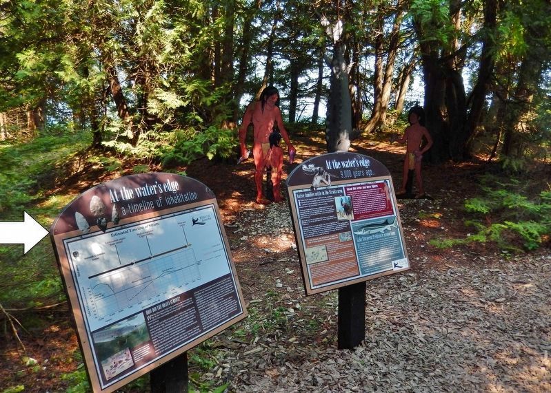
Other nearby markers. At least 8 other markers are within walking distance of this marker. At the Water's Edge (here, next to this marker); Warrior, brother & leader (within shouting distance of this marker); Charles de Langlade (about 500 feet away, measured in a direct line); Settling the Straits (about 600 feet away); McGulpin Family Life (about 700 feet away); William H. Barnum (about 700 feet away); Minneapolis (about 700 feet away); James W. Bennett (about 700 feet away). Touch for a list and map of all markers in Mackinaw City.
Related markers. Click here for a list of markers that are related to this marker. Discovery Trail to the Straits of Mackinac
Also see . . .
1. Odawa. The Canadian Encyclopedia website entry:
"Odawa (or Ottawa) are an Algonquian-speaking people (see Indigenous Languages in Canada) living north of the Huron-Wendat at the time of French penetration to the Upper Great Lakes." (Submitted on March 9, 2022, by Larry Gertner of New York, New York.)
2. Welcome to McGulpin Point. Website homepage:
The promontory which would become known as McGulpin Point has a history which starts perhaps thousands of years ago with Native American use and continues into the 20th Century as a lighthouse location. Anishnaabek history tells of the Odawa
coming to the Straits of Mackinac to expel an earlier tribe living in Northern Michigan. The Odawa took advantage of this vacuum and moved into Emmet County, first settling at McGulpin Point. (Submitted on August 15, 2020, by Cosmos Mariner of Cape Canaveral, Florida.)
3. Discovery Trail to the Straits of Mackinac. The story of McGulpin Point Lighthouse and Historic Site spans thousands of years, from our earliest inhabitants who made it their home to the Europeans who arrived and settled the grounds. (Submitted on August 16, 2020, by Cosmos Mariner of Cape Canaveral, Florida.)
Credits. This page was last revised on March 9, 2022. It was originally submitted on August 12, 2020, by Cosmos Mariner of Cape Canaveral, Florida. This page has been viewed 138 times since then and 8 times this year. Photos: 1, 2, 3, 4. submitted on August 15, 2020, by Cosmos Mariner of Cape Canaveral, Florida.


