Lewiston in Niagara County, New York — The American Northeast (Mid-Atlantic)
Lewiston Mound
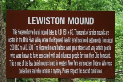
Photographed by Dale K. Benington, June 11, 2012
1. Mound Lewiston Marker
Missing?
Topics. This historical marker is listed in these topic lists: Cemeteries & Burial Sites • Indigenous Peoples and Communities. A significant historical year for this entry is 160 CE.
Location. Marker has been reported missing. It was located near 43° 9.991′ N, 79° 2.67′ W. Marker was in Lewiston, New York, in Niagara County. It could be reached from South 4th Street south of Tuscarora Street. This historical marker is located on the grounds of the Earl W. Brydges Artpark. To get to this historic marker one must take South 4th Street south all the way to where the road ends, at the entrance
this page online

Regionally, this marker was in Upstate New York, specifically in Western New York, and in the Buffalo Metropolitan Area. It was also in the American Northeast and in the Mid-Atlantic. Globally, it was in North America, on the Great Lakes, in the Western Hemisphere, in the Western World, and in the Anglosphere. Historically, it found itself in what was once the Viceroyalty of New France, the Haudenosaunee (Iroquois) Confederacy, New Netherland, and one of the original Thirteen Colonies.
Other nearby markers. At least 8 other markers are within walking distance of this location: Fort Joncaire (within shouting distance of this marker); The Magazin Royale (within shouting distance of this marker); The Cradles (within shouting distance of this marker); Oak Hill and Scovell Knoll (about 400 feet away, measured in a direct
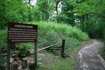
Photographed by Dale K. Benington, June 11, 2012
2. Mound Lewiston Marker
View of the historical marker, in the foreground, alongside the park walking trail, along side of the Hopewell burial mound.
Another marker is no longer nearby. The Lewiston Mound (was a few steps from this marker but has been confirmed missing).
Also see . . .
1. Lewiston Mound. This is a link to information provided by Wikipedia, the free encyclopedia. (Submitted on June 27, 2013, by Dale K. Benington of Toledo, Ohio.)
2. Marker Missing (removed)?. Why are They Hiding the Lewiston Indian Burial Mound? Youtube video. (Submitted on September 13, 2025, by Mark Hilton of Montgomery, Alabama.)
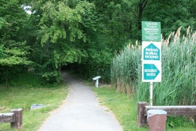
Photographed by Dale K. Benington, June 11, 2012
3. Mound Lewiston Marker
View taken from the paved street area, of the park's trailhead, that leads into the woods, past the Lewiston Mound.
[Ed. Note - even the Indian Burial Mound blue sign shown in this photo is missing as per Youtube link.]
[Ed. Note - even the Indian Burial Mound blue sign shown in this photo is missing as per Youtube link.]
Credits. This page was last revised on September 13, 2025. It was originally submitted on June 27, 2013, by Dale K. Benington of Toledo, Ohio. This page has been viewed 2,363 times since then and 145 times this year. Last updated on August 29, 2020, by Bradley Owen of Morgantown, West Virginia. Photos: 1, 2, 3. submitted on June 27, 2013, by Dale K. Benington of Toledo, Ohio. • Michael Herrick was the editor who published this page.
Editor’s want-list for this marker. Photo verifying marker is gone. A link to the National Register nomination form with a citation of the mound's historical significance. • Can you help?
