Saint Anthony Main in Minneapolis in Hennepin County, Minnesota — The American Midwest (Upper Plains)
The Falls That Built the City
— Saint Anthony Falls Heritage Trail —
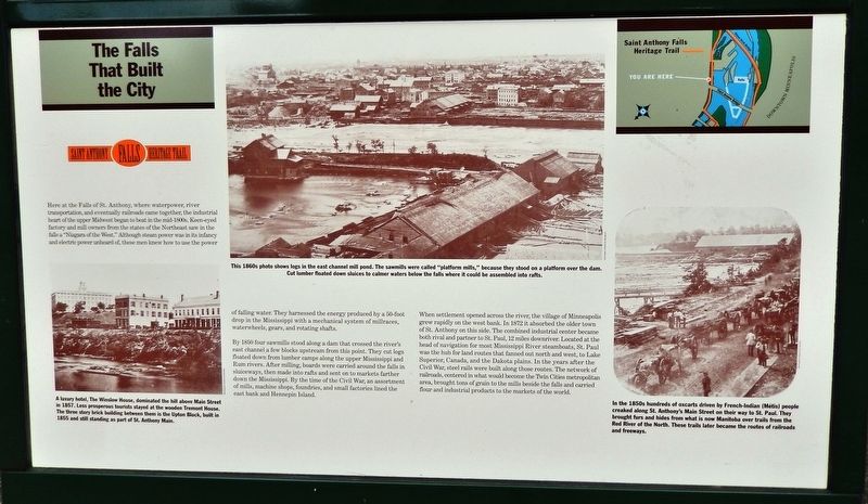
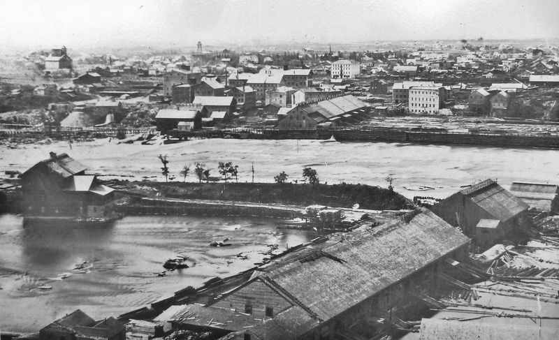
By 1850 four sawmills stood along a dam that crossed the river's east channel a few blocks upstream from this point. They cut logs floated down from lumber camps along the upper Mississippi and Rum rivers. After milling, boards were carried around the falls in sluiceways, then made into rafts and sent on to markets farther down the Mississippi. By the time of the Civil War, an assortment of mills, machine shops, foundries, and small factories lined the east bank and Hennepin Island.
When settlement opened across the river, the village of Minneapolis grew rapidly on the west bank. In 1872 it absorbed the older town of St. Anthony on this side. The combined industrial center became both rival and partner to St. Paul, 12 miles downriver. Located at the head of navigation for most Mississippi River steamboats, St. Paul was the hub for land routes that fanned out north and west, to Lake Superior, Canada, and the Dakota plains. In the years after the Civil War, steel rails were built along those routes. The network of railroads, centered in what would become the Twin Cities metropolitan area, brought tons of grain to the mills beside the falls and carried flour and industrial products to the markets of the world.
(panel above marker on kiosk)
The Mississippi River
The Mississippi River is one of the largest rivers in the world. It divides east from west through the center of the United States: boundary, obstacle, water supply, drainage system, highway. It is 2,350 miles long and flows from Lake Itasca in northern Minnesota southward to New Orleans and the Gulf of Mexico. Its watershed covers 1,231,000 square miles and drains portions of thirty-two states and two Canadian provinces.
Wild and natural resources abound in the river corridor. Forty percent of North American waterfowl migrate along its flyway. As a major mid-continent waterway, the Mississippi has carried people and products north and south over thousands of years.
The river has stirred imagination and creativity in the worlds of art, music, dance, and literature. Stories of human time and habitation are found in cities and in open spaces;
Hennepin Historical Museum
2. Marker detail: East Channel Mill Pond, 1860s
This 1860s photo shows logs in the east channel mill pond. The sawmills were called "platform mills," because they stood on a platform over the dam. Cut lumber floated down sluices to calmer waters below the falls where it could be assembled into rafts.
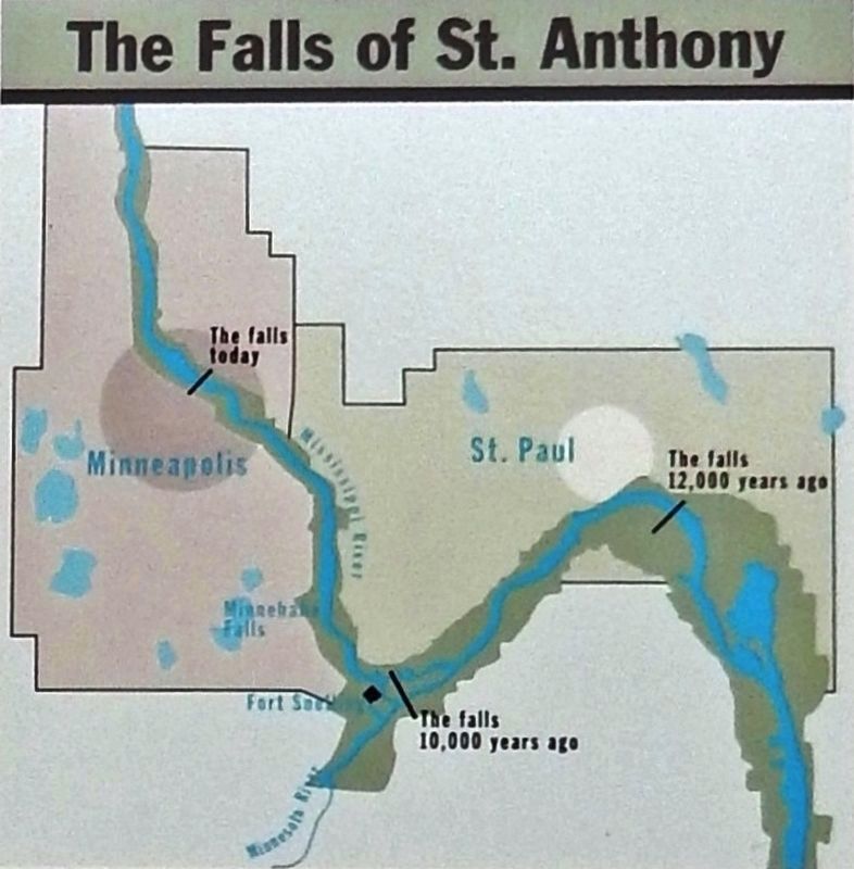
The Falls of St. Anthony
The Falls of St. Anthony is the only major waterfall on the Mississippi River. It has meant many things to people over time: a place of wonder and mystery; a landmark for travelers, explorers, traders, and tourists; a waterpower harnessed by early industrialists to produce wealth, power, and international fame for the region.
The falls were not always where they are today. Over many centuries, forces of erosion caused them to move upstream to their present location, where they were stabilized in the 1870s to protect the waterpower for the growing city of Minneapolis. That pathway of erosion defined the geography of the Twin Cities.
St. Paul was settled in the 1840s, at the head of steamboat navigation on the Mississippi, near the original site of the falls some 12,000 years ago. It became the territorial capital of Minnesota in 1849 and the state capital in 1858.
Minneapolis, twelve miles upstream from St. Paul, developed in the 1850s around the waterpower of the falls, to become the flour-milling capital of the nation from 1880 to 1930 and the largest city in Minnesota today.
Minnesota Historical Society
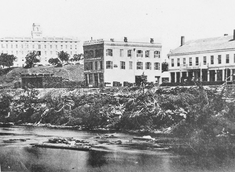
3. Marker detail: The Winslow House, 1857
A luxury hotel, The Winslow House, dominated the hill above Main Street in 1857. Less prosperous tourists stayed at the wooden Tremont House. The three story brick building between them is the Upton Block, built in 1855 and still standing as part of St. Anthony Main.
Erected by St. Anthony Falls Heritage Board.
Topics. This historical marker is listed in these topic lists: Industry & Commerce • Railroads & Streetcars • Settlements & Settlers • Waterways & Vessels. A significant historical year for this entry is 1850.
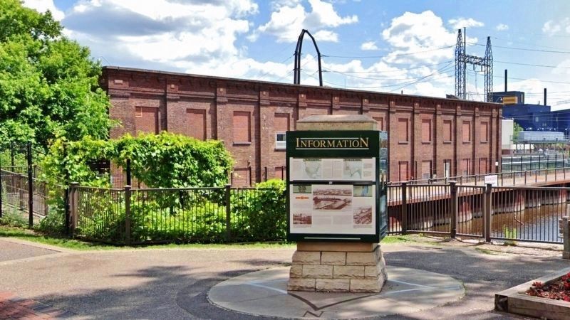
Location. 44° 59.051′ N, 93° 15.297′ W. Marker is in Minneapolis, Minnesota, in Hennepin County. It is in Saint Anthony Main. Marker is on Southeast Main Street west of Southeast 3rd Avenue, on the left when traveling west. Marker is mounted on a sidewalk kiosk, overlooking the St. Anthony Falls Hydro Project Office (former Minneapolis General Electric Company Main Street Station). Touch for map. Marker is in this post office area: Minneapolis MN 55414, United States of America. Touch for directions.
Other nearby markers. At least 8 other markers are within walking distance of this marker. Follow the Water: Part 1 - Intake and Tunnel (here, next to this marker); Electricity and Minneapolis (a few steps from this marker); Harnessing Waterpower (within shouting distance of this marker); Power on the East Side (within shouting distance of this marker); Main Street Builds (within shouting distance of this marker); Hydroelectricity: The Early Years (about 300 feet away, measured in a direct line); Hydroelectricity Comes of Age (about 400 feet away); Franklin Steele (about 400 feet away). Touch for a list and map of all markers in Minneapolis.
Also see . . .
Minnesota Historical Society
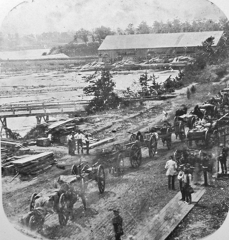
4. Marker detail: St. Anthony's Main Street, 1850s
In the 1850s hundreds of oxcarts driven by French-Indian (Métis) people creaked along St. Anthony's Main Street on their way to St. Paul. They brought furs and hides from what is now Manitoba over trails from the Red River of the North. These trails later became the routes of railroads and freeways.
1. Falls Provide Townsite and Waterpower. The St. Anthony Falls provided the source of power for lumber and flour milling, the two industries that fueled the city's rapid growth. Soldiers built the first flour mill in 1823 and the first commercial sawmill was in operation in 1841. Attracting settlers from New England, particularly lumbermen from Maine, the rich land was ready for settlement. (Submitted on September 1, 2020, by Cosmos Mariner of Cape Canaveral, Florida.)
2. Saint Anthony Falls (Wikipedia). Millers on the Minneapolis side formed a consortium to extract power by diverting upper-level water into waterwheel-equipped vertical shafts (driven through the limestone bedrock into the soft, underlying sandstone) and then through horizontal tunnels to the falls' lower level. The mills on the St. Anthony (east) side of the river were less-well organized harnessing the power, and therefore industry developed at a slower pace on that side. (Submitted on September 1, 2020, by Cosmos Mariner of Cape Canaveral, Florida.)
Credits. This page was last revised on February 12, 2023. It was originally submitted on August 31, 2020, by Cosmos Mariner of Cape Canaveral, Florida. This page has been viewed 208 times since then and 31 times this year. Photos: 1. submitted on August 31, 2020, by Cosmos Mariner of Cape Canaveral, Florida. 2, 3, 4, 5. submitted on September 1, 2020, by Cosmos Mariner of Cape Canaveral, Florida. 6. submitted on August 31, 2020, by Cosmos Mariner of Cape Canaveral, Florida.
