Near Bolivar in Jefferson County, West Virginia — The American South (Appalachia)
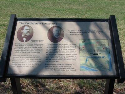
The Confederate Perspective
Harpers Ferry National Historical Park
— National Park Service, U.S. Department of the Interior —
"General J.R. Jones was directed to make a demonstration against the enemy's right."
Jackson's official report
Confederate Colonel Edmund Pendleton wrote about the night of September 14, 1862, from his perspective across the road on School House Ridge. Pendleton and his men were facing this direction, holding the Union forces in check on Bolivar Heights behind you.
"We lay upon our arms till nearly daylight, the quietude of the night being unbroken, save by a sharp musketry fire of a few minutes duration in front of our right and a few hundred yards distant, which proved to have occurred between two regiments of the enemy on picket duty, who had mutually mistaken each other for foes."
Colonel Pendleton was mistaken. The gunfire he heard was exactly what General "Stonewall" Jackson wanted. Jackson intended to outflank the enemy stronghold on Bolivar Heights by moving artillery and infantry to the far left of the Union position. To cover this maneuver and distract the Union troops, Jackson ordered some of his forces on School House Ridge to stage a feint attack against the Union skirmish line near the road below. Confederate victory was inevitable now.
Even though the attack here lasted only a short time, it was a critical part of the Confederate strategy, and a life and death situation for the soldiers who were involved.
Erected by National Park Service, U.S. Department of the Interior.
Topics. This historical marker is listed in this topic list: War, US Civil. A significant historical date for this entry is September 14, 1819.
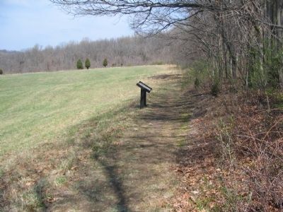
Location. 39° 19.518′ N, 77° 45.816′ W. Marker is near Bolivar, West Virginia, in Jefferson County. Marker can be reached from Bakerton Road (County Route 27), on the right when traveling north. Located along the Union Skirmish Line Trail, in Harpers Ferry National Historic Park. Touch for map. Marker is in this post office area: Harpers Ferry WV 25425, United States of America. Touch for directions.
Other nearby markers. At least 8 other markers are within walking distance of this marker. From Skirmish Line to Burial Ground (about 300 feet away, measured in a direct line); Five Rounds into the Darkness (about 700 feet away); Union Skirmish Line (approx. 0.2 miles away); Historic Heights (approx. 0.2 miles away); Battle of Harpers Ferry / Union Stronghold (approx. 0.2 miles away); We Began Firing At Will: The 111th New York Regiment (approx. 0.2 miles away); Bolivar Heights Trail (approx. 0.2 miles away); Harpers Ferry (approx. 0.2 miles away). Touch for a list and map of all markers in Bolivar.
More about this marker. Above the main text are portraits of Colonel Edmund Pendleton, 15th Louisiana Infantry and General J.R. Jones. To the right a map depicts the tactical situation detailed in the marker text.
Also see . . . 1862 Battle of Harpers Ferry. National Park Service summary of the battle. (Submitted on May 19, 2008, by Craig Swain of Leesburg, Virginia.)
Additional commentary.
1. Brig. Gen. J.R. Jones
John R. Jones commanded what had been General Jackson's Division, famous for their exploits in the Shenandoah Valley earlier in 1862. Jones' tenure as Division Commander was short lived. A few days after the Battle of Harpers Ferry, Jones was wounded (or incapacitated by some other means) at the battle of Antietam. Jones was later accused of cowardice by several of his subordinates after the Battle of Chancellorsville in May 1863 and was relieved. In July of that year he was captured by Federal forces shortly after the battle of Gettysburg. Jones was never exchange and served the remainder of the war as a prisoner.
— Submitted May 19, 2008, by Craig Swain of Leesburg, Virginia.

Photographed By Craig Swain, April 5, 2008
3. J.R. Jones' Position
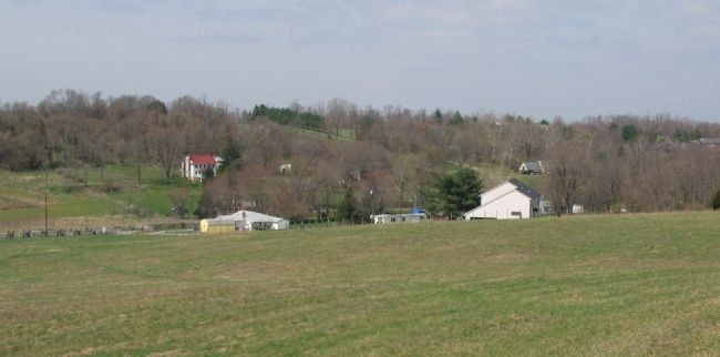
Looking from the marker location across the valley, and Bakerton Road. J.R. Jones' Division occupied the high ground on School House Ridge opposite the northern end of Bolivar Heights. Artillery of Brockenbrough's Maryland Battery stood on the ground near the modern house in the center distance.

Photographed By Craig Swain, April 5, 2008
4. Confederate View of Bolivar Heights
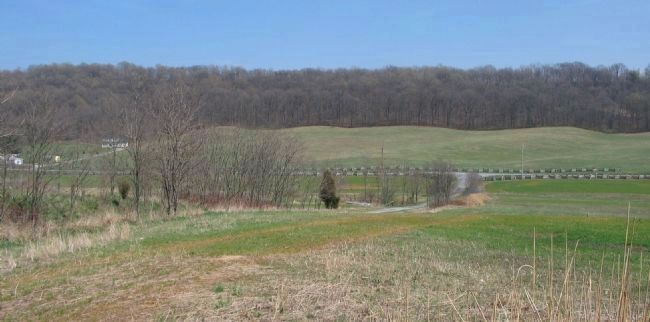
On the opposite side of the valley, looking back toward the marker's location. Bolivar Heights is the wooded high ground in the distance. Bakerton Road runs from left to right. Notice the "fingers" extending off Bolivar Heights.
Credits. This page was last revised on September 8, 2020. It was originally submitted on May 19, 2008. This page has been viewed 1,213 times since then and 22 times this year. Last updated on September 6, 2020, by Bradley Owen of Morgantown, West Virginia. Photos: 1, 2, 3. submitted on May 19, 2008, by Craig Swain of Leesburg, Virginia. 4. submitted on May 26, 2008, by Craig Swain of Leesburg, Virginia. • Devry Becker Jones was the editor who published this page.

