Woodbine in Camden County, Georgia — The American South (South Atlantic)
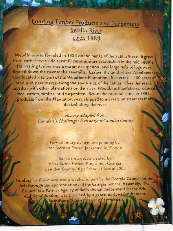
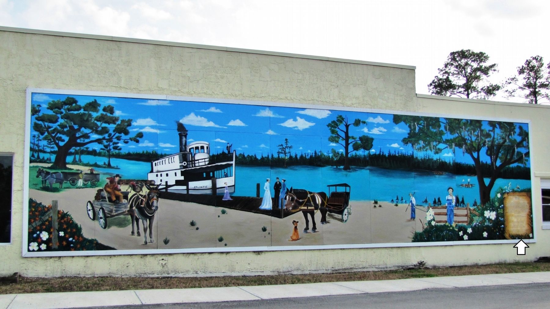
Loading Timber Products and Turpentine
Satilla River
— circa 1889 —
"Camden's Challenge: A History of Camden County"
Formal image design and painting by:
Mr. Vernon Potter, Jacksonville, Florida
Based on an idea created by:
Miss Jackie Fortier, Kingsland, Georgia
Camden County High School, Class of 2003
Funding for this mural was provided in part by the Georgia Council for the Arts through the appropriations of the Georgia General Assembly. The Council is a Partner Agency of the National Endowment for the Arts. Additional funding was provided by a generous donation from the Woodbine Citizens Steering Committee.
Topics. This historical marker is listed in these topic lists: Agriculture • Industry & Commerce • Settlements & Settlers • Waterways & Vessels. A significant historical year for this entry is 1893.
Location. 30° 58.136′ N, 81° 43.45′ W. Marker is in Woodbine, Georgia, in Camden County. Marker is on West 3rd Street just west of Bedell Avenue (U.S. 17), on the left when traveling west. Marker and panoramic mural are painted on north wall of building at this address, facing West 3rd Street. Touch for map. Marker is at or near this postal address: 306 Bedell Avenue, Woodbine GA 31569, United States of America. Touch for directions.
Other nearby markers. At least 8 other markers are within 15 miles of this marker, measured as the crow flies. Camden County (about 500 feet away, measured in a direct line); Refuge Plantation (approx. 1.1 miles away); Post Road (approx. 6.9 miles away); Tre Francesco Porfirio (approx. 11.9 miles away); Joe H. Joseph / Hammond Roberts (approx. 11.9 miles away); Jacob Joseph (approx. 11.9 miles away); Treaty of Coleraine (approx. 13.7 miles away); Kings Ferry (approx. 14.4 miles away in Florida).
Also see . . .
1. Woodbine History. Records of the site where Woodbine
is located date back to 1765, when William Trowin, John Brown, William Struthers, and John McGillvary petitioned for and received fourteen hundred acres on the south side of the Great Satilla River at a place referred to as Pile’s Bluff. (Submitted on September 8, 2020, by Cosmos Mariner of Cape Canaveral, Florida.)
2. Camden County. Until the Civil War the community thrived, owing to a large number of plantations along the river cultivating rice, cotton, corn, and other products. In the 1890s Camden County's economy was bolstered by timber and turpentine products. These evolved to larger commercial pulp-paper manufacturing operations from the 1940s to the present. (Submitted on September 8, 2020, by Cosmos Mariner of Cape Canaveral, Florida.)
3. Woodbine History. It is said that during the Civil War, Northerners destroyed the plantation house. In 1882, the overseer's house was destroyed by a tornado. In 1893, the railroad took over transportation of rice from the vessels on the Satilla River. In fact, the railroad ran through on the actual plantation itself. (Submitted on September 8, 2020, by Cosmos Mariner of Cape Canaveral, Florida.)
4. Woodbine (Wikipedia). Woodbine was incorporated as a town in 1908. The town grew more after the Atlantic Coastal Highway was constructed during 1927 and the county seat relocated there the following year. (Submitted on September 8, 2020, by Cosmos Mariner of Cape Canaveral, Florida.)
Credits. This page was last revised on September 8, 2020. It was originally submitted on September 7, 2020, by Cosmos Mariner of Cape Canaveral, Florida. This page has been viewed 221 times since then and 26 times this year. Photos: 1, 2. submitted on September 8, 2020, by Cosmos Mariner of Cape Canaveral, Florida.

