Brookhaven in Suffolk County, New York — The American Northeast (Mid-Atlantic)
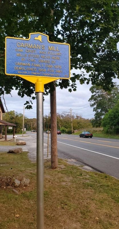
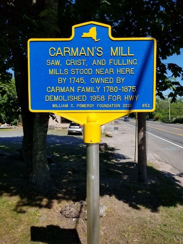
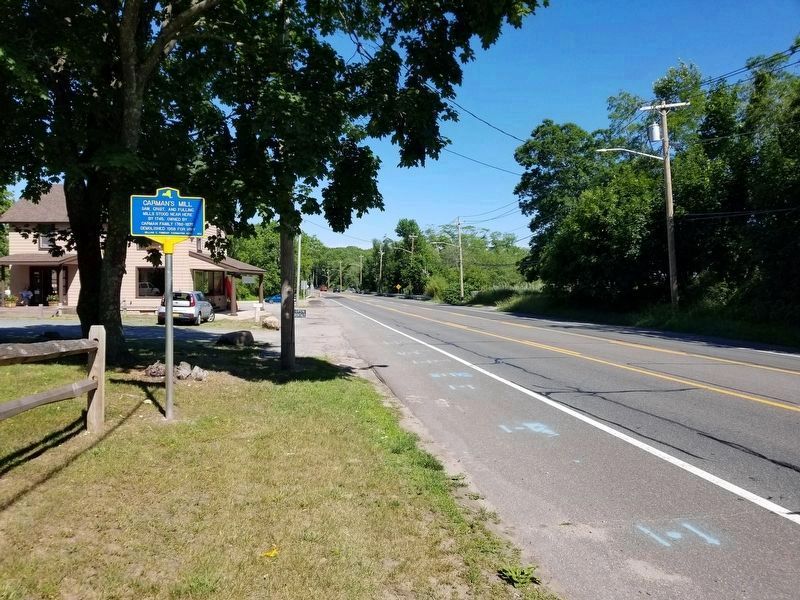
Carman's Mill
Erected 2020 by William G. Pomeroy Foundation. (Marker Number 652.)
Topics. This historical marker is listed in these topic lists: Agriculture • Environment • Industry & Commerce • Settlements & Settlers. A significant historical year for this entry is 1745.
Location. 40° 48.092′ N, 72° 53.152′ W. Marker is in Brookhaven, New York, in Suffolk County. Marker is on Montauk Highway, 0.1 miles east of Private Road, on the right when traveling west. Touch for map. Marker is at or near this postal address: 2979 Montauk Highway, Brookhaven NY 11719, United States of America. Touch for directions.
Other nearby markers. At least 8 other markers are within 3 miles of this marker, measured as the crow flies. Ca. 1740 Cemetery (within shouting distance of this marker); Fort St. George (approx. 0.9 miles away); Poospatuck Res. (approx. 2.3 miles away); Mastic Station (approx. 2.4 miles away); Woodhull Grave (approx. 2˝ miles away); Gen William Floyd (approx. 2.6 miles away); Forge River (approx. 2.7 miles away); Lily Lake (approx. 2.8 miles away).
Also see . . . Carman's Mill | Willam G. Pomeroy Foundation. (Submitted on September 17, 2020, by Jordan Romano of Kings Park, New York.)
Credits. This page was last revised on June 22, 2021. It was originally submitted on September 17, 2020, by Jordan Romano of Kings Park, New York. This page has been viewed 173 times since then and 23 times this year. Photos: 1. submitted on September 17, 2020, by Jordan Romano of Kings Park, New York. 2, 3. submitted on June 17, 2021, by Alexander Erwin of East Patchogue, New York. • Bill Pfingsten was the editor who published this page.


