Near Berkeley Springs in Morgan County, West Virginia — The American South (Appalachia)
Cacapon Mountain Overlook
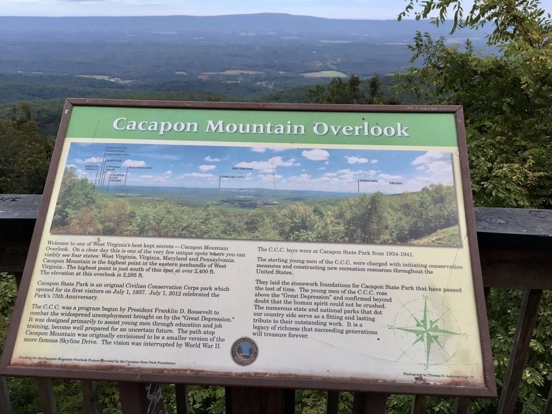
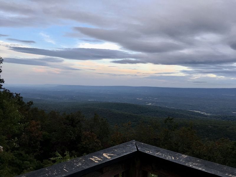
Welcome to one of West Virginia’s best secrets – Cacapon Mountain Overlook. On a clear day this is one of the very few unique spots where you can visibly see four states: West Virginia, Virginia, Maryland, and Pennsylvania. Cacapon Mountain is the highest point in the eastern panhandle of West Virginia. The highest point is just south of this spot at over 2,400 ft. The elevation at this overlook is 2,285 ft.
Cacapon State Park is an original Civilian Conservation Corps park which opened for its first visitors on July 1, 1937. July 1, 2012 celebrated the park’s 75th Anniversary.
The C.C.C. was a program begun by President Franklin D. Roosevelt to combat the widespread unemployment brought on by the “Great Depression.” It was designed primarily to assist young men through education and job training, become well prepared for an uncertain future. The path atop Cacapon Mountain was originally envisioned to be a smaller version of the more famous Skyline Drive. The vision was interrupted by World War II.
The C.C.C. boys were at Cacapon State Park from 1934-1941.
The sterling young men of the C.C.C. were charged with initiating conservation measures and constructing new recreation resources throughout the United States.
They laid the stonework foundations for Cacapon State Park that have passed the test of time. The young men of the C.C.C. rose above the “Great Depression” and confirmed beyond doubt that the human spirit could not be crushed. The numerous state and national parks that dot our countryside serve as a fitting and lasting tribute to their outstanding work. It is a legacy of richness that succeeding generations will treasure forever.
Erected by Cacapon State Park Foundation.
Topics and series. This historical marker is listed in these topic lists: Charity & Public Work • Horticulture & Forestry • Parks & Recreational Areas • Roads & Vehicles. In addition, it is included in the Civilian Conservation Corps (CCC) series list. A significant historical date for this entry is July 1, 1937.
Location. 39° 28.253′ N, 78° 20.625′ W. Marker is near Berkeley Springs, West Virginia, in Morgan County. Marker is on Overlook Trail, 0.7 miles north of Middle Fork Cabin Lane, on the right. This marker is steps away from a marker entitled Washington Heritage Trail-Overlook at Cacapon State Park. Touch for map. Marker is in this post office area: Berkeley Springs WV 25411, United States of America. Touch for directions.
Other nearby markers. At least 8 other markers are within 4 miles of this marker, measured as the crow flies. Overlook at Cacapon State Park (a few steps from this marker); Ridge Fish Hatchery (approx. 1.8 miles away); West Virginia (Morgan County) / Virginia
(approx. 2.6 miles away); Cacapon State Park (approx. 3 miles away); Cacapon State Park Playground Equipment (approx. 3.1 miles away); Cacapon State Park Picnic Grills (approx. 3.2 miles away); Oriskany Sand (approx. 3.4 miles away); Welcome to Cacapon State Park (approx. 3.4 miles away). Touch for a list and map of all markers in Berkeley Springs.
Additional keywords. Civilian Conservation Corps
Credits. This page was last revised on September 23, 2021. It was originally submitted on September 26, 2020, by T. Elizabeth Renich of Winchester, Virginia. This page has been viewed 2,396 times since then and 288 times this year. Photos: 1, 2, 3. submitted on September 26, 2020, by T. Elizabeth Renich of Winchester, Virginia. • Devry Becker Jones was the editor who published this page.


