Annapolis in Anne Arundel County, Maryland — The American Northeast (Mid-Atlantic)
The Old Treasury Building
The Old Treasury
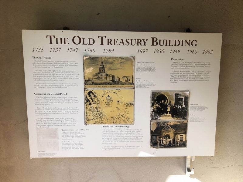
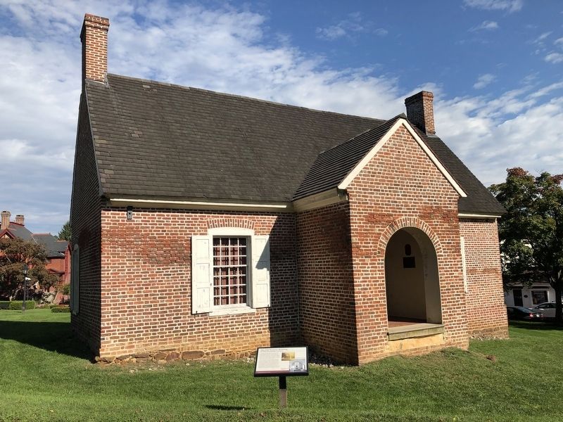
The Old Treasury was built between 1735 and 1737 as the office for the Commissioners for Emitting Bills of Credit. The Commissioners were responsible for lending Maryland's newly-authorized paper currency to the colonists.
The office employed five people--three commissioners, a clerk, and a bookkeeper--who worked only on Wednesdays. The commissioners issued and regulated the bills of credit. Unissued bills were store in an iron chest protected by three locks. Each commissioner had a key to one lock; thus no bills could be issued unless all three commissioners were present.
Known in the colonial period as The Paper Currency Office and the Loan-Office, the building acquired its present name in the 1780s when it housed the Treasurer's office.
Currency in the Colonial Period
Maryland colonists relied on tobacco as their primary form of currency. Tobacco, however, had many disadvantages as a medium of exchange. It was a bulky and perishable commodity, varied in value from year to year, and could not easily be carried around in any quantity.
To provide a better form of currency, particularly for small purchases, in 1733 the Maryland General Assembly authorized the issuance of £90,000 in paper money. The money would be loaned in small amounts to property owners, with their land as security for the loan.
To fund the new money, known as bills of credit, the Assembly taxed all tobacco shipped out of the colony. The income from the tax was invested in Bank of London stock. As a result, Maryland's paper currency--unlike that of most other colonies--remained sound and kept its value during the colonial period.
Preservation
As early as 1773, the weight of the arched ceiling caused the walls of the building to crack. Despite many repairs over the years, by 1949 the damage was so great that the interior had become unrecognizable.
Governor William Preston Lane, Jr. authorized "a complete rehabilitation and restoration" of the Old Treasury, the first such restoration of a public building carried out by the State of Maryland. The State gave responsibility for the project to Baltimore architects Henry Powell Hopkins and Laurence Hall Fowler, each of whom had designed other buildings in Annapolis.
Other State Circle Buildings
There are only two buildings inside State Circle today: the State House and Old Treasury. Over the years, however, a number of other buildings have been located here. These structures included King William's School, the powder house or magazine, the public necessary, the armory, a market house, the first "repository" for public records, and a Methodist
Inside the State House, there is an exhibit on the history of the State Circle buildings, as well as many other exhibits on Maryland history.
[Captions:]
Quotations from Maryland Gazette:
2 March 1747: Whereas some evil minded person made an attempt to break into the Paper Currency Office to rob same, there is a reward of £30 at said office and his Lordship's pardon if his accomplice turns the villain in…
17 March 1768: Sunday morning last died in goal, William Dupriest, under confinement for having been concerned for counterfeiting $8 of province. It is generally thought that he took a dose of laudanuum, as he slept from the Tuesday preceding his death.
1789 view of the State House grounds:
This view of State Circle, published in the February issue of Columbian Magazine and attributed to Charles William Peale, shows the buildings within the circle at that time. To the right of the recently completed State House are the Old Council Chamber and Ballroom, the octagonal public necessary, and the Old Treasury.
Sanborn:
This 1897 Sanborn Map Company insurance map of Annapolis shows the buildings standing
Plaque Unveiling:
At a ceremony held on March 25, 1930, Governor Albert C. Ritchie unveiled a plaque presented by the Peggy Stewart Chapter of the Daughters of the American Revolution.
Tour Group:
Senior guide Harry Hughes addresses a group of junior guides in 1960, when the Old Treasury served as Historic Annapolis Foundation's tour office.
Topics. This historical marker is listed in these topic lists: Agriculture • Colonial Era • Government & Politics • Industry & Commerce. A significant historical date for this entry is March 2, 1747.
Location. 38° 58.739′ N, 76° 29.413′ W. Marker is in Annapolis, Maryland, in Anne Arundel County. Marker is at the intersection of State Circle and East Street, on the left when traveling north on State Circle. Touch for map. Marker is at or near this postal address: 66 State Cir, Annapolis MD 21401, United States of America. Touch for directions.
Other nearby markers. At least 8 other markers are within walking distance of this marker. A different marker also named Old Treasury Building (here, next to this marker); a different marker also named The Old Treasury Building (a few steps from this marker); Liberty Tree (a few steps from this marker); St. Mary's City Cannon (within shouting distance of this marker); Katharine Hepburn Slept Here (within shouting distance of this marker); Cornhill & Fleet Streets (within shouting distance of this marker); State Circle & Maryland Ave. (within shouting distance of this marker); Roger Brooke Taney, 1777 - 1864 (within shouting distance of this marker). Touch for a list and map of all markers in Annapolis.
Credits. This page was last revised on October 1, 2020. It was originally submitted on October 1, 2020, by Devry Becker Jones of Washington, District of Columbia. This page has been viewed 146 times since then and 22 times this year. Photos: 1, 2, 3. submitted on October 1, 2020, by Devry Becker Jones of Washington, District of Columbia.


