
Berryville in Clarke County, Virginia — The American South (Mid-Atlantic)
Berryville
Our County Seat

Initially known as "Battletown" for the Saturday night brawls that took place at the local inns, the town of Berryville was officially chartered in 1798 and named for Benjamin Berry, a local businessman. The new town became the county seat when Clarke County was formed in 1836.
In 1987, Berryville was listed on the Virginia Landmark's Register and the National Register of Historic Places. 314 buildings have been identified as contributing historical resources. In 1992, Berryville was accepted into the Virginia Main Street Program, created by the National Trust for Historic Preservation, to preserve, revitalize and promote downtown commercial centers in small towns throughout the United States.
The Barns of Rose Hill
Today, two old dairy barns across the street in Rose Hill Park are being restored and renovated to become a community cultural arts center.
[Captions:]
This is an early-20th-century postcard of the Clarke County Courthouse constructed in 1836.
George Washington kept an office in Berryville in the late 1740s when he served as survey for Lord Fairfax.
An artist's rendition of the Barns of Rose Hill before renovation. (Painting by Edward Cooper)
The Berryville Cornet Bands, 1902
Topics and series.
this page online
Location. 39° 9.031′ N, 77° 58.799′ W. Marker is in Berryville, Virginia, in Clarke County. It is on East Main Street (Virginia Route 7B) 0.1 miles west of Page Street, on the right when traveling west. Touch for map. Marker is at or near this postal address: 32 E Main St, Berryville VA 22611, United States of America. Touch for directions.

Regionally, this marker is in the Washington Metropolitan Area and in Northern Virginia. It is also in the American South, specifically in the Upper South, and in the Mid-Atlantic. Globally, it is in North America, the Western Hemisphere, the Western World, and the Anglosphere. Historically, it finds itself in what was once the territory of the Mississippian Culture, one of the original Thirteen Colonies, one of the Confederate States of America, and the Antebellum South.
Other nearby markers. At
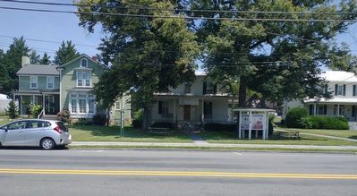
Photographed by Craig Doda, July 23, 2022
2. Berryville Marker
Credits. This page was last revised on August 7, 2022. It was originally submitted on October 11, 2020, by Devry Becker Jones of Washington, District of Columbia. This page has been viewed 538 times since then and 56 times this year. Photos: 1. submitted on October 11, 2020, by Devry Becker Jones of Washington, District of Columbia. 2. submitted on August 7, 2022, by Craig Doda of Napoleon, Ohio.
