Elizabethton in Carter County, Tennessee — The American South (East South Central)
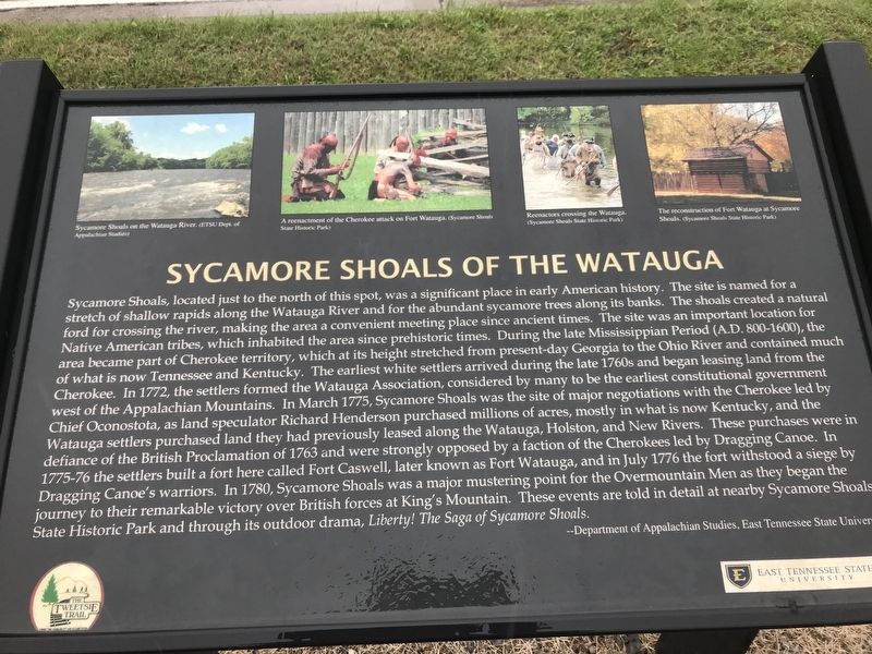
Sycamore Shoals of the Watauga
Inscription.
Sycamore Shoals, located just to the north of this spot, was a significant place in early American history. The site is named for a stretch of shallow rapids along the Watauga River and for the abundant sycamore trees along its banks. The shoals created a natural ford for crossing the river, making the area a convenient meeting place since ancient times. The site was an important location for Native American tribes, which inhabited the area since prehistoric times. During the late Mississippian Period (A.D. 800-1600), the area became part of Cherokee territory, which at its height stretched from present-day Georgia to the Ohio River and contained much of what is now Tennessee and Kentucky. The earliest white settlers arrived during the late 1760s and began leasing land from the Cherokee. In 1772, the settlers formed the Watauga Association, considered by many to be the earliest constitutional government west of the Appalachian Mountains. In March 1775, Sycamore Shoals was the site of major negotiations with the Cherokee led by Chief Oconostota, as land speculator Richard Henderson purchased millions of acres, mostly in what is now Kentucky, and the Watauga settlers purchased land they had previously leased along the Watauga, Holston, and New Rivers. These purchases were in defiance of the British Proclamation of 1763 and were strongly opposed by a faction of the Cherokees led by Dragging Canoe. In 1775-76 the settlers built a fort here called Fort Caswell, later known as Fort Watauga, and in July 1776 the fort withstood a siege by Dragging Canoe's warriors. In 1780, Sycamore Shoals was a major mustering point for the Overmountain Men as they began the journey to their remarkable victory over British forces at King's Mountain. These events are told in detail at nearby Sycamore Shoals State Historic Park and through its outdoor drama, Liberty! The Saga of Sycamore Shoals.
— Department of Appalachian Studies, East Tennessee State University
Captions (left to right)
• Sycamore Shoals on the Watauga Ríver. (ETSU Dept. of Appalachian Studies)
• A reenactment of the Cherokee attack on Fort Watauga. (Sycamore Shoals State Historic Park)
• Reenactors crossing the Watauga. (Sycamore Shoals State Historic Park)
• The reconstruction of Fort Watauga at Sycamore Shoals. (Sycamore Shoals State Historic Park)
Erected by Tweetsie Trail; East Tennessee State University.
Topics. This historical marker is listed in these topic lists: Native Americans • Settlements & Settlers • War, US Revolutionary • Waterways & Vessels. A significant historical month for this entry is March 1775.
Location. 36° 20.593′
N, 82° 15.039′ W. Marker is in Elizabethton, Tennessee, in Carter County. Marker is on West Elk Avenue (U.S. 321) 0.1 miles south of Williams Avenue, on the right when traveling north. Touch for map. Marker is in this post office area: Elizabethton TN 37643, United States of America. Touch for directions.
Other nearby markers. At least 8 other markers are within walking distance of this marker. A different marker also named Sycamore Shoals of the Watauga (within shouting distance of this marker); Watauga Purchase (within shouting distance of this marker); Watauga Fort (within shouting distance of this marker); Transylvania Purchase (within shouting distance of this marker); Valentine Sevier, "The Immigrant" (approx. 0.2 miles away); Bemberg Station / Port Rayon (approx. 0.6 miles away); Bemberg Water Tower (approx. 0.7 miles away); Monument to the Patriots (approx. 0.9 miles away). Touch for a list and map of all markers in Elizabethton.
Credits. This page was last revised on October 16, 2020. It was originally submitted on October 13, 2020, by Duane and Tracy Marsteller of Murfreesboro, Tennessee. This page has been viewed 252 times since then and 16 times this year. Photos: 1, 2. submitted on October 13, 2020, by Duane and Tracy Marsteller of Murfreesboro, Tennessee. • J. Makali Bruton was the editor who published this page.

