Yuma in Yuma County, Arizona — The American Mountains (Southwest)
Juan Bautista de Anza National Historic Trail
Inscription.
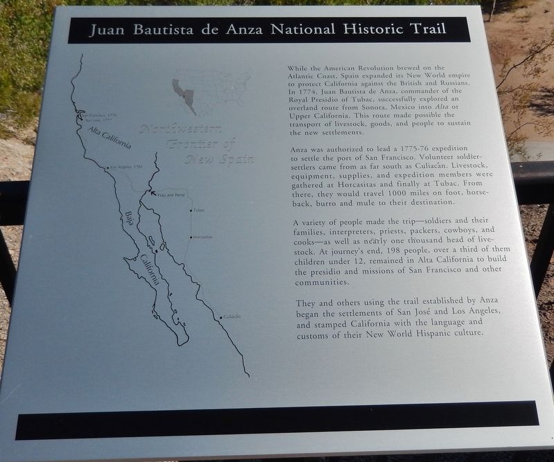
While the American Revolution brewed on the Atlantic Coast, Spain expanded its New World empire to protect California against the British and Russians. In 1774, Juan Bautista de Anza, commander of the Royal Presidio of Tubac, successfully explored an overland route from Sonora, Mexico into Alta or Upper California. This route made possible the transport of livestock, goods, and people to sustain the new settlements.
Anza was authorized to lead a 1775-76 expedition to settle the port of San Francisco. Volunteer soldier-settlers came from as far south as Culiacán. Livestock, equipment, supplies, and expedition members were gathered at Horcasitas and finally at Tubac. From there, they would travel 1000 miles on foot, horseback, burro and mule to their destination.
A variety of people made the trip — soldiers and their families, interpreters, priests, packers, cowboys, and cooks — as well as nearly one thousand head of livestock. At journey’s end, 198 people, over a third of them children under 12, remained in Alta California to build the presidio and missions of San Francisco and other communities.
They and others using the trail established by Anza began the settlements of San José and Los Angeles, and stamped California with the language and customs of their New World Hispanic culture.
Topics and series. This historical marker is listed in these topic lists: Colonial Era • Exploration • Roads & Vehicles • Settlements & Settlers. In addition, it is included in the Juan Bautista de Anza National Historic Trail series list. A significant historical year for this entry is 1774.
Location. 32° 43.681′ N, 114° 36.894′ W. Marker is in Yuma, Arizona, in Yuma County. Marker can be reached from Prison Hill Road, half a mile north of Harold C. Giss Parkway. Marker is located in Yuma Territorial Prison State Historic Park, overlooking the Colorado River. Touch for map. Marker is at or near this postal address: 220 Prison Hill Road, Yuma AZ 85364, United States of America. Touch for directions.
Other nearby markers. At least 8 other markers are within walking distance of this marker. The All-important Colorado River Crossing (here, next to this marker); "Indian Hill" (here, next to this marker); View of the Prison from Across the River (a few steps from this marker); Site of Old Ferry Landing (a few steps from this marker); "Ocean to Ocean" Highway Bridge (within shouting distance of this marker); Crossing Into History
(within shouting distance of this marker); Yuma East Wetlands Today (within shouting distance of this marker); Drinking Water Life in the Desert (within shouting distance of this marker). Touch for a list and map of all markers in Yuma.
Also see . . . Juan Bautista de Anza National Historic Trail. National Park Service website entry:
On the eve of the American Revolution, Lt. Colonel Juan Bautista de Anza led more than 240 men, women, and children on an epic journey across the frontier of New Spain to establish a settlement at San Francisco Bay. (Submitted on October 21, 2020, by Cosmos Mariner of Cape Canaveral, Florida.)
Credits. This page was last revised on May 7, 2023. It was originally submitted on October 19, 2020, by Cosmos Mariner of Cape Canaveral, Florida. This page has been viewed 359 times since then and 39 times this year. Photos: 1, 2. submitted on October 21, 2020, by Cosmos Mariner of Cape Canaveral, Florida.

