Near Burkittsville in Frederick County, Maryland — The American Northeast (Mid-Atlantic)
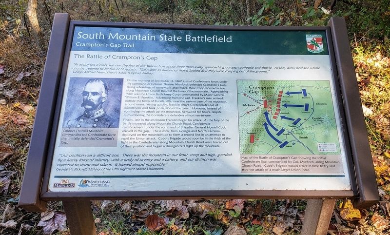
The Battle of Crampton's Gap
South Mountain State Battlefield
— Crampton's Gap Trail —
George Michael Neese, Chew's Ashby (Virginia) Artillery.
On the morning of September 14, 1862 a small Confederate force, under the command of Colonel Thomas Munford, defended Crampton's Gap. Taking advantage of stone walls and fences, these troops formed a line along Mountain Church Road at the base of the mountain. Approaching them was the Union Sixth Army Corps commanded by Major General William B. Franklin. Advancing from the east, Franklin's men arrived outside the town of Burkittsville, near the eastern base of the mountain, around noon. Acting quickly, Franklin drove Confederates out Of Burkittsville and took possession of the town. However, instead of continuing the attack up the mountain, he waited for hours, despite outnumbering the Confederate defenders almost ten-to-one.
Finally, late in the afternoon Franklin began his attack. As the fury of the battle increased along Mountain Church Road, Confederate reinforcements under the command of Brigadier General Howell Cobb arrived in the gap. These men, from Georgia and North Carolina, deployed on the mountainside to form a second line in an attempt to repel the Union attack. Cobb's Brigade would soon be in the thick of the fight as the Confederates along Mountain Church Road were forced out of their position and began a disorganized flight up the mountain.
"Our position was a difficult one. There was the mountain in our front, steep and high, guarded by a heavy force of infantry, with a body of cavalry and a battery, and our division was expected to storm and take it. It looked almost impossible."
George W. Bicknell, History of the Fifth Regiment Maine Volunteers.
(captions)
Colonel Thomas Munford commanded the Confederate force that initially defended Crampton's Gap.
Map of the Battle of Crampton's Gap showing the initial Confederate line, commanded by Col. Munford, along Mountain Church Road. Cobb's Brigade would arrive in time to try and stop the attack of a much larger Union force.
Erected by Maryland Park Service.
Topics. This historical marker is listed in this topic list: War, US Civil. A significant historical date for this entry is September 14, 1862.
Location. 39° 24.335′ N, 77° 38.345′ W. Marker is near Burkittsville, Maryland, in Frederick County. Marker can be reached from the intersection of Arnoldtown Road and
Gapland Road, on the left when traveling south. Marker is the first stop on the 0.5 mile Crampton's Gap Walking Trail, east (down hill) of the War Correspondence Memorial Arch. Touch for map. Marker is at or near this postal address: 900 Arnoldtown Rd, Jefferson MD 21755, United States of America. Touch for directions.
Other nearby markers. At least 8 other markers are within walking distance of this marker. Journalists Who Gave Their Lives (a few steps from this marker); The Battle of South Mountain (a few steps from this marker); Crampton’s Pass Tablet C.P. 1 (a few steps from this marker); Maj. Gen. Lafayette McLaws' Command (a few steps from this marker); Crampton’s Pass Tablet C.P. 3 (a few steps from this marker); Sixth Army Corps (a few steps from this marker); First New Jersey Brigade (within shouting distance of this marker); War Correspondents (within shouting distance of this marker). Touch for a list and map of all markers in Burkittsville.
Also see . . . Gathland State Park. Maryland Department of Natural Resources (Submitted on October 24, 2020.)
Credits. This page was last revised on October 24, 2020. It was originally submitted on October 22, 2020, by Bradley Owen of Morgantown, West Virginia. This page has been viewed 318 times since then and 39 times this year. Photos: 1, 2. submitted on October 22, 2020, by Bradley Owen of Morgantown, West Virginia. • Bernard Fisher was the editor who published this page.

