Burkittsville in Frederick County, Maryland — The American Northeast (Mid-Atlantic)
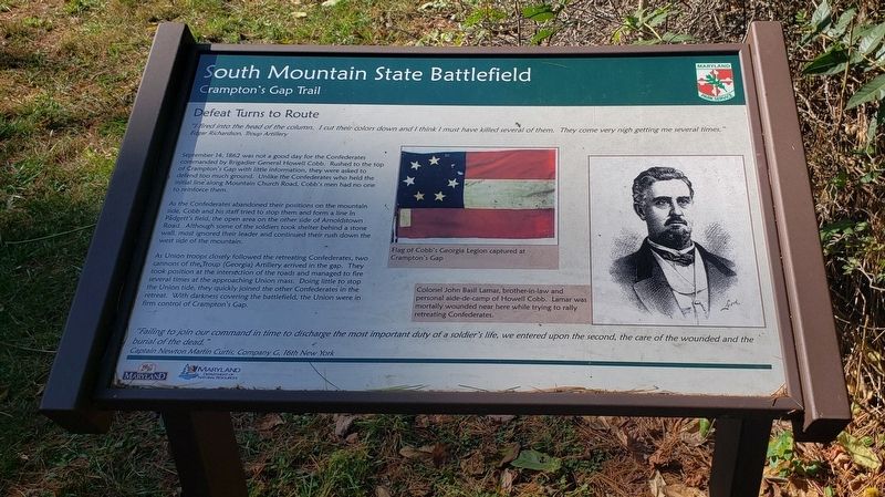
Defeat Turns To Route (sic)
South Mountain State Battlefield
— Crampton's Gap Trail —
September 14, 1862 was not a good day for the Confederates commanded by Brigadier General Howell Cobb.Rushed to the top of Crampton’s Gap with little information, they were asked to defend too much ground. Unlike the Confederates who held the initial line along Mountain Church Road, Cobb’s men had no one to reinforce them.
As the Confederates abandoned their positions on the mountain side, Cobb and his staff tried to stop them and form a line in Padgett’s field, the open area on the other side of Arnoldstown Road. Although some of the soldiers took shelter behind a stone wall, most ignored their leader and continued their rush down the west side of the mountain.
As Union troops closely followed the retreating Confederates, two cannons of the Troup (Georgia) Artillery arrived in the gap. They took position at the intersection of the roads and managed to fire several times at the approaching Union mass. Doing little to stop the Union tide, they quickly joined the other Confederates in the retreat. With darkness covering the battlefield, the Union were in firm control of Crampton’s Gap.
“Failing to join our command in time to discharge the most important duty of a soldier’s life, we entered upon the second, the care of the wounded and the burial of the dead.” Captain Newton Martin Curtis, Company G, 16th New York
Flag of Cobb’s Georgia Legion captured at Crampton’s Gap
Colonel John Basil Lamar, brother-in-law and personal aide-de-camp of Howell Cobb. Lamar was mortally wounded near here while trying to rally retreating Confederates.
Erected by Maryland Park Service.
Topics. This historical marker is listed in this topic list: War, US Civil. A significant historical date for this entry is September 14, 1862.
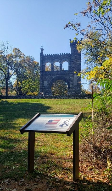
Location. 39° 24.336′ N, 77° 38.323′ W. Marker is in Burkittsville, Maryland, in Frederick County. Marker can be reached from the intersection of Arnoldtown Road and Gapland Road, on the left when traveling south. Marker is the final stop on the 0.5 mile Crampton's Gap Walking Trail, east (down hill) of the War Correspondence Memorial Arch. Touch for map. Marker is in this post office area: Burkittsville MD 21718, United States of America. Touch for directions.
Other nearby markers. At least 8 other markers are within walking distance of this marker. The Battle of Crampton's Gap (within shouting distance of this marker); The Battle of South Mountain (within shouting distance of this marker); Crampton’s Pass Tablet C.P. 1 (within shouting distance of this marker); Maj. Gen. Lafayette McLaws' Command
(within shouting distance of this marker); Crampton’s Pass Tablet C.P. 3 (within shouting distance of this marker); Sixth Army Corps (within shouting distance of this marker); First New Jersey Brigade (within shouting distance of this marker); War Correspondents (within shouting distance of this marker). Touch for a list and map of all markers in Burkittsville.
Regarding Defeat Turns To Route (sic). The word "route" is unfortunately used instead of "rout".
Credits. This page was last revised on November 12, 2020. It was originally submitted on October 24, 2020, by Bradley Owen of Morgantown, West Virginia. This page has been viewed 219 times since then and 15 times this year. Photos: 1. submitted on October 26, 2020, by Bradley Owen of Morgantown, West Virginia. 2. submitted on October 24, 2020, by Bradley Owen of Morgantown, West Virginia. • Bill Pfingsten was the editor who published this page.

