Near Catskill in Greene County, New York — The American Northeast (Mid-Atlantic)
Cross Here and Save Time
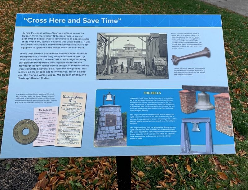
Before the construction of highway bridges across the Hudson River, more than 100 ferries provided crucial economic and social links to communities on opposite sides of the river. Ferry service, however, was unpredictable. It was relatively slow and ran intermittently; most ferries were not equipped to operate in the winter when the river froze.
In the 20th century, automobiles overtook other forms of transportation, and the ferry companies had to keep up with traffic volume. The New York State Bridge Authority (NYSBA) briefly operated the Kingston-Rhinecliff and Newburgh-Beacon ferries before bridges in these locations were completed. Several bells, formerly navigational aids located on the bridges and ferry wharves, are on display near the Rip Van Winkle Bridge, Mid-Hudson Bridge, and Newburgh-Beacon Bridge.
right photo caption: Ferries operated between the village of Athens and City of Hudson from 1778 to 1947. Completion of the Rip Van Winkle Bridge made this form of transportation unnecessary and eventually brought about the end of service between the two Hudson River towns. This photograph (left) was taken in 1941, a few years before ferry service ended.
Electric fog horns, like this one from the Kingston-Rhinecliff Bridge, replaced fog bells as navigational aids for the ferries and other marine traffic.
bottom left photo caption: The Newburgh-Fishkill (later Newburgh-Beacon) ferry operated under the slogan "Cross Here and Save Time.” Completing 52 crossings daily, it was the only ferry service north of New York City that ran two boats and operated throughout the winter.
bottom right photo caption: Fog Bells
The Beacon Long Wharf Bell (left) served as a navigation aid to the ferryboats that plied the river between Beacon and Newburgh. Similar bells were mounted on the ferry boats and wharves to aid navigation during fog and storms. In November 1988, the Bridge Authority relocated the bell to the toll plaza with a dedication on the 25th anniversary of the bridge's opening.
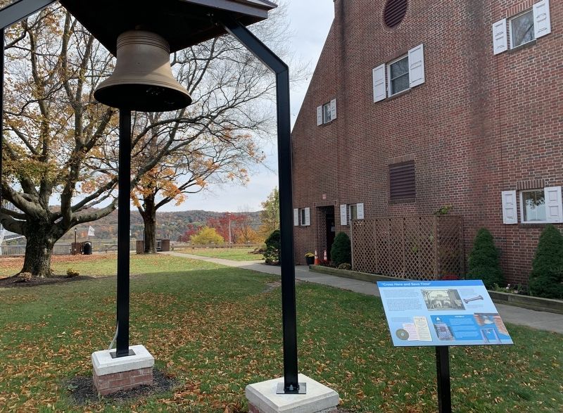
This original fog bell from the Rip Van Winkle Bridge (top right) was once mounted at the base of a masonry pier in the river. It was replaced by a more modern system, and the bell can now be seen at a river overlook near the bridge's toll plaza.
This original fog bell from the Mid-Hudson Bridge (bottom right) was replaced with an electrically powered fog horn. The bell is mounted on steel components from the original bridge sidewalk, which was removed when the sidewalk deck was replaced and widened around the bridge towers in 1998.
Topics and series. This historical marker is listed in these topic lists: Bridges & Viaducts • Waterways & Vessels. In addition, it is included in the Historic Bells series list. A significant historical month for this entry is November 1988.
Location. 42° 13.467′ N, 73° 51.332′ W. Marker is near Catskill, New York, in Greene County. Marker is on New York State Route 23 east of Colewood Avenue, on the right when traveling east. Located in the Rip Van Winkle Bridge Authority Park. Touch for map. Marker is in this post office area: Catskill NY 12414, United States of America. Touch for directions.
Other nearby markers. At least 8 other markers are within walking distance of this marker. Burns-Curran Maintenance Facility (here, next to this marker); 90th Anniversary of Rip Van Winkle Bridge (within shouting distance of this marker); Catskill Walking Tour (approx. 0.4 miles away); Sedwick Elevator (approx. 0.7 miles away); Railway Bridge (approx. 0.7 miles away); Lafayette’s Tour (approx. 0.7 miles away); The World War (approx. 0.7 miles away); Grist Mill (approx. ¾ mile away). Touch for a list and map of all markers in Catskill.
Also see . . . Newburgh-Beacon Ferry Schedule. A ferry service still exists at Newburgh. It carries commuters and cyclists across the Hudson River from Newburgh to access the Metro North lines leading to Grand Central Station in NYC. (Submitted on October 26, 2020, by Steve Stoessel of Niskayuna, New York.)
Credits. This page was last revised on October 27, 2020. It was originally submitted on October 25, 2020, by Steve Stoessel of Niskayuna, New York. This page has been viewed 165 times since then and 18 times this year. Photos: 1. submitted on October 25, 2020, by Steve Stoessel of Niskayuna, New York. 2. submitted on October 26, 2020, by Steve Stoessel of Niskayuna, New York. • Michael Herrick was the editor who published this page.

