Pontiac in Livingston County, Illinois — The American Midwest (Great Lakes)
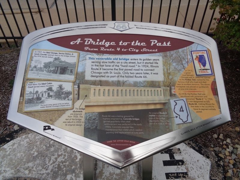
A Bridge to the Past
From Route 4 to City Street
In 1927, the Ideal Garage, Service Station, & Lunch Counter opened next to the bridge (where the VFW stands today).
Next door, the Ideal Cabin Court served weary travelers. This tourist camp, typical of the era before motels, featured 10 octagon-shaped cabins.
The bridge abutments are originals from 1926. The rest of the bridge was rebuilt in 2005 in its original design.
Route 66 was a testing ground for highway engineering. Concrete bridges gained popularity when steel reinforcement was perfected in the early 1900s. Concrete required less maintenance than metal which needed painting and replacement of rusty parts.
An original Route 4 marker is painted on one of the bridge abutments. This is the last of its kind in Illinois.
Pontiac Trail
In 1915, a gravel road between Chicago and St. Louis first opened as the Pontiac Trail, named for the famous chief who lived and died near its southern terminus. The above nameplate was placed on guideposts at one-mile intervals.
In 1918, the Pontiac Trail was resurfaced with pavement and renamed "Route 4." In 1926, it was designated as U.S. Route 66, making Illinois the first state in the country to have its segment entirely paved.
Erected by Illinois Route 66 Scenic Byway.
Topics and series. This historical marker is listed in these topic lists: Bridges & Viaducts • Industry & Commerce • Native Americans • Roads & Vehicles. In addition, it is included in the U.S. Route 66 series list. A significant historical year for this entry is 1924.
Location. 40° 53.289′ N, 88° 38.005′ W. Marker is in Pontiac, Illinois, in Livingston County. Marker is on North Division Street north of West Jefferson Street, on the right when traveling south. Touch for map. Marker is at or near this postal address: 1125 N Division St, Pontiac IL 61764, United States of America. Touch for directions.
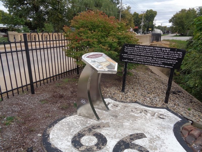
Other nearby markers. At least 8 other markers are within walking distance of this marker. Historic Division Street Bridge (here, next to this marker); Patrolling "Bloody 66" (approx. ¼ mile away); Lincoln Visits Strevell (approx. 0.4 miles away); An Underground Crossing (approx. half a mile away); Lincoln Speaks at Church (approx. half a mile away); Pontiac City Hall and Fire Station
(approx. half a mile away); Original Route 66 Wishing Well & Sign Countryside, Illinois 1941-2007 (approx. half a mile away); Original Washington Street Route 66 Bricks (approx. half a mile away). Touch for a list and map of all markers in Pontiac.
Credits. This page was last revised on October 28, 2020. It was originally submitted on October 28, 2020, by Jason Voigt of Glen Carbon, Illinois. This page has been viewed 308 times since then and 40 times this year. Photos: 1, 2, 3. submitted on October 28, 2020, by Jason Voigt of Glen Carbon, Illinois. 4. submitted on September 29, 2020, by Jason Voigt of Glen Carbon, Illinois.


