Dayton in Columbia County, Washington — The American West (Northwest)
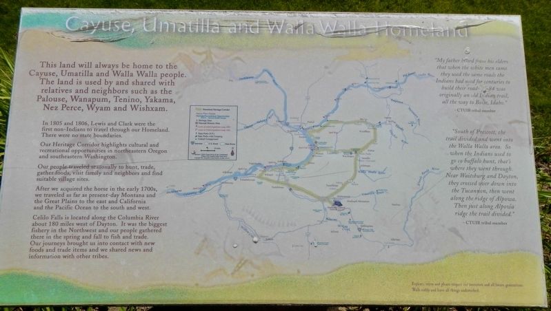
Cayuse, Umatilla, and Walla Walla Homeland
Inscription.
This land will always be home to the Cayuse, Umatilla and Walla Walla people. The land is used by and shared with relatives and neighbors such as the Palouse, Wanapum, Yakama, Wishxam, Wyam, Tenino and Nez Perce.
In 1805 and 1806, Lewis and Clark were the first non-Indians to travel through this area. Then, there were no state boundaries.
Our Heritage Corridor highlights cultural and recreational opportunities in northeastern Oregon and southeastern Washington.
Our people traveled seasonally to hunt, trade, gather foods, visit family and neighbors and find suitable village sites.
After we acquired the horse in the early 1700s, we traveled as far as present-day Montana and the Great Plains to the east and California and the Pacific Ocean to the south and west.
Celilo Falls is located along the Columbia River about 180 miles west of Dayton. It was the biggest fishery in the Northwest and our people gathered there in the spring and fall to fish and trade. Our journeys brought us into contact with new foods and trade items and we shared news and information with other tribes.
My father heard from his elders that when the white men came they used the same roads the Indians has used for centuries to build their roads. I-84 was originally an old Indian trail, all the way to Boise, Idaho." -- CTUIR tribal member
"South of Prescott, the trail divided and went into the Walla Walla area. So when the Indians used to go to buffalo hunt, that's where they went through. Nearing Waitsburg and Dayton they crossed over down into the Tucannon, then went along the ridge of Alpowa. Then just along Alpowa ridge the trail divided." -- CTUIR tribal member.
Topics. This historical marker is listed in this topic list: Native Americans. A significant historical year for this entry is 1805.
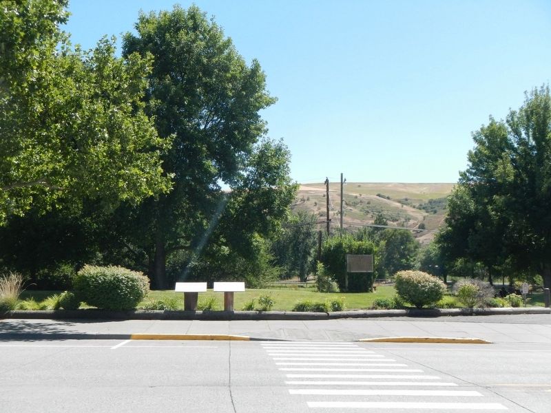
Location. 46° 19.128′ N, 117° 58.934′ W. Marker is in Dayton, Washington, in Columbia County. Marker is on East Main Street near North Front Street, on the right when traveling east. The marker is located at Flour Mill Park. Touch for map. Marker is at or near this postal address: 126 East Main Street, Dayton WA 99328, United States of America. Touch for directions.
Other nearby markers. At least 8 other markers are within walking distance of this marker. "a good road" (here, next to this marker); Dodge Quarantine Cabin (about 300 feet away, measured in a direct line); Smith Hollow Schoolhouse (about 300 feet away); The Celilo Falls Trail (about 700 feet away); Oldest Existing Depot in the State of Washington (approx. 0.2 miles away); Railroad Track Park (approx. 0.2 miles away); City of Dayton (approx. ¼ mile away); Columbia County (approx. ¼ mile away). Touch for a list and map of all markers in Dayton.
Credits. This page was last revised on October 31, 2020. It was originally submitted on October 31, 2020, by Barry Swackhamer of Brentwood, California. This page has been viewed 167 times since then and 21 times this year. Photos: 1, 2. submitted on October 31, 2020, by Barry Swackhamer of Brentwood, California.

