Dayton in Columbia County, Washington — The American West (Northwest)
"a good road"
Inscription.
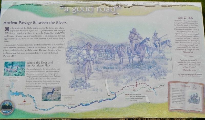
On the advice of the Walla Walla people, the Lewis and Clark Expedition followed "a good road...plenty of Deer and Antilopes" that led travelers overland between there Columbia - Walla Walla and Snake - Clearwater river confluences. The Expedition traveled approximately 100 miles on this route between April 30 and May 5, 1806.
For centuries, American Indians used this same trail as a principal route between the rivers. Later, other explorers, fur trappers, traders, miners, and settlers followed the route. The exact location of the trail is unclear, but most historians believe it passed through Dayton.
Where the Deer and Antelope Play
Deer are still plentiful in this region, including mule deer (Odocoileus hemionus) and white-tailed deer (Odocoileus virginiannus). American pronghorn (Antilocapra americana) no longer live in Washington but can be found in other parts of the northwest. Biologists are researching the possibility of restoring the species in this state. Although the pronghorn is often called an antelope, it is not a true antelope.
April 27, 1806
"the Indians informed us that there was a good road Which passed from the Columbia opposite to this Village to the enterance of Kooskooske (Clearwater River) on the S. Side of Lewis's (Snake) river, they also informed us, there was a plenty of Deer and Antilopes on the road with good water and grass...that the Country was level and the road good, under this circumstance we did not hesitate in pursuing the rout recommended by our guide and Corroberated by Yetleppit and others." ~ William Clark ~
"we knew that the a road in that direction if the country would permit would shorten our rout at least 80 miles." ~ Meriwether Lewis ~
These journal entries were written a few days before the explorers left to follow the overland trail.
Trailblazing
People have always followed trails from one place to another. Over time, some of these trails have become streets and highways. What trails have you traveled? In your journal, make a list of all the trails you have followed on this trip.
Erected by Lewis & Clark Expedition - Washington.
Topics and series. This historical marker is listed in these topic lists: Exploration • Native Americans • Roads & Vehicles. In addition, it is included in the Lewis & Clark Expedition series list. A significant historical date for this entry is April 27, 1806.
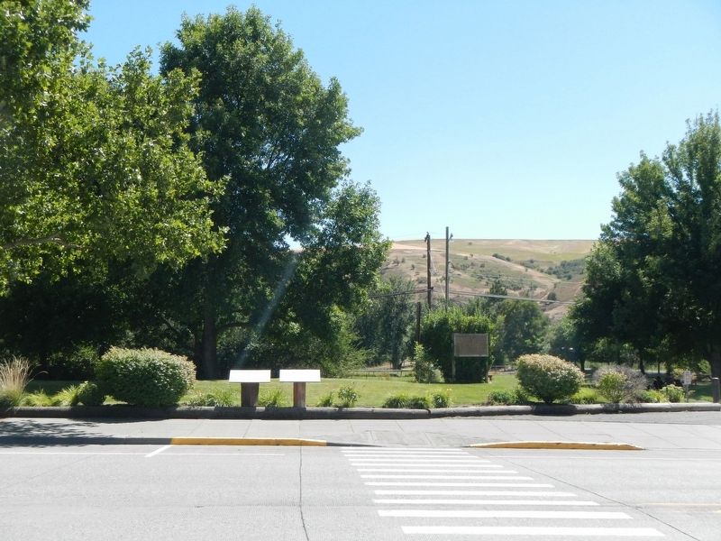
Location. 46° 19.128′ N, 117° 58.934′ W. Marker is in Dayton, Washington, in Columbia County. Marker is at the intersection of East Main Street and North Front Street, on the right when traveling east on East Main Street. This marker is located at Flour Mill Park. Touch for map. Marker is at or near this postal address: 126 East Main Street, Dayton WA 99328, United States of America. Touch for directions.
Other nearby markers. At least 8 other markers are within walking distance of this marker. Cayuse, Umatilla, and Walla Walla Homeland (here, next to this marker); Dodge Quarantine Cabin (about 300 feet away, measured in a direct line); Smith Hollow Schoolhouse (about 300 feet away); The Celilo Falls Trail (about 700 feet away); Oldest Existing Depot in the State of Washington (approx. 0.2 miles away); Railroad Track Park (approx. 0.2 miles away); City of Dayton (approx. ¼ mile away); Columbia County (approx. ¼ mile away). Touch for a list and map of all markers in Dayton.
Credits. This page was last revised on October 31, 2020. It was originally submitted on October 31, 2020, by Barry Swackhamer of Brentwood, California. This page has been viewed 120 times since then and 6 times this year. Photos: 1, 2. submitted on October 31, 2020, by Barry Swackhamer of Brentwood, California.

