Near Luray in Page County, Virginia — The American South (Mid-Atlantic)
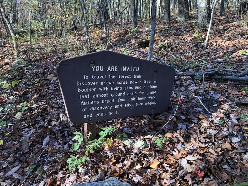
You Are Invited
Erected by Forest Service, U.S. Department of Agriculture.
Topics. This historical marker is listed in these topic lists: Agriculture • Industry & Commerce.
Location. 38° 38.501′ N, 78° 36.65′ W. Marker is near Luray, Virginia, in Page County. Marker can be reached from Lee Highway (U.S. 211) 0.1 miles east of Crisman Hollow Road, on the right when traveling east. Touch for map. Marker is at or near this postal address: 9531 Lee Highway, Luray VA 22835, United States of America. Touch for directions.
Other nearby markers. At least 8 other markers are within walking distance of this marker. Downy Serviceberry (within shouting distance of this marker); Flowering Dogwood (within shouting distance of this marker); History Marches Forward (within shouting distance of this marker); Pignut Hickory (within shouting distance of this marker); Massanutten Wildflower Trail (about 300 feet away, measured in a direct line); Jackson’s 2nd Corps Established (about 400 feet away); The Tea Tree (about 400 feet away); Page County / Shenandoah County (about 500 feet away). Touch for a list and map of all markers in Luray.
Additional keywords. millstones
Credits. This page was last revised on July 8, 2021. It was originally submitted on November 1, 2020, by Devry Becker Jones of Washington, District of Columbia. This page has been viewed 92 times since then and 10 times this year. Photo 1. submitted on November 1, 2020, by Devry Becker Jones of Washington, District of Columbia.
