Near Richmond in Henrico County, Virginia — The American South (Mid-Atlantic)
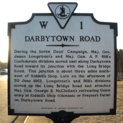
Darbytown Road
Photographed by Bernard Fisher, February 7, 2009
1. Darbytown Road Marker
Erected 1994 by Department of Historic Resources. (Marker Number W-1.)
Topics and series. This historical marker is listed in this topic list: War, US Civil. In addition, it is included in the Virginia Department of Historic Resources (DHR) series list. A significant historical date for this entry is June 30, 1862.
Location. 37° 30.708′ N, 77° 23.556′ W. Marker is near Richmond, Virginia, in Henrico County. It is on Darbytown Road 0.1 miles south of Henrico Arms Street, on the right when traveling south. Touch for map. Marker is in this post office area: Henrico VA 23231, United States of America. Touch for directions.

Regionally, this marker
this page online
Other nearby markers. At least 8 other markers are within walking distance of this marker: Richmond National Cemetery (approx. 0.2 miles away); A National Cemetery System (approx. 0.2 miles away); Veterans Memorial (approx. ¼ mile away); Medal of Honor Memorial Tree (approx. ¼ mile away); Richmond Defences (approx. ¼ mile away); a different marker also named Richmond Defences (approx. 0.7 miles away); Indian School in Fulton (approx. 0.8 miles away); Powhatan's Hill (approx. 0.8 miles away). Touch for a list and map of all markers in Richmond.
Photographed by Bernard Fisher, February 7, 2009
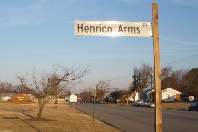
2. Darbytown Road facing northwest towards Richmond
Credits. This page was last revised on June 16, 2016. It was originally submitted on February 7, 2009, by Bernard Fisher of Richmond, Virginia. This page has been viewed 1,657 times since then and 52 times this year. Photos: 1, 2. submitted on February 7, 2009, by Bernard Fisher of Richmond, Virginia. • Craig Swain was the editor who published this page.
