Near Winchester in Frederick County, Virginia — The American South (Mid-Atlantic)
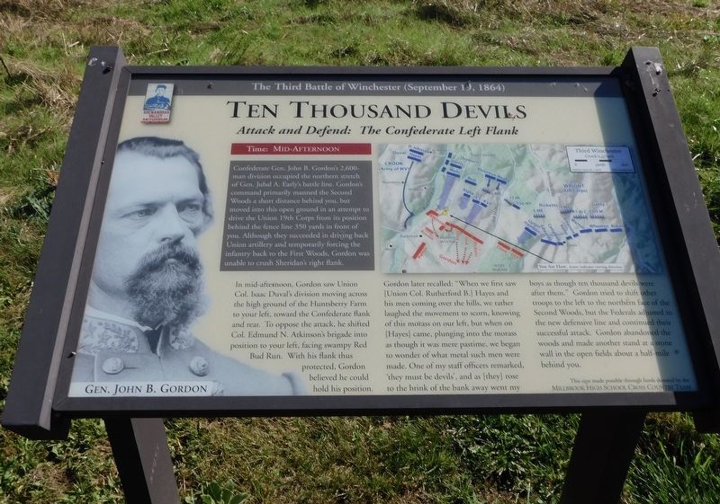
Ten Thousand Devils
Attack and Defend: The Confederate Left Flank
— The Third Battle of Winchester (September 19, 1864) —
Time: Mid-Afternoon
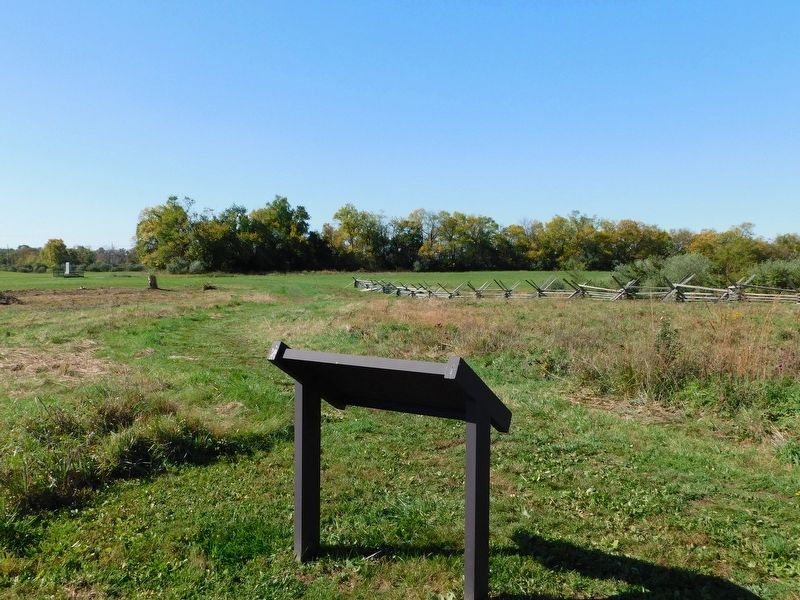
Confederate Gen. John B. Gordon's 2,600-man division occupied the northern stretch of Gen. Jubal A. Early's battle line. Gordon's command primarily manned the Second Woods a short distance behind you, but moved into this open ground in an attempt to drive the Union 19th Corps from its position behind the fence line 350 yards in front of you. Although they succeeded in driving back Union artillery and temporarily forcing the infantry back to the First Woods, Gordon was unable to crush Sheridan's right flank.
In mid-afternoon, Gordon saw Union Col. Isaac Duval's division moving across the high ground of the Huntsberry Farm to your left, toward the Confederate flank and rear. To oppose the attack, he shifted Col. Edmund N. Atkinson's brigade into position to your left, facing swampy Red Bud Run. With his flank thus protected, Gordon believed he could hold his position. Gordon later recalled: "When we first saw [Union Col. Rutherford B] Hayes and his men coming over the hills, we rather laughed the movement to scorn, knowing of this morass on our left, but when on [Hayes] came, plunging into the morass as though it was mere pastime, we began to wonder of what metal such men were made. One of my staff officers remarked, 'they must be devils', and as [they] rose to the brink of the bank away went my boys as though ten thousand devils were after them." Gordon tried to shift other troops to the left to the northern face of the Second Woods, but the Federals adjusted to the new defensive line and continued their successful attack. Gordon abandoned the woods and made another stand at a stone wall in the open fields about a half-mile behind you.
This sign made possible through funds donated by the Millbrook High School Cross Country Team
Erected 2020 by Shenandoah Valley Battlefields Association.
Topics. This historical marker is listed in this topic list: War, US Civil. A significant historical date for this entry is September 19, 1864.
Location. 39° 12.032′ N, 78° 7.412′ W. Marker is near Winchester, Virginia, in Frederick County. Marker can be reached from Redbud Road (Virginia Route 661) 0.9 miles east of Martinsburg Pike (U.S. 11), on the right when traveling east. Marker is located along the Third Battle of Winchester Trail. Touch for map. Marker is at or near this postal address: 541 Redbud Road, Winchester VA 22603, United States of America. Touch for directions.
Other nearby markers. At least 8 other markers are within walking distance of this marker. A Perfect Sheet Of Lead (approx. 0.2 miles away); The Cost of Battle (approx. 0.2 miles away); Southern Sharpshooters (approx. 0.2 miles away); The Middle Field (approx. 0.2 miles away);
Alabama (approx. 0.2 miles away); In Memory of Gilcin F. Meadors III (approx. 0.2 miles away); “Shrapnel Rained On Us” (approx. 0.2 miles away); Grover's Attack (approx. 0.2 miles away). Touch for a list and map of all markers in Winchester.
Also see . . .
1. The Third Battle of Winchester. The Shenandoah Valley Battlefields National Historic District (Submitted on November 3, 2020.)
2. James R. Wilkins Winchester Battlefields Visitor Center. The Shenandoah Valley Battlefields National Historic District (Submitted on November 5, 2020.)
Credits. This page was last revised on November 16, 2022. It was originally submitted on November 1, 2020, by Bradley Owen of Morgantown, West Virginia. This page has been viewed 260 times since then and 31 times this year. Last updated on November 6, 2020, by Bradley Owen of Morgantown, West Virginia. Photos: 1, 2. submitted on November 1, 2020, by Bradley Owen of Morgantown, West Virginia. 3. submitted on August 7, 2022, by Craig Doda of Napoleon, Ohio. • Bernard Fisher was the editor who published this page.


