Strasburg in Shenandoah County, Virginia — The American South (Mid-Atlantic)
Historic Strasburg
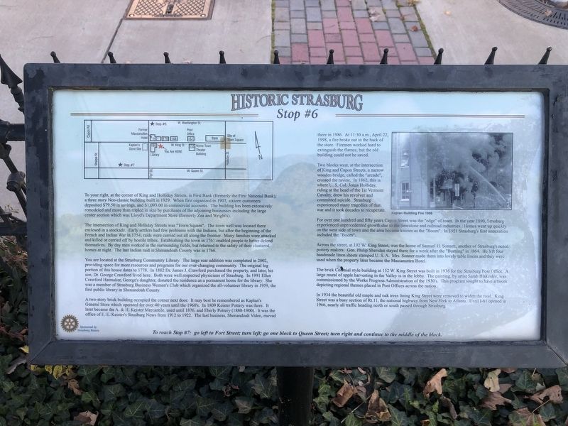
Stop #6
To your right, at the corner of King and Holliday Streets, is First Bank (formerly the First National Bank), a three story Neo-classic building built in 1929. When first organized in 1907, sixteen customers deposited $79.50 in savings, and $1,093.00 in commercial accounts. The building has been extensively remodeled and more than tripled in size by purchases of the adjoining businesses including the large center section which was Lloyd's Department Store (formerly Zea and Wright's).
The intersection of King and Holliday Streets was "Town Square". The town was located there enclosed in a stockade. Early settlers had few problems with the Indians, but after the beginning of the French and Indian War in 1754, raids were carried out all along the frontier. Many families were attacked and killed or carried off by hostile tribes. Establishing the town in 1761 enabled people to better defend themselves. By day men worked in the surrounding fields, but returned to the safety of their clustered homes at night. The last Indian raid in Shenandoah County was in 1766.
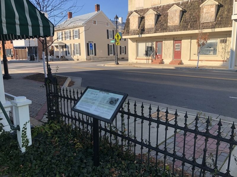
You are located at the Strasburg Community Library. The large rear addition was completed in 2002, providing space for more resources and programs for our ever-changing community. The original log portion of this house dates to 1778. In 1882 Dr. James Crawford purchased the property, and later, his son, Dr. George Crawford lived there. Both were well respected physicians of Strasburg. In 1991 Ellen Crawford Hatmaker, George's daughter, donated the residence as a permanent home for the library. She was a member of Strasburg Business Women's Club which organized the all-volunteer library in 1959, the first public library in Shenandoah County.
A two-story brick building occupied the corner next door. It may best be remembered as Kaplan's General Store which operated for over 40 years until the 1960's. In 1809 Keister Pottery was there. It later became the A. & H. Keister Mercantile, used until 1876, and Eberly Pottery (1880-1900). It was the office of E.E. Keister's Strasburg News from 1912 to 1922. The last business, Shenandoah Video, moved there in 1986. At 11:30 a.m., April 22, 1998, a fire broke out in the back of the store. Firemen worked hard to extinguish the flames, but the old building could not be saved.
Two blocks west, at the intersection of King and Capon Streets, a narrow wooden bridge, called the "arcade", crossed the ravine. In 1862, this is where U.S. Col. Jonas Holliday, riding at the head of the 1st Vermont Cavalry, drew his revolver and committed suicide. Strasburg experienced many tragedies of that war and it took decades to recuperate.
For over one hundred and fifty years Capon Street
Across the street, at 192 W. King Street, was the home of Samuel H. Sonner., another of Strasburg's noted pottery makers. Gen. Philip Sheridan stayed there for a week after the "Burning" in 1864. He left four handmade linen sheets stamped U.S.A. Mrs. Sonner made them into lovely table linens and they were used when the property later became he Massanutten Hotel.
The brick Colonial style building at 152 W. King Street was built in 1936 for the STrasburg Post Office. A large mural of apple harvesting in the Valley is in the lobby. The painting, by artist Sar Blakeslee, was commissioned by the Works Progress Administration of the 1930's. This program sought to have artwork depicting regional themes placed in Post Offices across the nation.
In 1934 the beautiful old maple and oak trees lining King Street were removed to widen the road. King Street was a busy section of Rt. 11, the national highway from New York to Atlanta. Until I-81 opened in 1966, nearly all traffic heading north or south passed through Strasburg.
To reach Stop #7: go left to Fort Street; turn left; go one block to Queen Street; turn right and continue to the middle of the block.
Erected by Strasburg Rotary. (Marker Number 6.)
Topics. This historical marker is listed in these topic lists: Colonial Era • Industry & Commerce • Settlements & Settlers • War, US Civil. A significant historical date for this entry is April 22, 1998.
Location. 38° 59.376′ N, 78° 21.8′ W. Marker is in Strasburg, Virginia, in Shenandoah County. Marker is on West King Street (U.S. 11) just east of South Fort Street, on the right when traveling east. Touch for map. Marker is at or near this postal address: 195 W King St, Strasburg VA 22657, United States of America. Touch for directions.
Other nearby markers. At least 8 other markers are within walking distance of this marker. Open House (a few steps from this marker); Sonner House (about 400 feet away, measured in a direct line); a different marker also named Historic Strasburg (about 400 feet away); a different marker also named Historic Strasburg (about 500 feet away); Saint Paul’s Lutheran Church (about 500 feet away); Stonewall's Surprise (about 600 feet away); a different marker also named Historic Strasburg (about 700 feet away); a different marker also named Historic Strasburg (about 700 feet away). Touch for a list and map of all markers in Strasburg.
Credits. This page was last revised on November 7, 2020. It was originally submitted on November 7, 2020, by Devry Becker Jones of Washington, District of Columbia. This page has been viewed 294 times since then and 25 times this year. Photos: 1, 2. submitted on November 7, 2020, by Devry Becker Jones of Washington, District of Columbia.

