Manor Township near Washington Boro in Lancaster County, Pennsylvania — The American Northeast (Mid-Atlantic)
Washington Boro Archaeological Sites
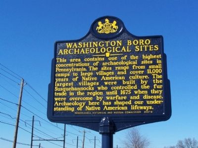
Photographed by Beverly Pfingsten, February 24, 2008
1. Washington Boro Archaeological Sites Marker
Erected 2007 by Pennsylvania Historical and Museum Commission.
Topics and series. This historical marker is listed in these topic lists: Colonial Era • Education • Indigenous Peoples and Communities • Settlements & Settlers. In addition, it is included in the Pennsylvania Historical and Museum Commission (PHMC) series list. A significant historical year for this entry is 1675.
Location. 39° 59.453′ N, 76° 28.158′ W. Marker is near Washington Boro, Pennsylvania, in Lancaster County. It is in Manor Township. It is on River Road 0.1 miles south of Penn Street (Pennsylvania Route 999), on the left when traveling south. Touch for map. Marker is at or near this postal address: 2010 River
this page online

Regionally, this marker is in South-Central Pennsylvania, specifically in Pennsylvania Dutch Country, and in the Susquehanna Valley. It is also in the American Northeast and in the Mid-Atlantic. Globally, it is in North America, the Western Hemisphere, the Western World, and the Anglosphere. Historically, it finds itself in what was once the Haudenosaunee (Iroquois) Confederacy and also one of the original Thirteen Colonies.
Other nearby markers. At least 8 other markers are within 2 miles of this marker, measured as the crow flies: Martin Chartier (approx. half a mile away); 40th Parallel (approx. 0.7 miles away); Great Minqua Path (approx. one mile away); Latrobe's Survey of the Susquehanna (approx. 1.7 miles away); Gateway to the Bay (approx. 1.7 miles away); Captain Thomas Cresap (approx. 1.7 miles away); The Dritt Mansion: A Home at the Center of History (approx. 1.7 miles away); Thomas Cresap and the Border War (approx. 1.7 miles away). Touch for a list and map of all markers in Washington Boro.
More about this marker. Marker is in
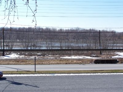
Photographed by Beverly Pfingsten, February 24, 2008
2. Susquehanna River as seen from the marker.
The Susquehanna was the main means of transportaion for the various Native-American tribes that lived in the area.
Credits. This page was last revised on February 7, 2023. It was originally submitted on February 25, 2008. This page has been viewed 3,863 times since then and 122 times this year. Last updated on November 7, 2020, by Carl Gordon Moore Jr. of North East, Maryland. Photos: 1, 2. submitted on February 25, 2008, by Bill Pfingsten of Bel Air, Maryland. • J. Makali Bruton was the editor who published this page.
