Colorado National Monument in Mesa County, Colorado — The American Mountains (Southwest)
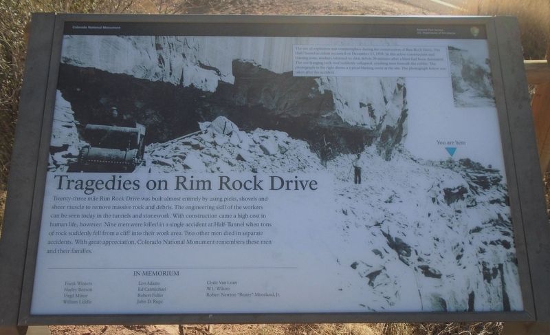
Tragedies on Rim Rock Drive
Twenty-three mile Rim Rock Drive was built almost entirely by using picks, shovels, and sheer muscle to remove massive rock and debris. The engineering skill of the workers can be seen today in the tunnels and stonework. With construction came a high cost in human life, however. Nine men were killed in a single accident at Half-Tunnel when tons of rock suddently fell from a cliff into their work area. Two other men died in separate accidents. With great appreciation, Colorado National Monument remembers these men and their families.
Frank Winters • Leo Adams • Clyde Van Loan
Harley Beeson • Ed Carmichael • W.L. Wilson
Virgil Minor • Robert Fuller • Robert Newton "Buster" Moorland, Jr.
William Liddle • John D. Rupe
The use of explosives was commonplace during the construction of Rim Rock Drive. The Half-Tunnel accident occurred on December 13, 1933. In this active construction and blasting zone, workers returned to clear debris 20 minutes after a blast had been detonated. The overhanging rock suddenly collapsed, crushing men beneath the rubble. The photograph to the right shows a typical blasting event at the site. The photograph below was taken after the accident.
Erected by National Park Service.
Topics. This historical marker is listed in these topic lists: Disasters • Parks & Recreational Areas • Roads & Vehicles. A significant historical date for this entry is December 13, 1933.
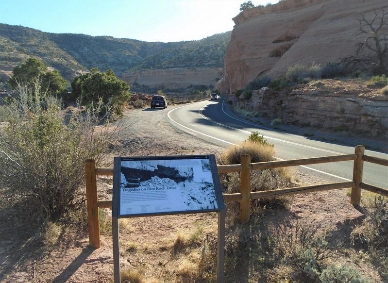
Location. 39° 5.39′ N, 108° 43.443′ W. Marker is in Colorado National Monument, Colorado, in Mesa County. Marker is along Rim Rock Drive, about 50 feet south of The Grand View overlook. Touch for map. Marker is in this post office area: Fruita CO 81521, United States of America. Touch for directions.
Other nearby markers. At least 8 other markers are within 5 miles of this marker, measured as the crow flies. The Grand View (within shouting distance of this marker); Ancient Environments (about 400 feet away, measured in a direct line); The Shape of Independence (approx. half a mile away); Climbing Independence (approx. half a mile away); The Shapes of Erosion (approx. ¾ mile away); John Otto (approx. 0.9 miles away); Stephen Tyng Mather (approx. one mile away); Western Slope Vietnam War Memorial Park (approx. 4.4 miles away). Touch for a list and map of all markers in Colorado National Monument.
Also see . . .
1. Colorado National Monument. National Park Service website entry (Submitted on November 10, 2020, by William Fischer, Jr. of Scranton, Pennsylvania.)
2. A CLASSIC WESTERN QUARREL: A History of the Road Controversy at Colorado National Monument
. National Park Service website entry (Submitted on November 11, 2020, by William Fischer, Jr. of Scranton, Pennsylvania.)
Credits. This page was last revised on November 25, 2021. It was originally submitted on November 10, 2020, by William Fischer, Jr. of Scranton, Pennsylvania. This page has been viewed 455 times since then and 60 times this year. Photos: 1, 2. submitted on November 10, 2020, by William Fischer, Jr. of Scranton, Pennsylvania.

