
Lexington in McLean County, Illinois — The American Midwest (Great Lakes)
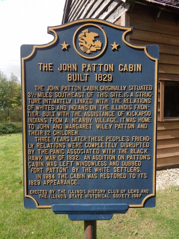
The John Patton Cabin
Built 1829
Photographed by Jason Voigt, September 29, 2020
1. The John Patton Cabin Marker
The John Patton Cabin, originally situated 3½ miles southeast of this site, is a structure intimately linked with the relations of whites and Indians on the Illinois frontier. Built with the assistance of Kickapoo Indians from a nearby village, it was home to John and Margaret Wiley Patton and their 12 children.
Three years later these people's friendly relations were completely disrupted by the panic associated with the Black Hawk War of 1832. An addition on Patton's Cabin was left windowless and dubbed "Fort Patton" by the white settlers.
In 1984 the cabin was restored to its 1829 appearance.
Erected 1987 by The Illinois History Club of LCHS and the Illinois State Historical Society.
Topics and series. This historical marker is listed in these topic lists: Forts and Castles • Indigenous Peoples and Communities • Wars, US Indian. In addition, it is included in the Illinois State Historical Society series list. A significant historical year for this entry is 1829.
Location. 40° 38.886′ N, 88° 46.809′ W. Marker is in Lexington, Illinois, in McLean County. It is on North Cherry Street north of North Harrison
this page online

Regionally, this marker is in Central Illinois. It is also in the American Midwest and in the Corn Belt. Globally, it is in North America, the Western Hemisphere, the Western World, and the Anglosphere. Historically, it finds itself in what was once the territory of the Mississippian Culture and also the Northwest Territory.
Other nearby markers. At least 8 other markers are within 9 miles of this marker, measured as the crow flies: "Memory Lane" (approx. 0.2 miles away); David Hyatt Van Dolah House (approx. 0.8 miles away); Historic Route 66 • Chenoa (approx. 7.1 miles away); In Memory of Maude Henline (approx. 7.3 miles away); Route 66 Fetch & Stretch Dog Park (approx. 7.4 miles away); Matthew T. Scott (approx. 7.6 miles away); 1926 Route 66 Alignment (approx. 8.4 miles away); Pure Oil Truck Stop (approx. 8.4 miles away). Touch for a list and map of all
Photographed by Jason Voigt, September 29, 2020
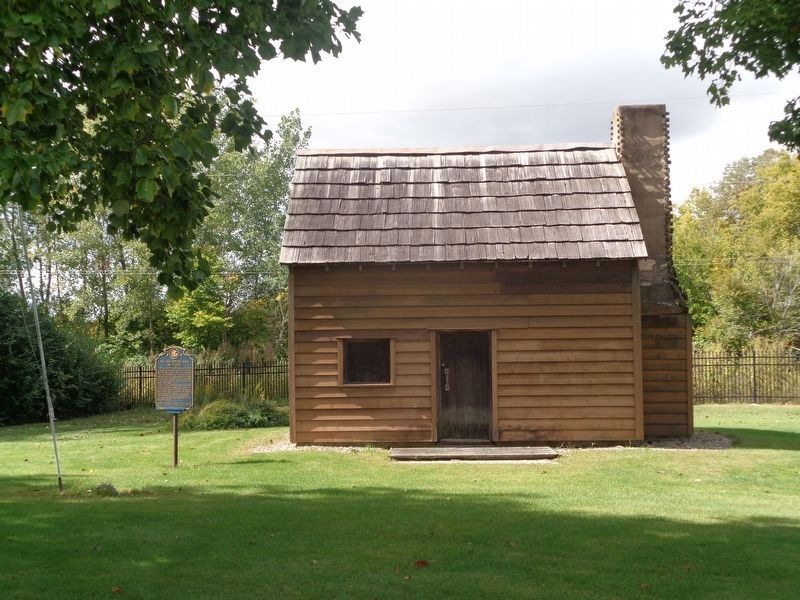
2. The John Patton Cabin Marker
Marker is next to the cabin
Another marker is no longer nearby. Illinois U.S. Route 66 (was approx. 0.8 miles away but has been confirmed missing).
Also see . . . John Patton Log Cabin on Wikipedia. Listed on the National Register of Historic Places (#86002008). (Submitted on November 14, 2020, by Jason Voigt of Glen Carbon, Illinois.)
Credits. This page was last revised on February 23, 2026. It was originally submitted on November 14, 2020, by Jason Voigt of Glen Carbon, Illinois. This page has been viewed 719 times since then and 36 times this year. Photos: 1, 2. submitted on November 14, 2020, by Jason Voigt of Glen Carbon, Illinois.
