North Side in Richmond, Virginia — The American South (Mid-Atlantic)
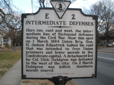
Intermediate Defenses
Erected 1989 by Department of Historic Resources. (Marker Number E-2.)
Topics and series. This historical marker is listed in this topic list: War, US Civil. In addition, it is included in the Virginia Department of Historic Resources (DHR) series list. A significant historical date for this entry is March 1, 1864.
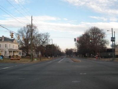
Location. Marker is missing. It was located near 37° 35.083′ N, 77° 26.845′ W. Marker was in Richmond, Virginia. It was in the North Side. Marker was at the intersection of Chamberlayne Avenue (U.S. 1) and West Laburnum Avenue, on the left when traveling north on Chamberlayne Avenue. Touch for map. Marker was in this post office area: Richmond VA 23227, United States of America. Touch for directions.
Other nearby markers. At least 8 other markers are within 2 miles of this location, measured as the crow flies. Richmond Defences (approx. ¼ mile away); Appointed to Serve (approx. 0.4 miles away); Emek Sholom Holocaust Memorial (approx. 0.8 miles away); First Lieutenant Jimmie W. Monteith, Jr. (approx. one mile away); a different marker also named Richmond Defences (approx. 1.3 miles away); Sheridan Maneuvers East (approx. 1.3 miles away); Spring Park (approx. 1.4 miles away); Joseph Bryan Park (approx. 1.4 miles away). Touch for a list and map of all markers in Richmond.
Also see . . . Kilpatrick-Dahlgren Raid. Civil War Richmond (Submitted on February 10, 2009.)
Credits. This page was last revised on February 1, 2023. It was originally submitted on February 10, 2009, by Bernard Fisher of Richmond, Virginia. This page has been viewed 1,141 times since then and 16 times this year. Photos: 1, 2. submitted on February 10, 2009, by Bernard Fisher of Richmond, Virginia. • Craig Swain was the editor who published this page.

