Reading in Berks County, Pennsylvania — The American Northeast (Mid-Atlantic)
The Dead Have No Rights
Schuylkill River Trail
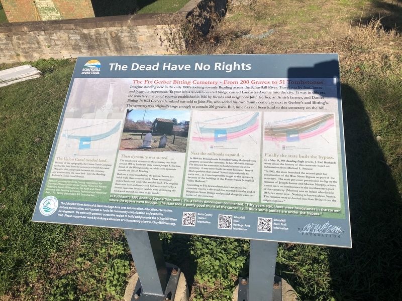
The Fix Gerber Cemetery - From 200 Graves to 51 Tombstones
Imagine standing here in the early 1800's looking towards Reading across the Schuylkill River. Travel was by foot, horse and buggy, or by stagecoach. To your left, a wooden covered bridge carried Lancaster Avenue into the city. It was in this era the cemetery in front of you was established in 1816 by friends and neighbors of John Gerber, an Amish farmer, and Daniel Bitting. In 1873 Gerber's farmland was sold to John Fix, who added his own family cemetery next to Gerber's and Bitting's. The cemetery was originally large enough to contain 200 graves. But, time has not been kind to this cemetery on the hill…
The Union Canal needed land…
Because of the topography, the Union Canal Company needed flat land from the cemetery to build the canal. This left a thin, steep bank between the cemetery and what became the canal bed — later the Reading Railroad's Union Canal Branch.
Then dynamite was stored……
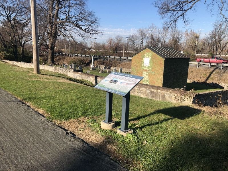
The small brick structure in the cemetery was built around 1871 by hardware store owner Joseph S. Stichter, friend of the Bitting family, to safely store dynamite outside the city of Reading.
Built on a stone foundation, the powder house has brick walls three courses thick. It has an unusual arched brick roof under the wooden roof. The original thick iron door and heavy lock bar were removed by a former caretaker because vandals were destroying the brickwork around the door to get inside.
Next the railroads expand....
In 1884 the Pennsylvania Schuylkill Valley Railroad took property around the cemetery. In his 1894 will, Samuel Fix directed his executors to build a house near the cemetery. It was never built because his heirs' lawyer filed a petition that stated "it was impracticable to carry out… as it was impossible to get to the cemetery because of the building of the Pennsylvania Schuylkill Valley Railroad."
According to Fix descendants, later access to the cemetery was by a dirt road that started from the end of Bingaman Street Bridge and passed along the eastern border of the cemetery.
Finally the state built the bypass.
In a May 19, 1991 Reading Eagle article, J. Earl Ruthardt wrote about the history of this cemetery based on information from Michael L. Strauss:
"In 1963, the state launched the second grab for construction of the West Shore Bypass on part of the cemetery. The state got court permission to dig up the remains of Joseph Santee and Marion Murphy, whose names were on tombstones in the northwestern part of the cemetery. (Marion) was an infant who died in 1867, her stone says.Nothing is known about Santee. The remains were re-buried less than 50 feet from the original graves."
In Ruthhard's 1991 Reading Eagle article, John J. Fix, a family descendent commented: "Fifty years ago, there were headstones in the corner, where the bypass went through. The state took a pretty good chunk of the corner. I still think some bodies are under the bypass."
Erected by Schuylkill River National & State Heritage Area.
Topics. This historical marker is listed in these topic lists: Cemeteries & Burial Sites • Railroads & Streetcars • Roads & Vehicles • Waterways & Vessels. A significant historical year for this entry is 1816.
Location. 40° 19.387′ N, 75° 55.919′ W. Marker is in Reading, Pennsylvania, in Berks County. Marker is on Schuylkill River Trail, 0.1 miles east of Lancaster Avenue (Business U.S. 222), on the right when traveling west. Touch for map. Marker is at or near this postal address: 44 Morgantown Rd, Reading PA 19611, United States of America. Touch for directions.
Other nearby markers. At least 8 other markers are within walking distance of this marker. Jackson’s Lock and the Port of Reading (approx. 0.3 miles away); a different marker also named Jackson's Lock and the Port of Reading (approx. 0.3 miles away); James H. Maurer (approx. 0.3 miles away); Hunter Liggett (approx. 0.7 miles away); Soldiers and Sailors Monument (approx. ¾ mile away); Angelica Creek Park (approx. 0.8 miles away); Henry A. Muhlenberg (approx. 0.8 miles away); Reading (approx. 0.8 miles away). Touch for a list and map of all markers in Reading.
Credits. This page was last revised on November 21, 2020. It was originally submitted on November 21, 2020, by Devry Becker Jones of Washington, District of Columbia. This page has been viewed 311 times since then and 50 times this year. Photos: 1, 2. submitted on November 21, 2020, by Devry Becker Jones of Washington, District of Columbia.

