Dayton in Lyon County, Nevada — The American Mountains (Southwest)
The Road to Nowhere
Dayton's History
The Carson and Colorado Railroad (C&C)
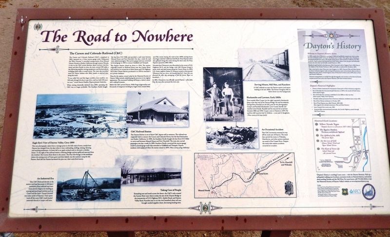
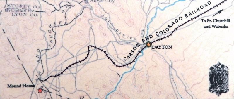
The Carson and Colorado Railroad (C&C), completed in 1881, operated on a 3-foot narrow-gauge track. Nicknamed the "Slim Princess," it provided transportation from Mound House, Nevada to Keeler, California through western Nevada. A trip on the C&C across desolate, desert territory was hot, dusty, and slow. Rarely on time, the train covered 300 miles a day delivering supplies, mining equipment, and food products, including fresh milk, to small towns. The train also provided water for Paiute Indians who filled vessels at selected sites along the track.
"It was called ‘the road that began nowhere, went nowhere, ran 300 miles through the desert to get there, and was built 100 years too soon,’" wrote Fannie Hazlett, Dayton pioneer historian.
When mining drastically declined circa 1900, operating the C&C was no longer profitable. The Southern Pacific bought the line from D.O. Mills and provided a mail route between Mound House and Fort Churchill. One day a week the mail train carried passengers. The narrow-gauge track was converted to broad-gauge in 1905 to connect Goldfield and Tonopah.
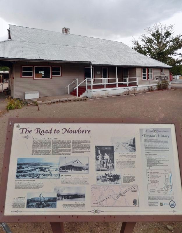
The Dayton Station closed its doors in 1934. The station, originally located on Railroad Street near the Carson River, was moved to its current site at Main Street and U.S. Highway 50 E. after Chester Barton purchased it in 1954 to remodel it as a private residence.
Plans for the station, owned today by the Historical Society of Dayton Valley, include rehabilitating the structure to its original appearance. The renovated building will house a visitor's center and a railroad museum.
Before the C&C served Dayton, Wells Fargo stagecoaches and thousands of emigrants traveling by wagon train crossed Main and Pike streets during the mid-to-late-1800s mining boom that began with the California Gold Rush. Pony Express riders also galloped along this route during the short time the Pony Express operated (1860-1861).
Nevada's first Chinatown once flourished at the corner of U.S. Highway 50 E. and the bridge, with 200 Chinese living in stone, mud, and tule houses along the Carson River. In 1859, U.S. Army explorer James H. Simpson noted in his journal: "Chinatown has two stores, one recently kept by E. Sam who was drowned the other day attempting to ford the Carson River on horseback..."
In 1861, Chinatown was officially named Dayton — after John Day, the man who surveyed the town site.
[sidebar] Dayton's History
Welcome to Dayton's Historic Sector.
In 1849, a pack train of Mormons traveling to California's goldfields camped near what is today the town of Dayton while waiting for the Sierra
Courtesy Historical Society of Dayton Valley
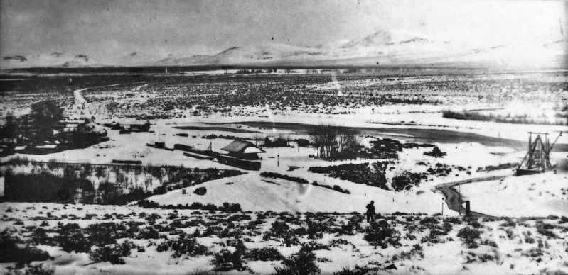
2. Marker detail: Eagle Eye's View of Dayton Valley, circa 1890
This rare photograph, taken from a vantage point in the hills west of town, reveals how Dayton has changed from the days when it was a railroading, milling, mining, farming, and ranching settlement. At lower left is an apple orchard and, in the yard, a chicken house. To the right of the railroad station a floating dredge recovers gold and mercury from the riverbed. The Carson River flows in the center. The Pine Nut Range, to the southeast (where the mining town of Como grew and then faded), was the summer camp for the Paiutes. Each fall the Paiutes harvested the pine nut, their main food source.
Blackburn's gold find led to the discovery of the Comstock Lode in Virginia City in 1859, then to the creation of the Nevada Territory in 1861, and finally to statehood for Nevada in 1864.
Take a trip back in time: Close your eyes. Imagine it is 1853. Dayton's Pike and Main Streets are dusty overland emigrant trails teeming with pioneers, some on horseback, others on foot or riding atop oxen-drawn covered wagons; many of them had traveled nearly 2,000 miles on their trek toward California.
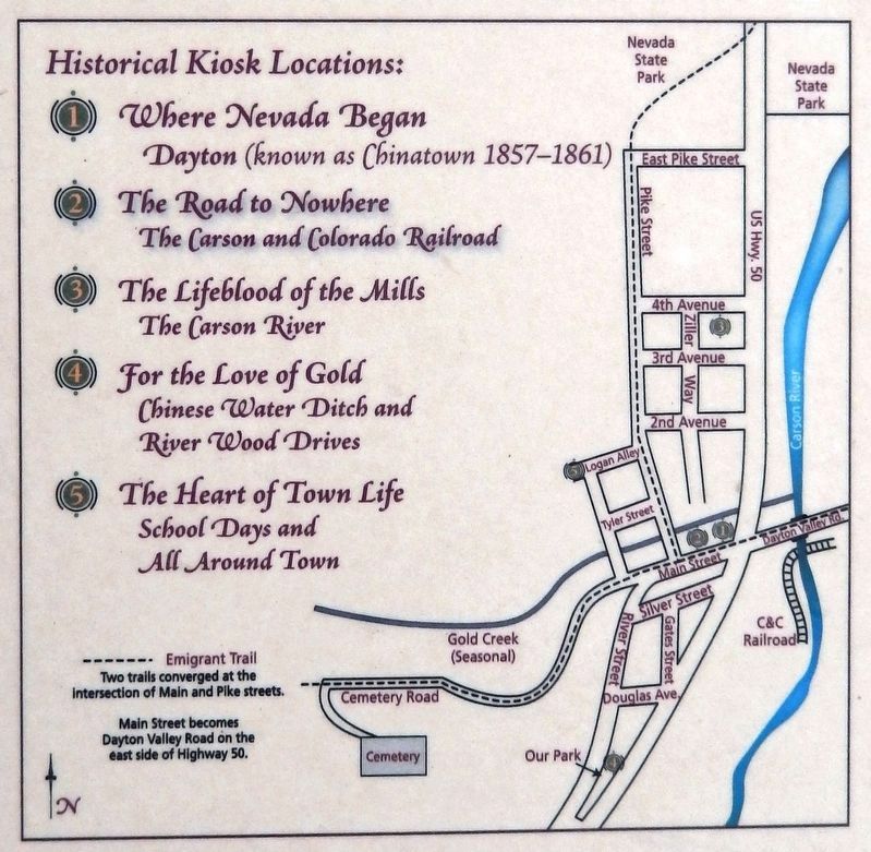
Dayton's rousing history is revealed through photographs and narrative on five historical kiosks located around town and in the Dayton Museum. (See their locations below.)
Dayton’s Historical Highlights:
• Home to Native Americans for thousands of years prior to Euro-American emigration.
• Site of Nevada's first documented gold discovery in 1849 at the mouth of Gold Cañon, where Dayton began.
• Site of Nevada's first cemetery, established in the 1850s in what was then lower Carson Valley, Utah Territory.
• Nevada's earliest permanent Euro-American settlement, inhabited
Courtesy Ray Walmsley
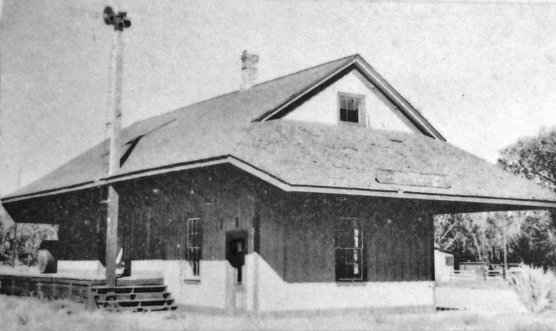
3. Marker detail: C&C Railroad Station
The Dayton Station is one of three C&C depots still in existence. The railroad was originally built to connect the Carson and Colorado Rivers, but the final destination was Keeler, California. In 1900, the Southern Pacific bought the line from D.O. Mills to carry mail between Mound House and Fort Churchill. The train also carried passengers one day a week. In 1905, Southern Pacific converted the narrow-gauge track to a broad-gauge track that extended to Goldfield and Tonopah. Dayton residents were saddened when the station closed in 1934.
• Site of first Chinese settlement in Nevada, 1857.
• Site of Pony Express stop called Nevada, 1860-1861.
(See original rock wall and monument, Pike and Main Streets.)
• Lyon County's first county seat, 1861.
• America's first transcontinental interstate, the Lincoln Highway, passed through Old Town Dayton.
Erected by U.S. Forest Service, Natural Resources Conservation Service, and Historical Society of Dayton Valley. (Marker Number 2.)
Topics and series. This historical marker is listed in these topic lists: Industry & Commerce • Native Americans • Railroads & Streetcars • Settlements & Settlers. In addition, it is included in the Lincoln Highway series list. A significant historical year for this entry is 1900.
Location. 39° 14.185′ N, 119° 35.401′ W. Marker is in Dayton, Nevada, in Lyon County. Marker is on Main Street just west of Lincoln Highway (U.S. 50), on the right when traveling west. Marker overlooks the southwest corner of the Carson & Colorado Depot building. Touch for map. Marker is at or near this postal address: 58 Main Street, Dayton NV 89403, United States of America. Touch for directions.
Other nearby markers. At least 8 other markers are within walking distance of this marker. Where Nevada Began (here, next to this marker); Carson & Colorado Railroad (a few steps from this marker); Union Hotel & Post Office
Courtesy Historical Society of Dayton Valley
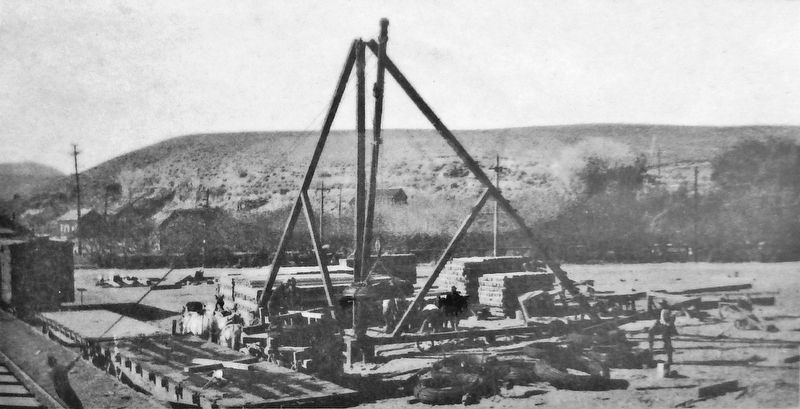
4. Marker detail: An Industrial Era
This C&C Railroad derrick at the station yard had the power to lift heavy machinery from railroad cars onto horse-drawn wagons for hauling to mining and ranching locations such as Como and the Sutro Tunnel (located two miles north of Dayton). Train spurs built off the main C&C track hauled materials directly to major mill sites.
Related markers. Click here for a list of markers that are related to this marker. Dayton's History
Courtesy Historical Society of Dayton Valley
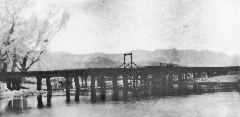
5. Marker detail: Taking Care of People
Extending east and south across the desert, the C&C's rails crossed the Carson River near what is today the site of the Dayton Bridge at the intersection of U.S. Highway 50 E., Quilici Road, and Dayton Valley Road. Ranches near or on the river benefited when rail cars brought needed supplies closer, decreasing hauling time.
Courtesy of the Cooper family
7. Marker detail: Blacksmiths and Lawmen, Early 1900s
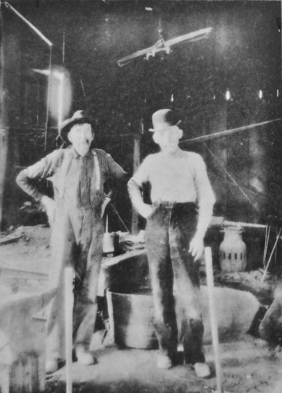
Town smithy Silas Cooper (on the right) operated a blacksmith shop at the west end of the Dayton Bridge. He and his sidekick, George Perry Randall (on the left), pose for the photographer. Cooper and Randall (blacksmith, Lyon County sheriff, and rancher) were friends. Randall and his sons served as lawmen between 1882 and 1936. Cooper came to Dayton in 1874. He and his wife Lauretta had 12 children — a son and 11 daughters.
Courtesy Historical Society of Dayton Valley
8. Marker detail: An Occasional Accident
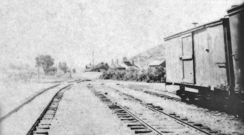
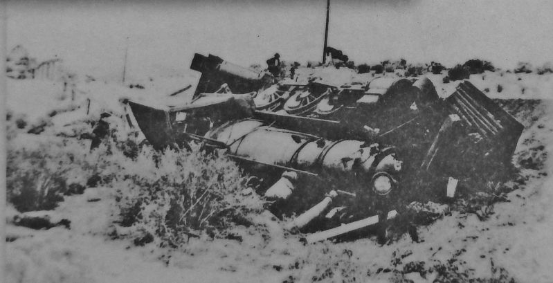
This C&C locomotive steamed its way off the track east of Dayton. The track that carried the trains to Wabuska, Hawthorne, and other points southeast ran south of the Carson River. Despite the train's slow motion accidents occurred on occasion.
10. Marker detail: Historical Kiosk Locations
Dayton's history is exciting! Learn more — visit the Dayton Museum. Pick up a self-guided walking tour brochure, souvenirs, books on Dayton's history, and stories about settling Nevada and the Old West. For open hours, call 775-246-6316 or visit the Historical Society of Dayton Valley's website at www.daytonnvhistory.org.
Credits. This page was last revised on November 27, 2020. It was originally submitted on November 24, 2020, by Cosmos Mariner of Cape Canaveral, Florida. This page has been viewed 318 times since then and 38 times this year. Photos: 1, 2, 3, 4, 5, 6, 7, 8, 9, 10, 11. submitted on November 26, 2020, by Cosmos Mariner of Cape Canaveral, Florida.
