Pensacola in Escambia County, Florida — The American South (South Atlantic)
Barrancas National Cemetery
Photographed by Craig Doda, December 23, 2018
1. Barrancas National Cemetery Marker
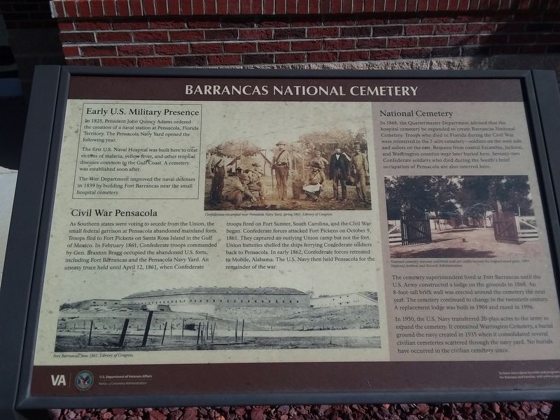
Early U.S. Military Presence
In 1825, President John Quincy Adams ordered the creation of a naval station at Pensacola, Florida Territory. The Pensacola Navy Yard opened the following year.
The first U.S. Naval Hospital was built here to treat victims of malaria, yellow fever, and other tropical diseases common to the Gulf Coast. A cemetery was established soon after.
The War Department improved the naval defenses in 1839 by building Fort Barrancas near the small hospital cemetery.
Civil War Pensacola
As Southern states were voting to secede from the Union, the small federal garrison at Pensacola abandoned mainland forts. Troops fled to Fort Pickens on Santa Rosa Island in the Gulf of Mexico. In February 1861, Confederate troops commanded by Gen. Braxton Bragg occupied the abandoned U.S. forts, including Fort Barrancas and the Pensacola Navy Yard. An uneasy truce held until April 12, 1861, when Confederate troops fired on Fort Sumter, South Carolina, and the Civil War began. Confederate forces attacked Fort Pickens on October 9, 1861. They captured an outlying Union camp but not the fort. Union batteries shelled
this page online
National Cemetery
In 1868, the Quartermaster Department advised that the hospital cemetery be expanded to create Barrancas National Cemetery. Troops who died in Florida during the Civil War were reinterred in the 7-acre cemetery—soldiers on the west side and sailors on the east. Remains from coastal Escambia, Jackson, and Washington counties were later buried here. Seventy-two Confederate soldiers who died during the South's brief occupation of Pensacola are also interred here.
The cemetery superintendent lived at Fort Barrancas until the U.S. Army constructed a lodge on the grounds in 1868. An 8-foot-tall brick wall was erected around the cemetery the next year. The cemetery continued to change in the twentieth century. A replacement lodge was built in 1904 and razed in 1996.
In 1950, the U.S. Navy transferred 20-plus acres to the army to expand the cemetery. It contained Warrington Cemetery, a burial ground the navy created in 1935 when
Photographed by Craig Doda, December 23, 2018
2. Barrancas National Cemetery Marker
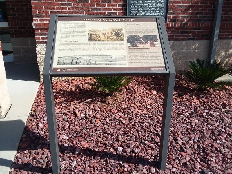
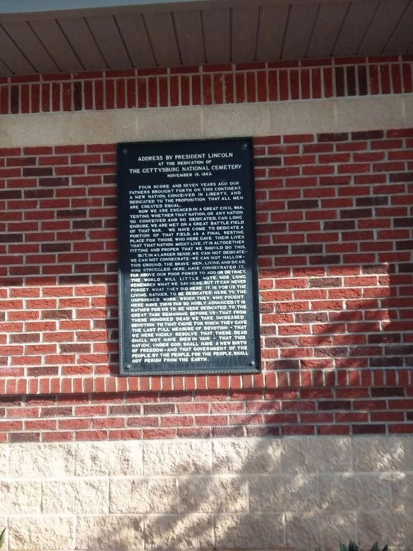
Info-board in front of Gettysburg Address
(captions)
Fort Barrancas, June 1861. Library of Congress.
Confederates encamped near Pensacola Navy Yard, spring 1861. Library of Congress.
National cemetery entrance and brick wall are visible beyond the original wood gates, 1904. National Archives and Records Administration.
Erected by U.S. Department of Veterans Affairs, National Cemetery Administration.
Topics and series. This historical marker is listed in these topic lists: Cemeteries & Burial Sites • Forts and Castles • War, US Civil. In addition, it is included in the National Cemeteries series list.
Location. 30° 21.45′ N, 87° 17.267′ W. Marker is in Pensacola, Florida, in Escambia County. It can be reached from Cemetery Road. Touch for map. Marker is at or near this postal address: 1 Cemetery Rd, Pensacola FL 32508, United States of America. Touch for directions.

Regionally, this marker is on the Florida Panhandle. It is also in the American South, specifically
Photographed by Craig Doda, December 23, 2018
3. Barrancas National Cemetery Marker
Other nearby markers. At least 8 other markers are within walking distance of this marker: Departed Shipmates & Ladies Memorial (here, next to this marker); Submarine Veterans Memorial (here, next to this marker); Enlisted Pilots Memorial (here, next to this marker); WW II Memorial (here, next to this marker); Remember Pearl Harbor (here, next to this marker); U.S. Navy and Coast Guard Memorial (within shouting distance of this marker); Officers of the Uniformed Services Memorial (within shouting distance of this marker); Navy Seabees Veterans Memorial (within shouting distance of this marker). Touch for a list and map of all markers in Pensacola.
Photographed by Craig Doda, December 23, 2018
4. Gettysburg Address Plaque
Credits. This page was last revised on August 4, 2025. It was originally submitted on November 25, 2020, by Craig Doda of Napoleon, Ohio. This page has been viewed 832 times since then and 61 times this year. Photos: 1, 2, 3. submitted on November 25, 2020, by Craig Doda of Napoleon, Ohio. 4. submitted on November 27, 2021, by Craig Doda of Napoleon, Ohio. • Bernard Fisher was the editor who published this page.
