Richmond Hill in Bryan County, Georgia — The American South (South Atlantic)
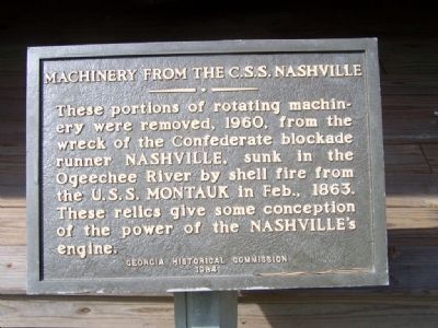
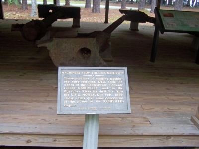
Machinery From The C.S.S. Nashville
Photographed by Mike Stroud, October 5, 2008
1. Machinery From The C.S.S. Nashville Marker
Erected 1964 by Georgia Historical Commission.
Topics. This historical marker is listed in these topic lists: War, US Civil • Waterways & Vessels. A significant historical month for this entry is February 1863.
Location. 31° 53.361′ N, 81° 12′ W. Marker is in Richmond Hill, Georgia, in Bryan County. It is on Fort McAllister Road. At Visitor Center parking lot at Fort McAllister. Touch for map. Marker is in this post office area: Richmond Hill GA 31324, United States of America. Touch for directions.

Regionally, this marker is on the Coastal Plain, on the Georgia Coast and the Golden Isles, and in Greater Savannah. It is also in the American South, specifically in the Deep South, and on the Eastern Seaboard. Globally, it is in the North Atlantic Region, North America, the Western Hemisphere, the Western World, and the Anglosphere. Historically,
this page online
Other nearby markers. At least 8 other markers are within walking distance of this marker: Antonio J. Waring, Jr. M.D. (within shouting distance of this marker); Guale Village at Seven-Mile Bend (about 400 feet away, measured in a direct line); Sinking of the CSS "Nashville (Rattlesnake)" (about 400 feet away); Destruction of the C.S.S. Nashville (about 400 feet away); C.S.S. Nashville (about 400 feet away); Fort McAllister The Naval Bombardments (about 400 feet away); Fort McAllister The Assault From The Rear (about 500 feet away); Capt. John McCrady (about 500 feet away). Touch for a list and map of all markers in Richmond Hill.
Photographed by Mike Stroud, 2008
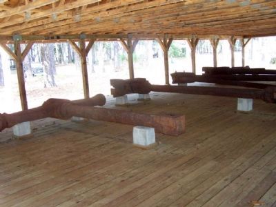
2. Machinery From The C.S.S. Nashville
Photographed by Mike Stroud, 2008
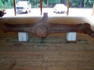
3. Machinery From The C.S.S. Nashville
Photographed by Mike Stroud, 2008
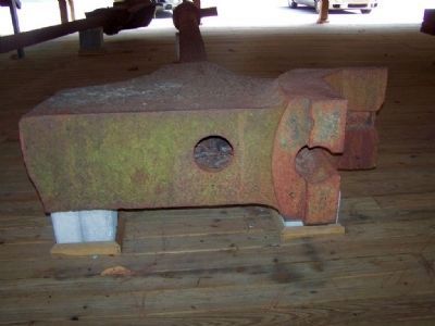
4. Machinery From The C.S.S. Nashville
Photographed by Mike Stroud, 2008
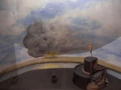
5. Diorama of the Montauk's gun turret, at museum
After several attempts, the iron clad Montauk
succeeded in destroying the Nashville on February 28, 1863. The Nashville had run aground on a sandbar at Seven Mile Bend on the Ogeechee River, while the Montauk was located at Harvey's Cut, near the entrance to the Atlantic Ocean - both in plain view of the fort.
Photographed by Mike Stroud, May 30, 2008
6. Machinery From The C.S.S. Nashville Marker
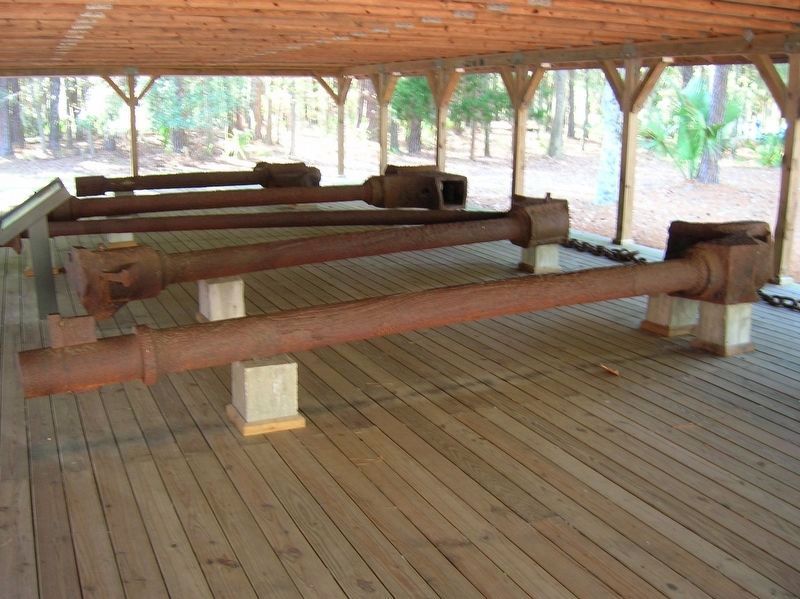
Photographed by Michael C. Wilcox, December 29, 2011
7. Machinery From The C.S.S. Nashville
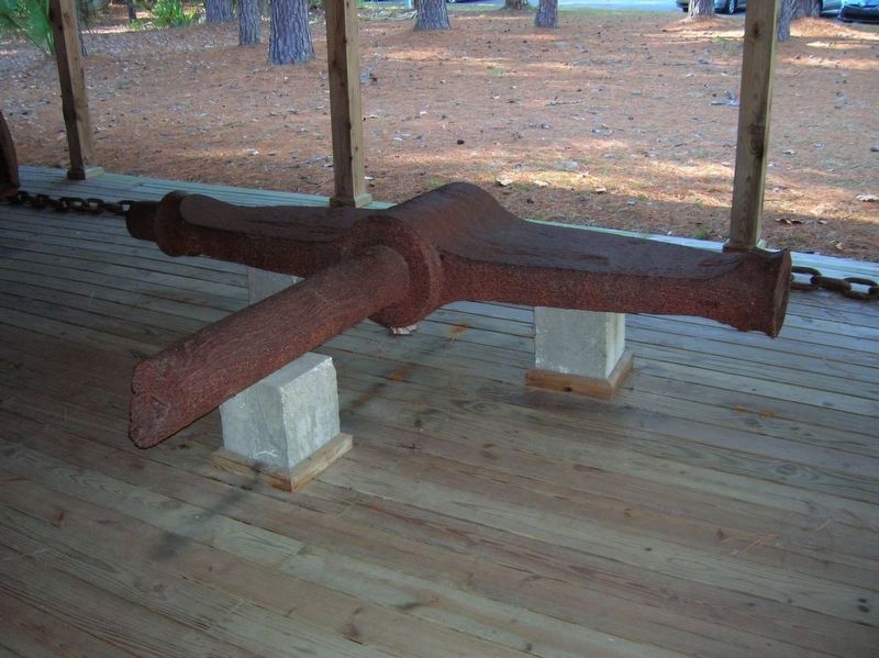
Photographed by Michael C. Wilcox, December 29, 2011
8. Machinery From The C.S.S. Nashville
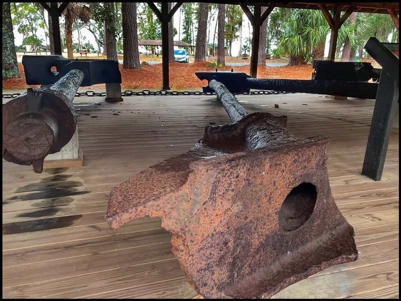
Photographed by Marty Pickett, January 1, 2024
9. Machinery from the C.S.S. Nashville
Credits. This page was last revised on February 1, 2024. It was originally submitted on October 20, 2008, by Mike Stroud of Bluffton, South Carolina. This page has been viewed 1,957 times since then and 24 times this year. Last updated on February 13, 2009, by Mike Stroud of Bluffton, South Carolina. Photos: 1, 2, 3, 4, 5, 6. submitted on October 20, 2008, by Mike Stroud of Bluffton, South Carolina. 7, 8. submitted on November 26, 2016, by Michael C. Wilcox of Winston-Salem, North Carolina. 9. submitted on January 31, 2024, by Marty Pickett of Lillian, Alabama. • Craig Swain was the editor who published this page.
