Muhlenberg Township near Reading in Berks County, Pennsylvania — The American Northeast (Mid-Atlantic)
The Schuylkill Navigation
Schuylkill River National & State Heritage Area
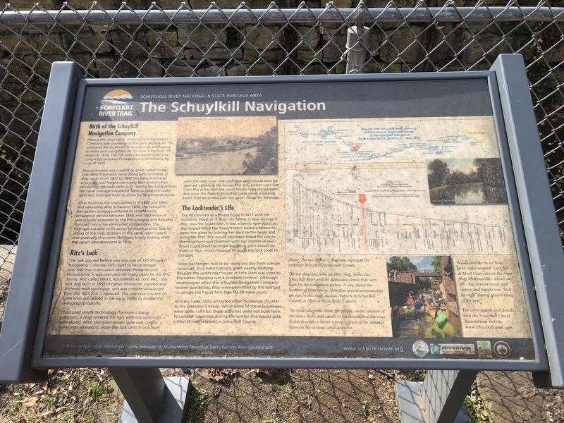
Birth of the Schuylkill Navigation Company
After a few false starts, the Schuylkill Navigation Company was chartered by the state legislature "to authorize the Governor to incorporate a Company to make lock navigation on the river Schuylkill" on March 8, 1815. The 106 mile slackwater canal was completed between Philadelphia and Possville by June of 1825.
The slackwater was created by constructed timber crib dams filled with stone along with stretches of dug canal. From 1825 to 1842 to the Schuylkill Canal enjoyed a coal freight monopoly that ended when competing railroads were built. Seeing the competition, the canal managers replaced dams to raise the water level and enlarged locks to allow for larger canal boats.
After finishing the improvements in 1845 and 1846, and rebuilding after a flood in 1850, the Schuylkill Navigation Company entered its second most prosperous period between 1855 and 1867 when it was actually operated by the Philadelphia and Reading Railroad. Since this eliminated competition, the Railroad was able to fix prices to insure profits. Due to silting of the river, sections of the canal were closed, and gradually shipments declined, finally ending after the canal's abandonment in 1916.
Ritz's Lock
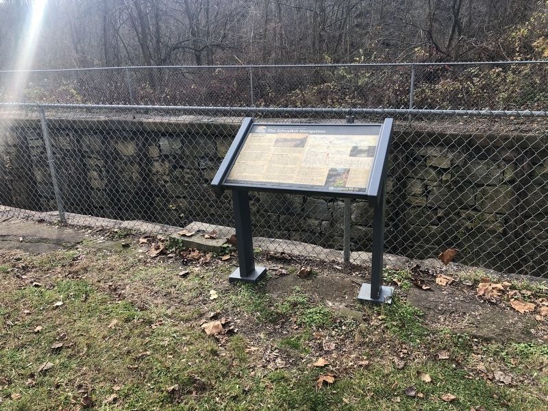
The lock you see before you was one of the 120 Schuylkill Navigation Company locks built to move bargest over 600 feet in elevation between Pottsville and Philadelphia. It was operated for many years by the Ritz family. Also called Felix's, Rothermel's or Lock #42, this lock was built in 1855 of native limestone, capped and trimmed with sandstone, and was considerably larger than the 1823 lock it replaced. The concrete you see on both ends was added in the early 1950s to enable the dredging of coal silt.
Locks used simple technology. To move a barge upstream, a boat entered the lock with the upstream gate closed. After the downstream gate was closed, water was allowed to enter the lock until it was level with the dam pool The upstream gate would then be opened, releasing the barge. The only power used was from the water and the canal tender who could open and close the heavily timbered gates using a balance beam that extended past the gate's hinge for leverage.
The Locktender's Life
Eva Ritz arrived as a young bride in 1911 with her husband, Floyd W.S. Ritz. Her father-in-law, George P. Ritz, was the locktender. It was a family operation, so she helped move the heavy timber balance beams to open the gates by leaning her back to the beam and using her feet. She would also bake bread for sale to the neighbors and boatmen with her mother-in law. Boats could travel as single barges or pairs drawn by three
Since the locktenders had to be ready any day from sunrise to sunset, they were typically given nearby housing. Because the locktender house at Felix Dam was close to the water, flooding was a constant concern. Although unemployed when the Schuylkill Navigation Company ceased operations, they were permitted by the railroad to occupy the house rent-free for 20 more years.
In many cases, locks attracted other businesses to cater the boatmen's needs. While some of these businesses were quite colorful, these activities were not built here. To combat loneliness during the winter, Eva would grab a train to visit relatives in Schuylkill County.
[Captions:]
Above: The two different diagrams represent the extensive Schuylkill Navigation System.
The top diagram, from an 1861 map, shows the Schuylkill River and the dams and canals that were built for the navigation system. It also shows the location of river towns. Note that several communities are not on this map, such as Auburn in Schuylkill County or Mohrsville in Berks County.
The lower diagram shows the profile, or the relation of the dams, locks and canals to the elevation of the river. It also provides a better representation of the distance between the various canal elements.
Would you like to see how locks really worked? Locks at Mont Clare, across the river from Phoenixville — shown at left — has been restored and canoes and kayaks can "lock through" during special times of the year.
For information and details, visit the Schuylkill Canal Association's website: www.schuylkillcanal.com
Erected by Schuylkill River National & State Heritage Area; Department of Conservation and Natural Resources; Muhlenberg Township.
Topics. This historical marker is listed in these topic lists: Industry & Commerce • Waterways & Vessels • Women. A significant historical date for this entry is March 8, 1815.
Location. 40° 23.505′ N, 75° 58.159′ W. Marker is near Reading, Pennsylvania, in Berks County. It is in Muhlenberg Township. Marker can be reached from the intersection of River Road and Georgetown Drive, on the left when traveling north. Touch for map. Marker is at or near this postal address: 4028 River Rd, Reading PA 19605, United States of America. Touch for directions.
Other nearby markers. At least 8 other markers are within 2 miles of this marker, measured as the crow flies. Removal of the Dams (a few steps from this marker); Reclaiming the River (about 300 feet away, measured in a direct line); Recreation on the River (about 500 feet away); Damming the River (about 600 feet away); Living with the River (approx. 0.2 miles away); Joseph Hiester (approx. 1.2 miles away); Gruber Wagon Works (approx. 1.6 miles away); 148th Fighter Squadron (approx. 1.6 miles away). Touch for a list and map of all markers in Reading.
Credits. This page was last revised on February 7, 2023. It was originally submitted on November 29, 2020, by Devry Becker Jones of Washington, District of Columbia. This page has been viewed 253 times since then and 33 times this year. Photos: 1, 2. submitted on November 29, 2020, by Devry Becker Jones of Washington, District of Columbia.

