Lake George in Warren County, New York — The American Northeast (Mid-Atlantic)
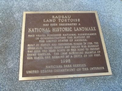
Radeau Land Tortoise
National Historic Landmark
This vessel possesses national significance
in commemorating the history of
the United States of America.
Built by British and provincial forces in 1758, the seven-gun, 26-oar French and Indian War gunboat was sunk two miles north of this point to prevent enemy capture. The only surviving example of her class, she remains at a depth of 107 feet.
1998
National Park Service
United States Department of the Interior
Erected 1998 by National Park Service.
Topics and series. This historical marker is listed in these topic lists: War, French and Indian • Waterways & Vessels. In addition, it is included in the National Historic Landmarks series list. A significant historical year for this entry is 1758.
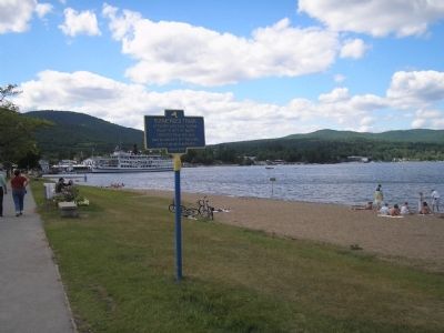
Location. 43° 25.107′ N, 73° 42.364′ W. Marker is in Lake George, New York, in Warren County. Marker is at the intersection of Beach Road and Fort George Road, on the left when traveling east on Beach Road. Marker is on the Lake George waterfront, across from Lake George Battlefield Park. Touch for map. Marker is in this post office area: Lake George NY 12845, United States of America. Touch for directions.
Other nearby markers. At least 8 other markers are within walking distance of this marker. Military Dock (a few steps from this marker); Submerged Track (a few steps from this marker); Colonial Maritime Heritage (within shouting distance of this marker); Delaware & Hudson Railroad (within shouting distance of this marker); The Hospital (about 300 feet away, measured in a direct line); Gen. Henry Knox Trail (about 400 feet away); Battle of Lake George (about 400 feet away); Memorial to Four Unknown Soldiers (about 600 feet away). Touch for a list and map of all markers in Lake George.
Also see . . .
1. The "Land Tortoise" Underwater Preserve Site. New York State Department of Environmental Conservation website entry (Submitted on February 13, 2009, by Bill Coughlin of Woodland Park, New Jersey.)
2. Diving Into History in Lake George. New York Times article, August 18, 1994 (Submitted on July 3, 2021, by Larry Gertner of New York, New York.)
Credits. This page was last revised on July 3, 2021. It was originally submitted on February 13, 2009, by Bill Coughlin of Woodland Park, New Jersey. This page has been viewed 1,651 times since then and 28 times this year. Photos: 1, 2, 3, 4. submitted on February 13, 2009, by Bill Coughlin of Woodland Park, New Jersey.


