Dongan Hills on Staten Island in Richmond County, New York — The American Northeast (Mid-Atlantic)
The King’s Highway
Photographed by Larry Gertner, May 20, 2013
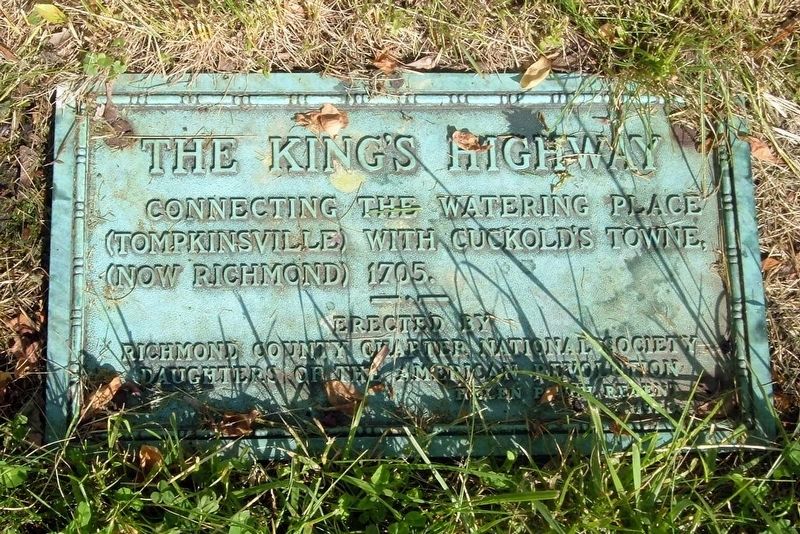
1. The King’s Highway Marker
Connecting the Watering Place (Tompkinsville) with Cuckold’s Towne (now Richmond) 1705.
Erected by Richmond County Chapter National Society Daughters of the American Revolution
Helen Pouch, Regent
1928
Erected 1928 by Richmond County Chapter National Society Daughters of the American Revolution (DAR).
Topics and series. This historical marker is listed in these topic lists: Colonial Era • Roads & Vehicles. In addition, it is included in the Daughters of the American Revolution (DAR) series list. A significant historical year for this entry is 1705.
Location. 40° 35.605′ N, 74° 6.013′ W. Marker is on Staten Island, New York, in Richmond County. It is in Dongan Hills. It can be reached from Richmond Road near Norden Street when traveling north. Touch for map. Marker is at or near this postal address: 1476 Richmond Rd, Staten Island NY 10304, United States of America. Touch for directions.

Regionally, this marker is in New York City. It is also in the American Northeast, in the Mid-Atlantic, and on the Eastern Seaboard. Globally, it is in the North Atlantic Region, North America, the Western Hemisphere,
this page online
Other nearby markers. At least 8 other markers are within walking distance of this marker: Billiou-Stillwell-Perine House (here, next to this marker); Huttner-Pasqualini Post, American Legion Memorial (about 400 feet away, measured in a direct line); Public School 11R (approx. ¼ mile away); Dongan Hills WWII Memorial (approx. ¼ mile away); Jerome X. O'Donovan Pond (approx. 0.4 miles away); General Douglas MacArthur Park (approx. half a mile away); Memorial Wall (approx. one mile away); "The Rescue" (approx. one mile away). Touch for a list and map of all markers in Staten Island.
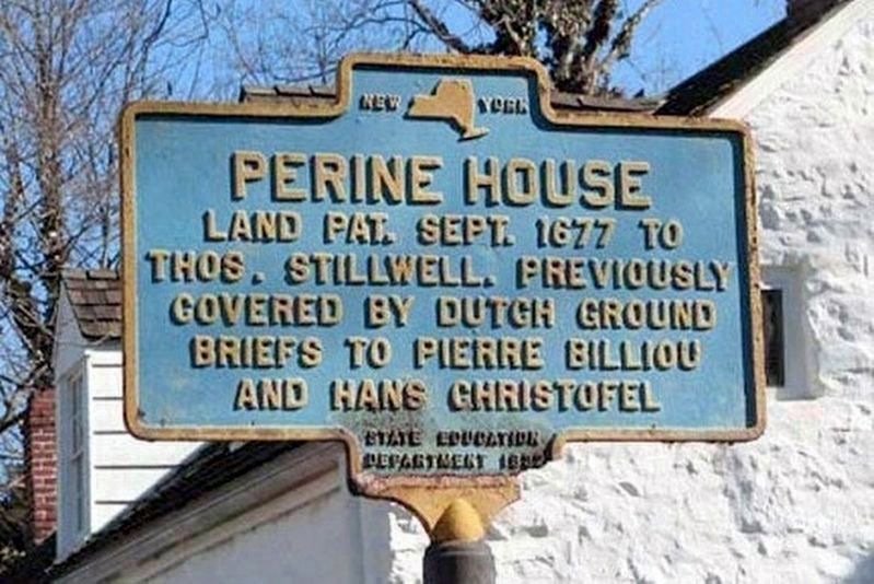
Another marker is no longer nearby. Perine House (was here, next to this marker but has been replaced with another marker now near it).
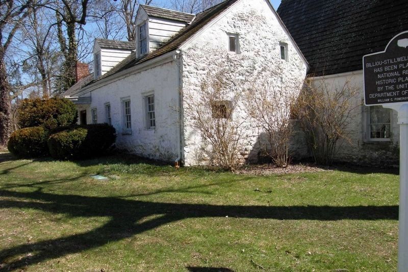
More about this marker. The marker is flat in the ground at the Billiou-Stilwell-Perine House.
Regarding The King’s Highway. Although the early history of Richmond Road is detailed in the pamphlet "History, story, legend of the old King's Highway: now the
Photographed by Larry Gertner, March 20, 2023
2. The King’s Highway Marker
In relation to the new marker at the site
Also see . . . "History, story, legend of the old King's Highway: now the Richmond Road, Staten Island, N.Y". Internet Archive website entry:
PDF copy of book by Charles Gilbert Hine for the Staten Island Antiquarian Society, 1916.
(Submitted on November 30, 2020, by Larry Gertner of New York, New York.)
Photographed by Larry Gertner, August 4, 2012
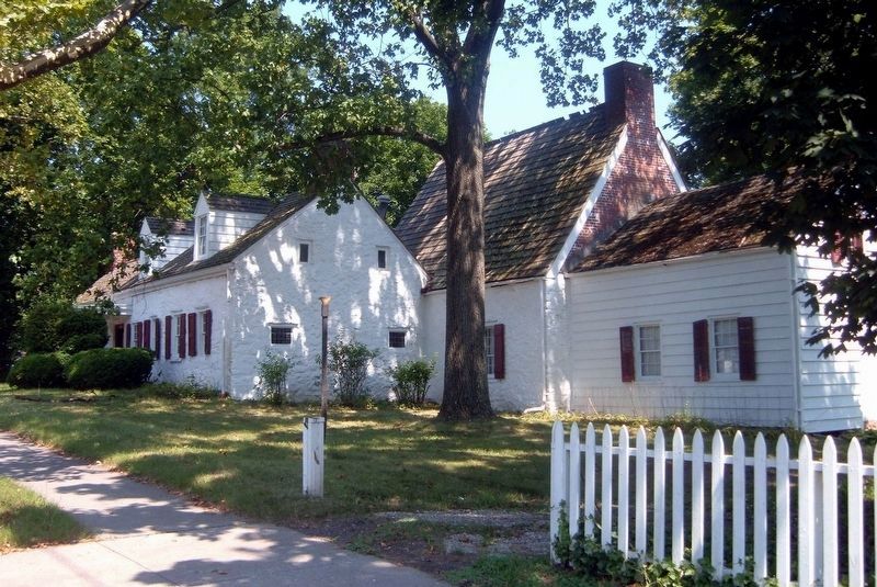
3. The Billiou-Stillwell-Perine House
The house is at 1476 Richmond Road. This is the oldest building on Staten Island, with construction dating back to 1662.
Photographed by Pinterest, Unknown
4. Perine House
The missing New York State Education Department marker
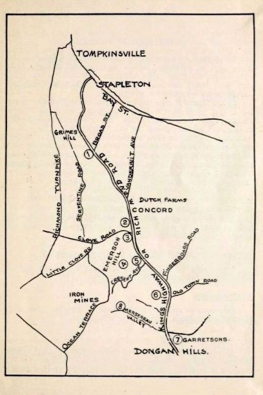
Internet Archive, 1916
5. The King’s Highway, northern section
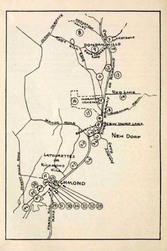
Internet Archive, 1916
6. The King’s Highway, southern section
Credits. This page was last revised on May 5, 2023. It was originally submitted on November 30, 2020, by Larry Gertner of New York, New York. This page has been viewed 442 times since then and 43 times this year. Photos: 1. submitted on November 30, 2020, by Larry Gertner of New York, New York. 2. submitted on April 3, 2023, by Larry Gertner of New York, New York. 3, 4, 5, 6. submitted on November 30, 2020, by Larry Gertner of New York, New York.
