Havre de Grace in Harford County, Maryland — The American Northeast (Mid-Atlantic)
State of Readiness
Star-Spangled Banner National Historic Trail
| — | National Park Service, U.S. Department of the Interior | — |
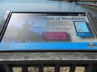
Photographed by Bill Pfingsten, April 5, 2013
1. State of Readiness Marker
During the War of 1812, Havre de Grace was a fishing village, but also played host to many travelers. The Post Road, the main route of land travel in the day, came through town, and travelers used the local ferry at the north end of town to cross the Susquehanna River.
When the British docked at Spesutia Island, Havre de Grace residents went on high alert, but lost their urgency after a few days of safety.
"Vigilance continued till within three or four days of the time when they were actually attacked. At this time, the inhabitants, wearied with continual excitement and laborious exercise, began to relax from their exertions…"
-Jared Sparks,
North American Review and Miscellaneous Journal 14, 1817
John Boyd was the first to see the British as they approached under the cover of night on May 3, 1813. He "gave the alarm to the sentinels, who were stationed near to his house."
Erected by National Park Service, U.S. Department of the Interior.
Topics and series. This historical marker is listed in these topic lists: Roads & Vehicles • War of 1812 • Waterways & Vessels. In addition, it is included
this page online
Location. 39° 32.3′ N, 76° 5.301′ W. Marker is in Havre de Grace, Maryland, in Harford County. It can be reached from Commerce Street. Marker is on the Havre de Grace Promenade near Tidings Park Marina. Touch for map. Marker is in this post office area: Havre de Grace MD 21078, United States of America. Touch for directions.

Regionally, this marker is in the Baltimore Metro Region and in Central Maryland. It is also in the American Mid-Atlantic, in the Chesapeake Bay Region, and on the Eastern Seaboard. Globally, it is in the North Atlantic Region, North America, the Western Hemisphere, the Western World, and the Anglosphere. Historically, it finds itself in what was once one of the original Thirteen Colonies and also the Antebellum South.
Other nearby markers. At least 8 other markers are within walking distance of this marker: Home Base (within shouting distance of this marker); Lower Susquehanna Heritage Greenway (within shouting distance of this marker); Enjoy the Havre de Grace Promenade (within shouting distance of this marker); The Bayou (within shouting distance of this marker); Invasion at Dawn (about 300 feet away, measured in a direct line); Capt. Anthony J. Synodinos & 1st Lt. Edward G. Conrad, (about 300 feet away); Havre de Grace War Memorial (about 300 feet away); Votes for Women (about 400 feet away). Touch for a list and map of all markers in Havre de Grace.
Credits. This page was last revised on March 19, 2026. It was originally submitted on April 5, 2013, by Bill Pfingsten of Bel Air, Maryland. This page has been viewed 660 times since then and 23 times this year. Last updated on December 2, 2020, by Carl Gordon Moore Jr. of North East, Maryland. Photo 1. submitted on April 5, 2013, by Bill Pfingsten of Bel Air, Maryland.
Editor’s want-list for this marker. A wide shot of the marker in context. • Can you help?
