Near Winchester in Frederick County, Virginia — The American South (Mid-Atlantic)
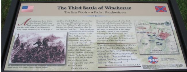
The Third Battle of Winchester
The First Woods - A Perfect Slaughterhouse
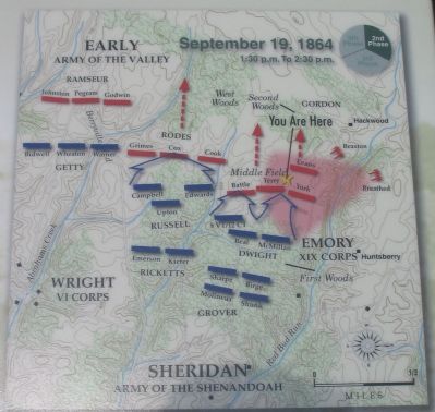
On the left of the Nineteenth Corps, the attack of the Sixth Corps had ended in the same fashion, with enemy troops facing each other across the Middle Field. During the next two hours both sides exchanged fire at long range. Meanwhile, several Union regiments, including the 8th Vermont and 12th Connecticut, took positions in the field (to your left front) between the lines to occupy the attention of the Southerners.
"For three mortal hours they [8th Vt. & 12th Conn.] stubbornly held the exposed position, while the ranks were thinned, and the hot carnage raged on every hand. They stood the test without flinching, and many a brave deed was there enacted...."
George Carpenter, 8th Vermont, U.S.A.
Erected by Civil War Preservation Trust.
Topics. This historical marker is listed in this topic list: War, US Civil.
Location. Marker has been reported permanently removed. It was located near 39° 11.859′ N, 78° 7.565′ W. Marker was near Winchester, Virginia, in Frederick County. Marker could be reached from Redbud Road (County Route 661), on the right when traveling east. Located at the First Woods Wayside, along the Battle Trail, inside the CWPT Third Winchester Battlefield site. The closest access site is a trail head on the west side of the Frederick County School complex parking lot. Touch for map. Marker was in this post office area: Winchester VA 22603, United States of America.
We have been informed that this sign or monument is no longer there and will not be replaced. This page is an archival view of what was.
Other nearby markers. At least 8 other markers are within walking distance of this location. Molineux's Stand (a few steps from this marker); Maine (within shouting distance of this marker); A Perfect Sheet Of Lead

2. Help Preserve 3rd Winchester
Details of CWPT efforts to save this battlefield.
Click for more information.
Click for more information.
More about this marker. On the lower left of the marker is "J.E. Taylor's sketch of Gen. Sheridan in the First Woods rallying Grover's Division." On the right side is a map showing the tactical situation between 1:30 and 2:30 p.m. on September 19, 1864.
Also see . . .
1. Summary of the Battle of Third Winchester. From the National Parks Service. (Submitted on October 27, 2007, by Craig Swain of Leesburg, Virginia.)
2. CWPT Walking Tour of The Third Battle of Winchester. This marker is one along the walking trail around a portion of the Third Winchester Battlefield, preserved by the Civil War Preservation Trust. (Submitted on October 27, 2007, by Craig Swain of Leesburg, Virginia.)
Photographed By Craig Swain, August 26, 2007
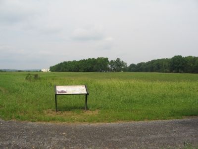
4. The First Woods Wayside
At this section of the battlefield, Dwight's Federal Division made contact with Terry's and York's Confederate Brigades. The Confederate advance checked, the two sides began to exchange long range fires across Middle Field. The treeline in the distant center are those alongside Hackwood Lane, and were not present at the time of the battle.
Photographed By Craig Swain, August 26, 2007
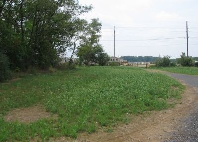
6. Actual Location of the First Wood's Tree Line
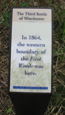
This sign, easily a quarter mile east on the Union side of the trail, indicates the tree line for the First Woods was far different than it is today. Presently, the tree line is a few feet east of the marker.
Credits. This page was last revised on December 4, 2020. It was originally submitted on October 27, 2007. This page has been viewed 1,875 times since then and 14 times this year. Last updated on December 2, 2020. Photos: 1. submitted on October 27, 2007, by Craig Swain of Leesburg, Virginia. 2. submitted on March 13, 2009, by Craig Swain of Leesburg, Virginia. 3, 4, 5, 6. submitted on October 27, 2007, by Craig Swain of Leesburg, Virginia. • J. Makali Bruton was the editor who published this page.
