Near Urbandale in Alexander County, Illinois — The American Midwest (Great Lakes)
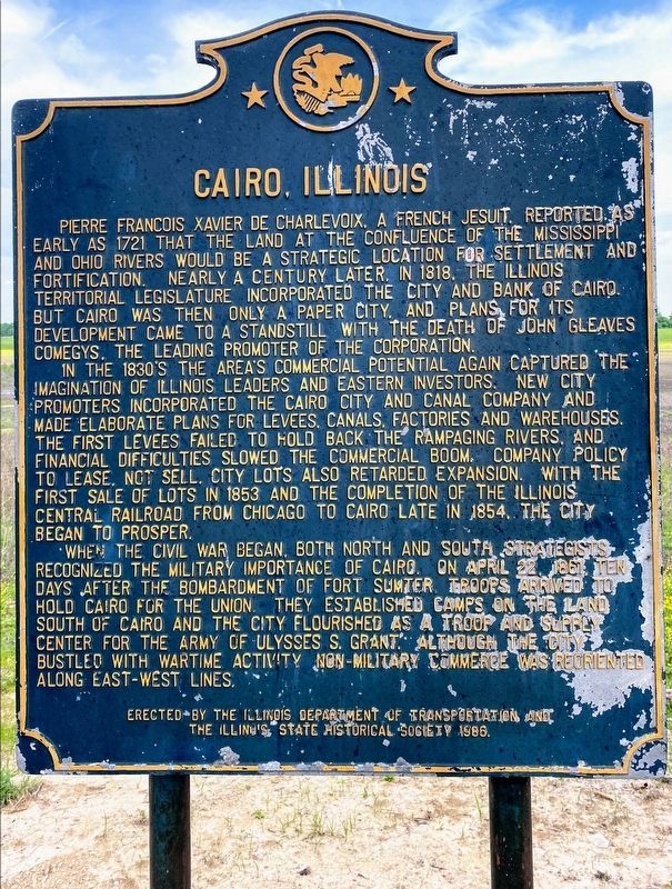
Cairo, Illinois
Pierre Francois Xavier de Charlevoix, a French Jesuit, reported as early as 1721 that the land at the confluence of the Mississippi and Ohio Rivers would be a strategic location for settlement and fortification. Nearly a century later, in 1818, the Illinois territorial legislature incorporated the city and the Bank of Cairo. But Cairo was then only a paper city, and plans for its development came to a standstill with the death of John Gleaves Comegys, the leading promoter of the corporation.
The area's commercial potential again captured the imagination of Illinois leaders and eastern investors in the 1830's. New city promoters incorporated the Cairo City and Canal Company and made elaborate plans for levees, canals, factories, and warehouses. The first levees failed to hold back the rampaging rivers, and financial difficulties slowed the commercial boom. Company policy to lease, not sell, city lots also retarded expansion. With the first sale of lots in 1853 and the completion of the Illinois Central Railroad from Chicago to Cairo late in 1854, the city began to prosper.
When the Civil War began, both Northern and Southern strategists recognized the military importance of Cairo. On April 22, 1861, ten days after the bombardment of Fort Sumter, troops arrived to hold Cairo for the Union. They established camps on the land south of Cairo, and the city flourished as a troop and supply center for General Ulysses S. Grant's army. Although the city bustled with wartime activity, non-military commerce was reoriented along east-west lines.
Erected 1986 by Illinois State Historical Society.
Topics and series. This historical marker is listed in these topic lists: Colonial Era • Exploration • Settlements & Settlers • War, US Civil. In addition, it is included in the Illinois State Historical Society series list. A significant historical date for this entry is April 22, 1861.
Location. 37° 3.617′ N, 89° 11.15′ W. Marker is near Urbandale, Illinois, in Alexander County. Marker is on Old U.S. 51 (Illinois Route 37) 1.1 miles south of Redman Road. Touch for map. Marker is in this post office area: Cairo IL 62914, United States of America. Touch for directions.
Other nearby markers. At least 8 other markers are within 2 miles of this marker, measured as the crow flies. A National Cemetery System (approx. 1.9 miles away); Mound City National Cemetery (approx. 1.9 miles away); Navy Seabees Memorial (approx. 1.9 miles away); In Honor of Those Who Gave the Ultimate Sacrifice (approx. 1.9 miles away); America's Medal Of Honor Memorial Tree (approx. 1.9 miles away); The Marine Ways (approx. 1.9 miles away); Confederate Soldiers Memorial (approx. 2 miles away); Mound City World War II Memorial (approx. 2 miles away).
Credits. This page was last revised on June 6, 2021. It was originally submitted on December 5, 2020, by Craig Doda of Napoleon, Ohio. This page has been viewed 235 times since then and 24 times this year. Photos: 1. submitted on June 2, 2021, by Shane Oliver of Richmond, Virginia. 2. submitted on December 5, 2020, by Craig Doda of Napoleon, Ohio. • Devry Becker Jones was the editor who published this page.

