Near Stanton in Mercer County, North Dakota — The American Midwest (Upper Plains)
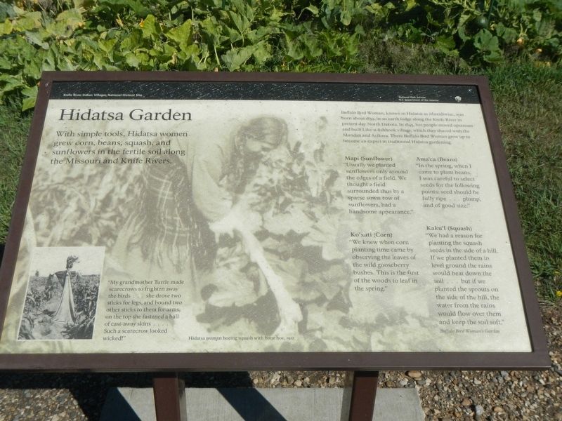
Hidatsa Garden
Photographed by Barry Swackhamer, August 28, 2020
1. Hidatsa Garden Marker
Caption: (bottom left) "My grand mother Turtle made scarecrows to frighten away the birds ... she drove town sticks for legs, and bound two other sticks to them for arms: on the top she fastened a ball of cast-away skins.... Such a scarecrow looked wicked!"
Buffalo Bird Woman, known in Hidatsa as Maxidiwiac, was born born about 1839, in an earth lodge along the Knife River in present day North Dakota. In 1845, her people moved upstream and built Like-a-fishhook village, which they shared with the Mandan and Arikara. There Buffalo Bird Woman grew up to become an expert in traditional Hidatsa gardening.
Mapi (Sunflower)
"Usually we planted sunflowers only around the edge of a field. We thought a field surrounded thus by a sparse sown row of, sunflowers, had a handsome appearance."
Ama'ca (Beans)
"In the spring, when I came to plant beans, I was careful to select seeds for the following points: seeds should be fully ripe ... plump, and of good size."
Ko'xati (Corn)
"We knew when corn planting time came by observing the leaves of the wild gooseberry bushes. This is the first of the woods to leaf in the spring."
Kaku'I (Squash)
"We has a reason for planting the squash seeds in the side of a hill. If we planted them in level
this page online
Buffalo Bird Woman's Garden
Erected by Department of the Interior, National Parks Service.
Topics. This historical marker is listed in these topic lists: Agriculture • Indigenous Peoples and Communities.
Location. 47° 19.903′ N, 101° 23.073′ W. Marker is near Stanton, North Dakota, in Mercer County. It can be reached from County Highway 37 near 6th Street Southwest, on the right when traveling north. This marker is located on Knife River Indian Villages Village Trail. Touch for map. Marker is at or near this postal address: 546 County Road 37, Stanton ND 58571, United States of America. Touch for directions.

Regionally, this marker is in the Mandan, Hidatsa, and Arikara Nation, in the Standing Rock Sioux Tribe, and on the Missouri Plateau. It is also in the American Lewis & Clark Corridor, on the prairies, and on the Northern Plains. Globally, it is in North America, the Western Hemisphere,
Photographed by Barry Swackhamer, August 28, 2020
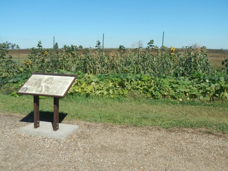
2. Hidatsa Garden and Marker
Other nearby markers. At least 8 other markers are within walking distance of this marker: Lewis & Clark at the Knife River Indian Villages (here, next to this marker); Tobacco (about 300 feet away, measured in a direct line); Awatixa Xi'e Village (about 600 feet away); Middens (approx. 0.2 miles away); Feeding the River (approx. half a mile away); Awatixa Village (approx. half a mile away); Cutbank Archeaology (approx. 0.6 miles away); River-Centered (approx. 0.6 miles away). Touch for a list and map of all markers in Stanton.
Credits. This page was last revised on December 10, 2020. It was originally submitted on December 10, 2020, by Barry Swackhamer of Brentwood, California. This page has been viewed 333 times since then and 25 times this year. Photos: 1, 2. submitted on December 10, 2020, by Barry Swackhamer of Brentwood, California.
